Western Canada
For a second we thought, maybe this is not the road that we will be traveling on but then we saw a map with a gravel section labled "The Hill". The last two times Deb dumped her bike were during the dirt bike training while practicing turning on a steep hill and then in eastern Montana on the gravel road. Now we would be combining the two for an extra challenge.After leaving Glacier National Park in Montana, we rode north on the east side of the park, crossing in to Alberta, Canada and Waterton Lakes National Park. The views of the Rocky Mountains were and the Waterton lakes were just beautiful. We traveled on highway 3 east in to British Columbia, a very scenic road with spruce and fir covered mountains and sparkling rivers. After spending a night in Cranbrook, we headed north and east back in to Alberta toward Lake Louise.
About fifteen miles from our destination it started to rain. We arrived at the campground and picked out a campsight then went to hang out in the shelter until the rain let up. Most of the people camping in tents came to the shelter to their cook dinners so we enjoyed conversing with them. Over our three nights in the campground, there were four others that we got to know by hanging out in the shelter due to the cold and rain. There was Jerry from Edmonton who knew all of the trails in the area and gave us advice on what to do, Tess and Tracy from San Francisco who were avid hikers and rock climbers and Paul from Belgium who quit work 15 years ago and spends most of his time travelling. Our second day at Lake Louise, it rained all day so we just walked in to the village to buy some food and then back to the campground and hung out with the others in the shelter. It wasn't until our third day there that we actually got to see the lake. The weather was beautiful that day. Lake Louise is a milky turquoise color due to the rock being ground to powder by the glacier that feeds it. We hiked the entire day, first along Lake Moraine, another beautiful lake and then along Lake Louise up to the Plain of Six Glaciers tea house. For Deb, it was a difficult hike, but the views were worth it and we treated ourselves to tea and scones at the tea house that is only accessible to hikers. On our last day after having breakfast in the shelter, we returned to our campsite and found Jiffy Pop, a bottle of olive oil and a can of fuel for our stove sitting on our picnic table, gifts from Tess and Tracy.
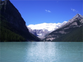
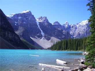
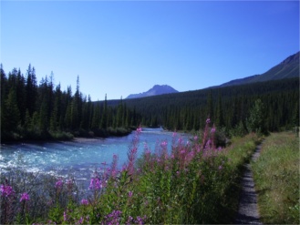
We said goodbye to Lake Louise and took the Icefields Parkway north to Jasper. Without exaggeration, this must be THE most scenic drive in all of North America. It is 140 miles of highway snaking it's way through two national parks, Banff and Jasper, where mountains, glaciers, waterfalls and tree-lined turquoise streams abound. The first night in Jasper we stayed in a private residence, it's much more affordable than the hotels. The next two nights were spent at the Whistlers campground. We went on hike to Cavell glacier, we were hoping to see an iceberg calve from it since it was a warm day, but no luck. We also went in to an ice cave just below Angel glacier, we took our chances that there wouldn't be an avalanche while we were there. One day we hiked to three lakes, this was the least crowded hike, we saw only one other couple the entire afternoon. The downside to having fewer people on the trails is that we have to be more vigilant regarding bears.
We road the Yellowhead Highway north to Prince George from Jasper. At one point there was construction with deeply grooved pavement. On a motorcycle, traction is everything and these grooves didn't provide for much traction, it was very scary but we drove slowly and managed to get through it ok. In Prince George we got a great deal on lodging, a room at a college with our own showers for $25. We checked in to taking a ferry from Prince Rupert to Vancouver Island but was told it was fully booked until Sept. 4 so the girl at the information booth suggested we take the ferry from Bella Coola instead. She said the road is part gravel but it is a well maintained road and the gravel is packed down. We said ok so we paid for the ferry trip. Later that evening, we were reading some of the brochures about the area and saw something that said the Bella Coola road has a 9 km section with grades of up to 18%, difficult for any type of vehicle. Usually, a warning sign will indicate if the steepness of the road is 6% or more, we couldn't imagine an 18% grade. For a second we thought, maybe this is not the road that we will be traveling on but then we saw a map with a gravel section labled "The Hill". The last two times Deb dumped her bike were during the dirt bike training while practicing turning on a steep hill and then in eastern Montana on the gravel road. Now we would be combining the two for an extra challenge. The morning we left Prince George, we stopped to get air in our tires and asked about the road to Bella Coola. These are the comments we heard "The nasty gravel doesn't start until you get to the top of the mountain. You guys will have a blast going The Hill on those things, its one switch back after the other. Before you start down, just look over the side and you'll see little colored dots, those are cars that have gone over the side. Sometimes you can't see where the road goes in front of you."
We went south from Prince George to Williams Lake, our last chance to back out of the road to Bella Coola, but we didn't, we turned west on highway 20 and into the Chilicon Valley. We stayed at a great little place in Tatla Lake, an inn with three rooms and a restaurant. It was located on a lake and had a beautiful view of the mountains. We met two other couples there, one from Victoria, BC and one from Michigan. We enjoyed spending the evening with them. The first 60 miles of gravel wasn't bad at all, it was hard-packed and just slightly rougher than pavement. Then the road turned to mostly dirt with some gravel for about 30 miles and then we started experiencing grades of 9%, 10%, 12%, 15%, and 18%.
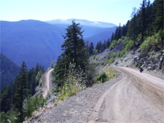
Deb was terrified but took it very slowly, especially in the sharp turns. Almost at the bottom of the mountain the road turned back to pavement. We both made the sign of the cross when our tires hit the pavement. The Bella Coola valley was beautiful with lush forests and the fast flowing Bella Coola river. We pitched our tent at a campground on the river (the only tent). In the evening, the owner told us that the river warden stopped by and asked her to let us know that a grizzly was sited down at the river just outside the campground. She said that they have never had a bear come into the campground. We were a bit uneasy with this knowledge, but decided to stay in the tent anyway. The next morning, we were thankful to still be alive. We went on three different hikes, one to a waterfall with hundreds of salmon spawning, two through old growth forests of cedar and spruce. The forests were so magical with an openess due to the high canopy and the undergrowth covered with moss, all lit in a greenish glow; it felt like there should have been a city of elves living there. It was hard to remember to be wary of bears. In one stream, even though there weren't any rapids, we saw salmon jumping out of the water as if they were trying to climb a waterfall.
We boarded the ferry early on a Friday morning and met several other couples. That evening about 17 of us set up our sleeping bags in the solarium and it was like a big slumber party for people over 40 years old. The views of the fiords were beautiful. At one point, we passed the place where Alexander McKenzie reached the Pacific travelling overland in 1793. In the afternoon it started raining so we couldn't see much due to the clouds and it rained the rest of the trip but we had a great time anyway.
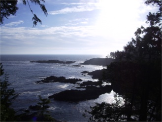
We arrived on Vancouver Island on Saturday morning and rode in the rain to Telegraph Cove. We set up our tent and had a few hours without rain that we used to explore the area. Telegraph Cove is a boardwalk community, all the homes are now tourist accomodation or stores, but it was interesting. This area is the best place to see killer whales but we didn't see anything from shore and decided not to take the whale watching tour. The next day, we packed up in the rain and drove south to Campell River and the day after that, we drove across the island to Ucluelet and Tofino on the Pacific side. We had just a couple of hours without rain and we hiked the Wild Pacific Coast Trail. It had beautiful views of the Pacific Ocean. The next morning, we rode for a while in the rain and then decided to wait until the rain stopped. The road across the island is a very curvy mountain road with about 6 miles of loose gravel due to construction.
Finally, on our last day on the island, we had sunny weather. We stopped at a BMW dealer in Victoria and Dave bought a new front tire. Victoria is a very beautiful city with a British feel. We took a tour of the parliment building and the Royal British Columbia Museum and then took a ferry back to the mainland.
