Norway (Sweden) - Part 1
The reception at Kirkenes was somewhat cold and wet. The city is a gray town with a small industrial harbor. The tourist information says that the area around the city is a melting pot where one can hear people speaking Finnish, Russian, or Sami, the language of the indigenous people.
The reception at Kirkenes was somewhat cold and wet. The city is a gray town with a small industrial harbor. The tourist information says that the area around the city is a melting pot where on can hear people speaking Finnish, Russian, or Sami, the language of the indigenous people.
It was really the proximity to Russia that attracted me to Kirkenes. My travel guide suggested that one could make guided daytrips into Russia by bus. I had really wanted to go to Murmansk, but this particular trip (in the one day version) was no longer available. Hence I decided on the next-best thing, a one day trip to the industrial town "Nikel", just across the border.
Nikel, as the names suggests, in the location of a very large nickel mine and smelter. It is not a very scenic place, but one could get a very good impression of what the day-to-day life in the former Soviet Republic must have been like.
The first impression is that of a busy plant with smoking plants. As we passed the city towards the east, the whole ecological damage became apparent. Since there is no cleaning of the exhaust fumes, nature in the area has been destroyed. Just dead wood and gray soil remain.
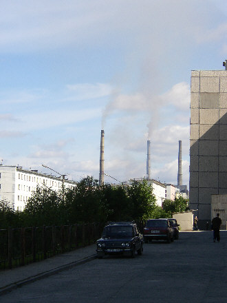
"A view from the city center"
"Click for a view of the outskirts"
Despite the somewhat dreary impression, I found this to be a very interesting trip - also because it was my first time in Russia.
The next day I spent a more pleasant environment. I went on a small trip along the Norwegian-Russian border. This involved another short stretch of gravel road towards Jakobselv, as small group of houses close to a rocky beach on the Barents Sea. This is the location of the King Oskar II chapel built in 1869. Since -in those days - Russians where considered to have respect for the church, the chapel was originally intended by the Norwegians to deter Russians from trespassing onto Norwegian territory. In more recent days this was no longer deemed as prudent: the area is also NATO's eastern-most mainland-based radar surveillance of Russia; an electronic eye with the Pentagon as the ultimate end-user.
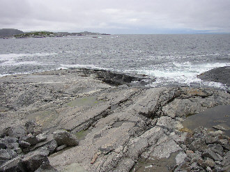
"Historic defense against trespassing"
The next leg of my trip was to be a, if not the, highlight of my trip: the North Cape. The way there was lined with fantastic views of the fjords and mountains of the Norwegian coast.
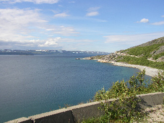
"On the way to the North Cape"
To get onto the Mageroya island where the North Cape is located, one has to use a combination of winding roads and tunnels. There where considerable differences in temperature: 25 C in the sun, and somewhat close the low single digits inside of the tunnels. I still admire the people on bicycles who rode through the tunnels. These turned out to be quite long (some as long a 7 km and going uphill, too).
I put up my tent on a campground just below the North Cape plateau. There were some interesting observers of the scene:
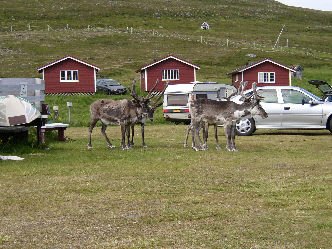
"On the northernmost campground"
Having set up the tent, I had to go to go up to the North Cape plateau. The whole site up there had been described to me a being very touristy - which I guess it is. There is a gigantic parking area which is filled with camp mobiles. I was expecting big crowds also within the North Cape center (incl. Museum, shops, restaurants, a bar, post office etc.) but that was not the case. Another pleasant surprise was meeting to fellow travelers: Goetz Stahlschmidt from Germany on an almost vintage Yamaha XJ900 and Pamela Hammond from Australia. Pamela had come to Europe for a 4 months bicycle trip through Norway. Goetz was on a tour which included Scandinavia and the western parts of Russia.
The weather had turned bad, with some rain, fog and unpleasantly low temperatures. Of course we decided on taking the picture of us under the North Cape globe, but the weather did not allow for a photographic masterpiece. For the record, here it is anyway.
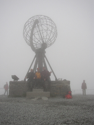
"Australian-German Convention in the fog"
The weather changed over night and it turned sunny again. Since the ticket for the plateau was valid for two days, I made a second attemp to have my picture taken.
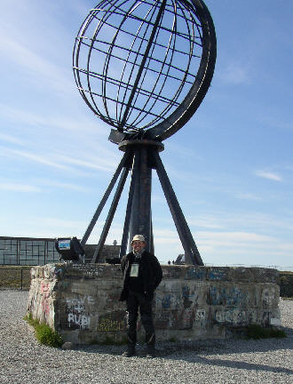
"All alone - in the sunshine"
The next place on the trip schedule was Hammerfest - the self-proclaimed northernmost city in the world. To get there meant another trip through the tunnels and the differences in temperature. I think that this was the reason for an unpleasant cold that slowed me down. I just about made it to the campground. All the log cabins (which seem to exist everywhere in Scandinavia) where occupied and I had no choice but to put up my tent again. After that I was seriously exhausted and just rolled up in my sleeping bag.
Fortunately, this cold decided to go away within 24 hours and the next day looked somewhat brighter. However, this only applied to my state-of-mind, not so much to the weather. I also met another motorcycle traveler. When I had arrived at the campground, I had already noticed a BMW R 80 GS Basic parked in a corner, but I had seen nobody around. It turned out that it belonged to Piet Schoene from Southern Germany. Piet is a serious fan of Norway and of Hammerfest. He has come here regularly for a number of years and knows the place in an out.
Piet spent the day to show me around the city of Hammerfest. This is yet another rather industrialized place with some 10,000 or so inhabitants (but no public internet availability).
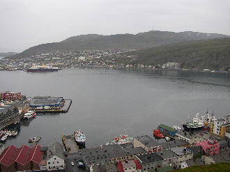
"Hammerfest - view of the city and harbor"
When I spoke to people about my travel plans there was one location which always resulted in the same reaction (certainly with people of about my age): everybody had heard about it geography classes in school: Kiruna, Sweden - the iron ore "home mine" of Europe.
I really do not know what caused this fascination with me. It must have been the location in the far north or something - I can't say, really. Anyway, this was a must on my schedule. The trip there was rather long: some 550 km from Hammerfest, which I decided to make in two days.
I arrived in Kiruna in bright sunshine and found another rather small town which had only been built in the early 1900's in order to exploit the local ore fields. Of course the first thing I did was to book a tour.
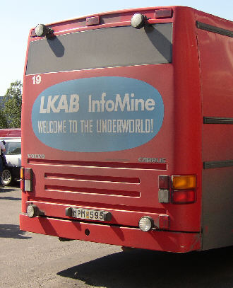
"Above ground"
"Click for a view of the underworld"
The interesting thing with this mine tour is that one goes down to a level of 540 m underground in a regular bus. The company which runs the mine, LK AB has used old shafts to set up a information center which includes an auditorium, a museum, a cafeteria and several gigantic machines which have been or are being used in the mine. The whole tour lasted for 2 1/2 hours and is in my opinion a must for everybody with a technical mind or, for that matter, anybody who had heard about the Kiruna iron ore in school..
Next on my schedule was the return to Norway, in order to take the Ferry to Solvaer, the main location on the Lofoten Islands. On the way I was to meet some very interesting people - but I shall write about that in "Norway - Part 2"
More to follow.
