Day 9
Country
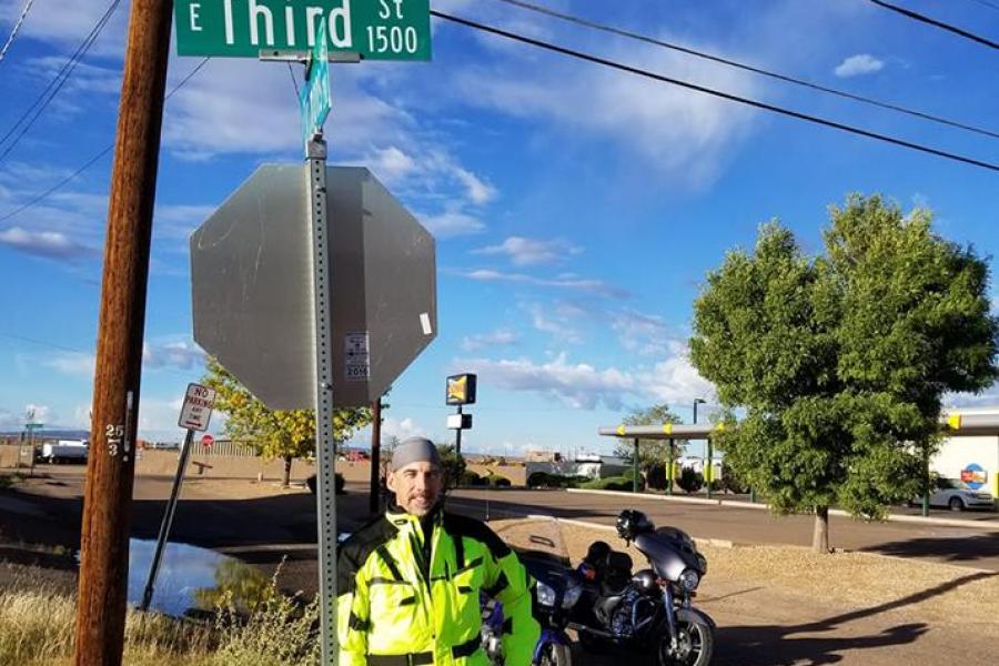
This Tour note has something special for the reader in the form of several quizzes, and an opportunity to get involved in the Tour yourself! Day 9's agenda for the 2018 Prefrontal Tour was an epic sprint across 627 miles of desert, starting in Holbrook, AZ and ending in Bakersfield, CA, the hometown of Buck Owens. The first thing of note on the road was a series of signs for the Jack Rabbit Ranch, and I wondered if they grow them for food or fur. No, we didn't stop... We continued west through towns with interesting names like "Deaf Smith", and "Two Guns". Towns in the east like "Schenectady" and "Niskayuna", although historically significant or interesting to someone, just don't resonate with me. Our first quiz involves the attached photo taken at some point in the morning, and the question is what am I doing, and where? A second quiz is that 44 miles west of there you could say I was a shoplifting actress... Where and what was I then? Shortly after that, we saw a deer crossing sign that said "Next 40 miles", and I thought that showed a lack of organization. We do a much better job in the northeast, because our deer can usually cross in zones only a few miles wide. New York alone probably spends millions of tax dollars a year on cross-training programs for these otherwise aimless ungulates... I put on some music after the first 100 miles, the first time on the Tour I've listened to something besides the hum of the bike and the whine of the tires on the pavement. Journey seemed appropriate. We passed the 3,000 mile mark near Snoopy's brother's hometown, so Quiz 3 is what was his name and where were we then? Based on the mileage I made a note to check the tires, oil, and blinker fluid tomorrow. Later as we crested the pass into the Mojave region, there was a storm dropping a torrent of rain across the valley to the right of the highway, its path an obvious trace of steam across the desert for many miles to the left. But dust devils were still whirling just beyond its margin, a testament to the rarity of the event we were still witnessing across the highway as it slowly moved north. The thermal liners in my suit just weren't cool anymore once the temps hit 82 degrees, and we both pulled over to remove some layers. No can do - that spot was swarming with desert bees, so we tried again a few miles on. With the liners out I located all of the zipper vents in the sleeves and chest, and opened the vents in the back to keep the jacket from inflating. It just wouldn't do to be dayglo yellow *and* poofy. We rolled into Bakersfield near dusk and took quite a while to find a hotel we felt was safe - Bakersfield is a lot bigger and badder than it was a few decades ago. Finally in closing, the team is asking for your help, and this is your chance to get involved with the Tour. We're taking recommendations on the route home, to commence in a couple of days, depending on weather, points of interest, and states not yet traveled. So far, we've relied on a combination of AAA TripTik, Dark Sky, and Intellicast to plot rest stops, weather, and road conditions a few days in advance, but you're welcome to use whatever you have at your disposal. Let's see those suggestions!

