The Route
Details of The Proposed Route: Trans-Canada; USA, Central America; South America; Australasia, Asia, Eastern Europe, Scandanavia, Western Europe.The Route Overall

North America
Canada (no Visa required)
USA (Visa Waiver Programme)
Mexico (Tourist Card) 6 months
Central America
Guatemala (no Visa required) 90days
El Salvador (no Visa required) 90days
Nicaragua (no Visa required) 90days
Costa Rica (no Visa required) 90days
Panama (no Visa required) 90days
South America
Ecuador (no Visa required)
Peru (no Visa required) 90days
Bolivia (no Visa required) 90days
Chile (no Visa required)
Argentina (no Visa required)
Australasia
New Zealand (no Visa required)
Australia (Visa required)
Asia
Japan (no Visa required)
Siberia (Visa Required)
Mongolia (Visa required)
Kazakhstan (Visa required)
Russia (Visa required)
Eastern Europe
Ukraine (Visa required)
Belarus (Visa required)
Latvia (no visa required)
Estonia (no visa required)
Scandinavia
Finland (no visa required)
Sweden (no visa required)
Norway (no visa required)
Denmark (no visa required)
Western Europe
Germany (no visa required)
Holland (no visa required)
Belgium (no visa required)
France (no visa required)
The Mexican Visa looks to be obtainable at point of entry, the others I'll need to get from the Embassy of those countries, either when I come home for a holiday, or while in Australia. The Route Part 1; Stage 1
My Proposed route is as above, but there are several factors governing its implementation. If I can leave in late June/early July then this is it, if not then I may have to juggle the times a bit, even starting in the Southern Hemisphere and heading north. This is no problem, just another opportunity, no but, yes but really is.. Of course the weather is a factor and this will require some ad-hoc adjustments depending on the time it takes to get to the various countries.
Canada
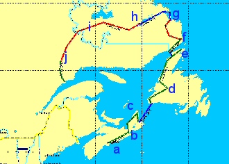
See text for annotation

Nova Scotia
So, providing both my bike and I find ourselves in (a) Halifax, Nova Scotia, Canada, in July, then I head north along the east coast of Nova Scotia to the National Park (NP) on Bretton Island, (c) camping at Boyleston Provincial Park (PP) at Guysborough on the way. (b)
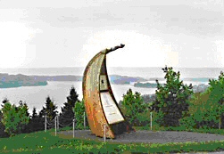
Boyleston Provincial Park, Nova Scotia

Newfoundland and Labrador.
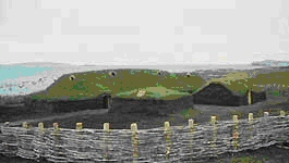
From there via ferry from North Sydney, to the island of Newfoundland. (d) I want to travel up to the north of Newfoundland to see the Viking settlement at LAinse aux Meadows (e)
LAinse aux Meadows

I then have to retrace my route returning to catch the ferry from St Barbe to Lourdes du Blanc Sablon on mainland Newfoundland and Labrador. Heading north from here to Mary Harbour (f) where the tarmac runs out and I change to off road tyres for my journey to Cartwright. (g) Catch the ferry from Cartwright to Happy Valley/Goose Bay. (h) A quick visit to Sheshatshit, then head SW to Labrador City (i) via Churchill Falls.
Quebec Province
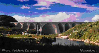
Manic 5

Then into the Province of Quebec where the tarmac starts again so I can change back to my road tyres. Passing the Manic Dams (j) I will reach the St Lawrence Seaway at Baie Comeau
This is the end of Stage 1; Stage 2 is Trans-Canada to Inuvik in the Northwest Terrotory.
Next blog: The Route; Part 1; Stage 2; Trans-Canada.
