Majestic Cordillera Blanca
"You were measured on radar back at the overpass. You were doing 50 km/hr in a 45 km/hr zone. The fine is 150 Soles. You can pay me here now. And your driver's licence is a photocopy. Where is the original?"
These words are coming from an officer of the Carreteras, the Peruvian police force I have found up til now to be professional, helpful and honest. This officer is one of the few exceptions. But word has gotten around about this little band of extra-profit entrepreneurs: watch out if you are travelling the Pan Americana Highway north of Lima. My reply to this young officer is one of respect but firm denial of the charges. I explain my respect for the laws of Peru and my attempt to go exactly the speed limit but the tsunami of trucks, buses, cars and taxis I'm travelling with on this autopista free-for-all flood by me at such a terrifying speed I have real fear for my life. I explain my concern of being hit from behind by these waves of flashing metal. All this weaving and lurching traffic create diesel exhaust like a black fog, restricting my view of the dangers ahead. My exact words to him are far more childlike but the genuine concern is not lost on him. As far as the photocopy license goes, I deny that too, even though we both know he's right. I'm not about to surrender my real license to a guy who is abusing his legitimate power. When he runs the charges by me one more time I suggest "nosotros iremos sus jefe, quizás?" The thought of both of "us going to see his boss, perhaps?" seems to be the turning point. In the end, much to my relief, I am released under the promise "viajar mas dispacio". I am happy to travel slower, even if that means it'll take a month of Sundays to travel the rest of Peru.
The rest of the day I spend tooling along at exactly the speed limit or below. Now on the four lane divided highway that essentially cuts through empty desert, doing 90 km/hr is fine if somewhat pedestrian. But for reasons still unclear to me and to other extranjero motorcyclists as well, there are sections where the speed limit is mysteriously posted at 60. As far as I can see there is nothing but sand ahead, sand on the left, sand on the right. As well, the start of the zone is usually clearly marked but the end is not. How does one know where the slow zone ends? No wonder this stretch of highway is a profit maker for some.
In an effort to maintain sanity and reduce the growing number of mysteries I face, I stop in one of the pueblos along the way to find out what in hell are in those trucks. I'm told it is sugar cane. OK, well at least that makes sense.
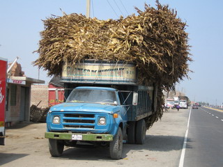
Things take a turn for the better after a pleasant night in Barranca, some 200 km north of Pandemonium, Peru (otherwise known as Lima). I turn off the Pan Americana and head north east for the famous Cordillera Huayhuash, then north between the majestic Cordillera Blanca and Cordillera Negra. Garúa, the coastal fog that obscures the vast fields of green sugar cane surrounding me, is gradually replaced with clear mountain air as I climb steadily away from the coast to 13,000 ft.
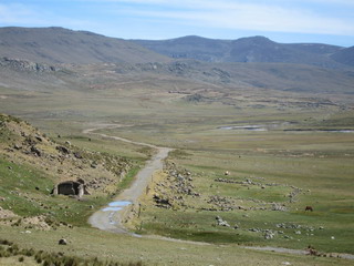
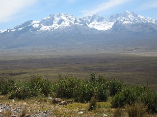
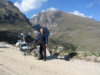
At the summit I enter into a broad valley and turn north. I'm riding in the cordillera of "Touching the Void" fame. The range to my west is the Cordillera Negra (black mountain range), so named because it has no snow, being lower and under the drying influence of the coastal desert further west. The Cordillera Blanca to my east have peaks of over 6700 meters, most capped with brilliant white snow and vast glaciers. Their moisture is gathered from the moist Amazon Basin further east.
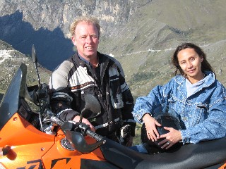
At the mountain city of Huaraz, I find Simon. The meeting was previously suggested by Diego while his Lima staff at KTM Peru were working on Katie. An ex-pat from the U.K., Simon owns the restaurant Chilli Heaven with Beatriz, his charming Peruvian partner. Simon also owns a KTM 950 and is more than happy to guide me on a tour around the mountains for a couple of days.
The KTM's are put to the test, as is my resolve not to think of possible consequences from some of the narrow rugged trails. Even though I'm riding along at over 10,000 feet, some mountain peaks tower more than two miles above me.
On one of our excursions, we stop in to visit another expat from the UK, Alex. We have tea and pan con miel (buns with honey) at his most remarkable mountain hostal, The Way Inn.
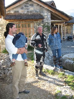
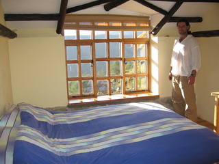
Skillfully taking advantage of existing landscape, Alex has hand built his idyllic retreat out of field stone and local wood. The views are spectacular, whether looking down the valley to distant Negra peaks or to look east to the Cordillera Blanca towering next to his doorstep. The rooms are equally inviting, with cozy warm beds, great views from spacious windows and lots of sunshine.
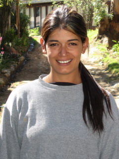
In Huaraz, I stay at Hospedaje Los Retamas, owned and managed by a close friend of Beatriz, Ybett Penagos. She inherited her hospedaje, essentially a motel with a shady courtyard, from her aunt. In spite of a young daughter to care for, Ybett works hard every day to restore the business to its days of former glory. Like Beatriz, I wish her much luck and good fortune.
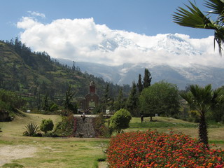
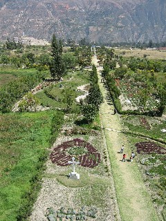
On May 31, 1970, a severe earthquake shook the Ancash department (county or region), of which the city of Huaraz is the capital. The resulting damage destroyed the city. As a child, Beatriz survived by living under a park bench in the Plaza de Armas (the town's centerpiece park). In the aftermath, choking dust from collapsed buildings killed many survivors. At Yungay, an hour's drive north of Huaraz, that town suffered an even worse fate. While the tierra de temblar shook Yungay to pieces, creating general chaos and billowing clouds of obscuring dust, it also shook Nevada Huascaran (6768 metres), a mountain some 15 kilometers distant. A huge section of glacier dislodged, resulting in an avalanche. The ice and snow crashed into a lake, causing it to overflow and creating a wave of mud, ice and water 4 kilometers across and as much as 25 meters deep. This terrifying force then funnelled down a natural valley and inundated the town. What was left of the town was completely obliterated by this catastrophic force. Only a handful survived, having the remarkable luck, when the flood hit, of visiting the cemetary located on the top of a modest cerro (hill) closeby.
In the town itself over 20,000 people lost their lives. Today, the orginal site is marked with fields of roses, scattered white crosses and a facade replica of their beloved catholic cathedral. In the first photo below, you can see Nevada Huascaran shrouded in cloud in the background.
In the second photo, you can see the former town's main street outlined with hedges and flowers. Look on the left side of the picture, beyond the green space. You can see the small white hill and the cemetary, ironically enough, that was responsible for saving some lives.
As a result of the disaster, the Peruvian government lowered all mountain lakes and continues to monitor their levels to this day. The new town of Jungay was re-established further north.

