The Quilotoa Circuit
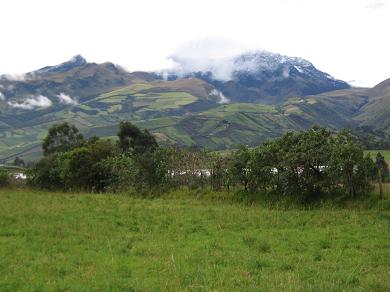
From the tourist town of Baños it is time to head north to the Avenue of the Volcanoes. That and the Quilotoa Circuit are next on the list of stuff to see. The route takes me to Ambato, then north on the busy Pan Americana Highway, then west at the starting point, Latacunga. Rain showers chase me along. Disappointingly, the more than a half dozen giant 5000 and 6000 meter volcanoes along the 'avenue' are hiddened from view by the solid ceiling of low cloud.
The first leg of the circuit is a lovely 2 lane narrow but paved highway leading west for about an hour and a half. It is only 75 km but the constant curves and climbing/descending along the mountainous contour lines keep Katie and I busy. At Zumbahua we turn north. With the asphalt now laying on sandier soil, the very real danger of wash-outs add another thing to watch for. Where the rains have undercut the base, huge bites of road are missing, sometimes creating a crevasse of many meters. Inattention to the road would lead to serious injury or worse. None of the sudden disappearances of the road are marked.
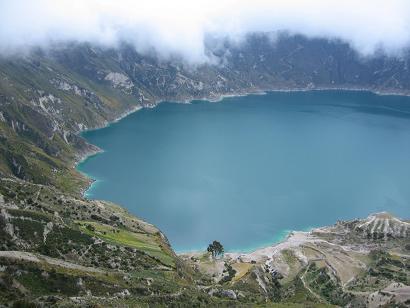
The reward comes at over 13,000 feet when we arrive at the volcanic lake of Quilotoa. Clouds swirl, the temperature at the crater's edge is less than 10 above and a cold wind blows. But the view is sublime. One can hike down to the azure water's edge in half an hour, and climb back in an hour in a half (the altitude takes its toll on climbers). Being in the piston-head frame of mind, I stand at the edge and just take pictures.
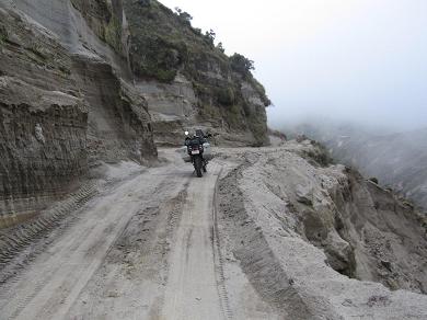
Continuing the circuit, I head north off pavement and onto a soft dirt road. Katie snakes around in the deep powder-like dirt. It doesn't help a grader (a grader in South America!?!) has just worked the road over. Adding to the fun are steep dropoffs and more rain. Tell me again why I keep taking the road less travelled?
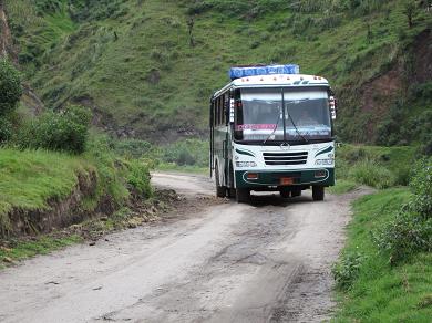
The road gradually improves as the day wears on. Now, and thank heavens not sooner, my favorite mountain road compañeros show up. Camions and autobuses. True to form the drivers all have death wishes combined with the urgency to go as fast as possible, regardless of road conditions. Or the fact that smaller sized traffic might be occupying the road too.
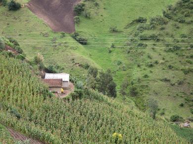
There are not many places to pull over and get the picture of the lifetime, but the snapshot below shows how the andinos live, whether they are in Peru or Ecuador. The crops are hand tilled and harvested. Blankets are spread out to thrash the sheeves. The seeds are spread to dry. The waist high sacks of harvest placed at the roadsign for camion pick-up. It is a simple life but a hard one. Clothes are still washed in mountain streams and hung on bushes or simple clothes lines to dry. For every one picture I do take, a 1000 National Geographic quality ones are taken in my mind. They are truly unique scenes and cultures to observe as Katie and I pass through in these few moments.
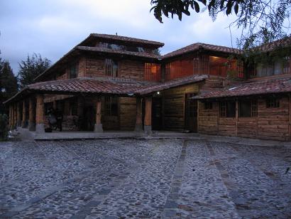
Sunset is at 6:15. It is now 5:50 and I am not off the mountains and finished the loop. It has taken me all day to ride less than 200 kilometres. But now I must find a place to camp or stay within the next 15 minutes or face riding in the dark, surely a foolhardy thing to do. Light rain adds to the challenge. With no plan other than to stop and set up my tent in the next few minutes if nothing shows up, a town does show up like a miracle. Not marked on my GPS, the pueblo of Toacazo arrives in the windshield. A quick inquiry at the town's only service station has a customer leading me to an unmarked hacienda that occasionally takes guests. As darkness falls, I arrive at the beautiful log house of Ramiro Vela. I can stay even though the place is temporarily closed. Katie gets to park in the spacious dining room. Ramiro rustles up some crackers, cheese, tea and a beer. We are all happy. Through the night, from my cosy and dry bed, I can head rain falling on the roof of the hacienda. I fall back to sleep easily.
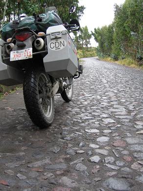
The next morning, it is still raining. And now the final leg of the Quilotoa Circuit is cobblestone road. Katie finds it slippery when wet. We idle along in first gear, the shocks getting a workout too as we judder over a road surface of round riverstone.
Rejoining the Pan Americana an hour later, Katie and I ride for Cotopaxi. the popular destination volcano (5897m or 19,347 feet) everyone raves about. Except today it is less than 10 C at 10,000 feet where I'm at and a cold rain is still falling. I realize to ride up to one of the world's most perfectly coned volcanos is to take a ride in the snow. Further, I will see nothing but the inside of the clouds. So, reluctantly, Katie and I head for Quito and a dry hotel room.

