Two Pegs to Patagonia, The 3 Americas
Follow this story by emailA Travel Story by Bruce Porter
A Travel Story by Bruce Porter
Bit the bullet, bought the flight tickets.
September 8th 2010 is the day we fly out to Toronto to start our 3 Americas trip .
Now we just need to get the panniers made for Jean's bike, buy lots of stuff to live off, sort out paper work so we can get through borders, starting with Canada. We have bought one way tickets, we expect to be be questioned at immigration. Better practice our smiles.
Not a major change, (but an expensive one) decided that my XJR was not the right bike for the trip. uses lots of fuel, tyres expensive and if I "ding" a wheel (alloy) I'm stuffed. Getting a replacement will be expensive, at least with spoked wheels I should be able to get local repairs done.
My old XJ900F reached a milestone today, 100,000 miles.
She is a 1994 "J" reg, I've had her since 1997 with 11,500 miles.
She has never let me down.
And then she rolled over.... just like new again.
Spent a few hours with Vern (Project VND) trying to work out how, where and what size panniers to stick on the bike. There was a lot of hmmming and arhhhing. Much measuring, re-measuring, head scratching and discussion.
Finally a decision was made, he will need to make a cut out around the exhausts and there will be relatively flat tops with hooking points.
The mortgage. Finally paid off this month. Took it out when I was 21.
Its been a long time..... maybe I'll go on a little trip to celebrate.
While riding my Pegaso last month I heard a vibration, so I crawled over the bike and noticed the radiator was loose. On closer inspection the 2 top rivets were missing. I popped into Pitstop and Paul had a look, then started to fix it by widening the hole and adding a pop rivet. The 1st one went in OK, the 2nd punctured the rad :-(
When we looked more we realised the radiator was slightly bent (from previous owners drop). After checking a new one was 300ukp ! I went to see a local radiator repair shop, only to be told it was knackered.
I'm not panicking, honest. But with the bikes due To ship out on the 1st September it would be nice if everything was in placeWe are waiting on 2 major items at the moment
1) The panniers
2) Anti-malarials
We seem to have got into limbo with the surgery pracice nurse and the doctor over getting our prescription for the Malerone, and if we order online it we need to post off the prescriptions to get the pills. It is over £100 cheaper to order online though.
And of course we want to pack the pills in the bike panniers.
Finally, after what seems like an age, we have the panniers fitted to the bikes.
The tightly fitted garage, 4 bikes are squeezed in here, you can just see the XJ900 buried at the back.
This month has been a nightmare of organisation, originally I had a great plan where these last 2 weeks would have been a case of relax, throw the bikes on a plane, and then we run away.
After a frantic few days of packing, repacking, buying extra items to aid packing (once we had the panniers we had a better idea of how we wanted to fit things, we delivered the bikes to James Cargo for air freighting to Toronto.
As we pootled down the M56 it occured to me that this was actually our shake down run, it was the 1st time we had both been out with the full kit load. We resisted the temptation to pitch the tent and repack as a final experiment.
Touched down just before 17:00 local time (22:00 GMT), pretty uneventful flight, smooth, on time (heck we actually had a plane !) and food as well.
After being hit with $25 taxi fare to go less than a mile (as the crow flies) because no one would let us walk across the runways, these were the words we were met with on Thursday morning when we did find them.
Yes, nearly £1000.
I'm still not sure what had gone wrong, but the bikes had been put into storage, at a cost of $596/day, they had been there since Monday. We got James Cargo on the case while we went to sort out customs clearance and it has been 95% resolved, I am still awaiting a refund from JC.
Does my bum look wet in this ?
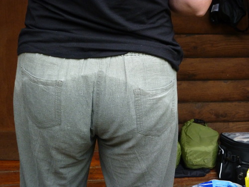
Results of wearing Dainese "all weather" pants for 2 hours in heavy rain.
Since crossing into the US, we have been wandering around the North East (New England) states, in fact we headed East and North into Maine before dropping south.
The border crossing at Cornwall was very un-stressful, we were asked the expected questions about status and financial situation then stamped through for 6 months, I think the B2 Visas helped. I resisted any jokes with Officer Geiger over his name in case a sense of humour failure ensued.
After our soaking in Pennsylvania the weather has picked up as we have dropped south, after a stop over near Washington with an ex Sun colleague, Christin Tran, we headed on down to Colonial Willamsburg. I've written about the area last time we here in 2007, so I won't go into detail again, other than saying it is the home of the 1st permanent colony in the US (forget that Plymouth Rock crap).
Why "Yee Hah!" ? Well, we are now in the Confederate South and joined the locals doing what locals do.

Kill Devil Hills, Kiitihawk, North Carolina. The track marks the world's first successful powered flights, by the Wright brothers, on a freezing cold day in December 1903. A piece of the plane was sent to the moon and back on the Apollo 11 mission in 1969.
Those Wright brothers were damn clever people.
We have just spent a couple of days camping on the beach at Kitty Hawk (North Carolina). The Atlantic swell was "awesome" thanks to the recent hurricanes.
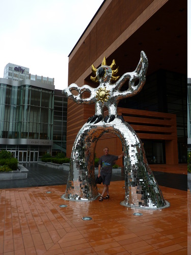
Another cultural interlude (to balance out the previous shooting session) - Bruce was dragged into the modern art museum in Charlotte, North Carolina.
And not the weather kind.
With our drift south we noticed a lot of motorbikes, all going the same way, So we did the natural thing and followed them.
We ended up at Panama City Beach, Florida, bike week.
http://www.thunderbeachproductions.com/Sun, sea, sand, beer, bikes. music. I keep needing reminding that it is October as I sip a beer in the evening dressed in Tshirt and shorts in about 22C.
Its not as big as Sturgis, where we went in 2007, but bikes are in the 10-20,000 range and the whole town ihas been taken over.
Meaher State Park, by Spanish Fort, Alabama.
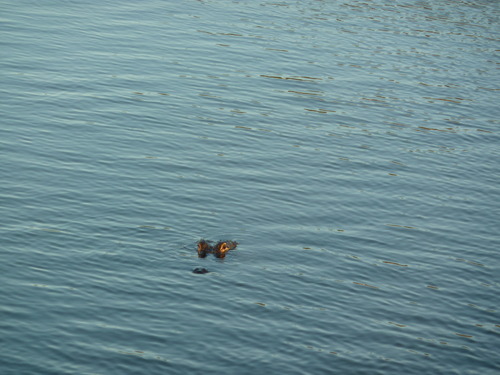
Is it a log? No its a 10 foot alligator skulking in the lagoon 200m from our tent. I slept with my feet facing the lagoon.
They call the ... yadda yadda yadda, been there seen that.
I drove my chevy to the levy ..... etc etc etc, actually camped by it.
The man who said he would look at my bike, did, it was one look, followed by "What sort of bike is that ? I thought it would be a Harley, I'm not going to start looking at that."
He then sent us to the Harley dealer, saying they worked on all sorts of bikes. The Harley dealer took one look at the bike and said, "Its a metric, we don't work on metrics".
Now, Jean and I were stood there thinking the same thing, "does electricity work in different units in the US?"
We are back on the road. Final diagnosis was a fault in the electronic dash, so the high beam switch has been taken out of the equation and a hardwire by pass put in.
If this bike gets home, it will be fun getting it through an MOT.
To finish off an expensive day, I had a haircut.We headed out for Texas over swamp and marshes, where they have adapted houses for the tropical storms and hurricanes.
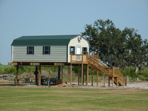
From bleak oil terminals, to verdant (and warm) country side.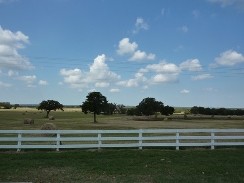
You would not see British crops left out in the field so late in the year.
Following our long 300 mile day into Texas, and not stopping in Abbeville which was having its annual party, we did the only sensible thing we could. We ran back to Louisiana, a very short 75 mile, 1 diner, ride to the State Park near Lake Charles. A proper camp site in a swamp
Garden around trailer house in Sabine, Texas
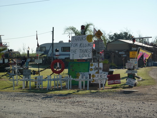
They're not happy with BP here.
As so many T shirts shout out in San Antonio.
And, they are right, its something like 2000 miles across.We have all seen the film, heard the stories , so I wanted to see the real thing.
The Alamo.

This is the only remaining building from the events in 1836 that led to the formation of the Republic of Texas.
I'm not sure which wall it was that Ozzy was arrested for "dis-respecting" this national monument, but he could have used the restrooms round the back.
Big Bend NP
At least we were heading south, even if it was away from the border. Although, while there we camped by the Rio Grande, which is the border.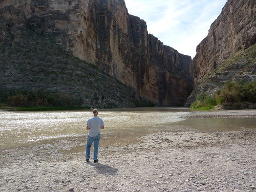
USA to the right, Mexico to the left.
Back in 2002, the local soft borders were closed, Mexicans still try and cross to sell souvenirs, if caught they risk a large fine.
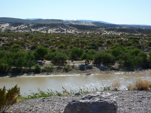
After all the tales of hassle at the borders, armed patrols on the roads and watching for bandits as we travelled through the USA, it was a very uneventful crossing.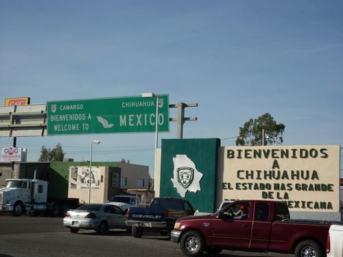
We bimbled up to the border around 8:30, had the sense to stop despite being waved through, park the bikes, walk over to the USA customs and hand in our white visa cards. I can see why so many people fail to as the USA guards are not interested in south bound traffic at all.
Some notes on driving in Mexico.
Petrol :- The oil and petrol business is state owned, there is one brand of fuel, Pemex. The price is the same every where in the country, even on the toll roads. Octane is variable, they all have 87 which the the equivalent of our old 2 star and then there is 91 which is the same as the UK unleaded and sometimes 92 or 93.
Or Mexico D.F (District Federal) as it is known, or just Mexico. It does not seem right following signs for Mexico while in Mexico.
The Mexican motorway service areas are a little different from ours, a line of restaurants appear with ladies waving brightly coloured flags to attract our attention.
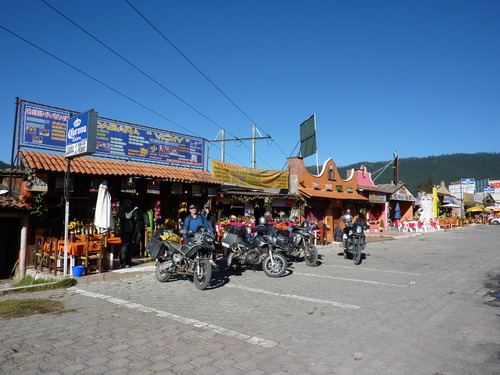
We had some nice Chorizo Verde tacos, everything in it was green, including the taco.
Jean does not think I should mention we had green poo the next day.
Garry led us out of the city, dropping south to avoid the ring road and a scenic detour to view the volcanoes, then as he had to go to work he pointed us in the direction we needed to go and with a wave merged with the traffic and faded into the distance.
For the 1st time in two weeks we were on our own again. Our general direction was towards the Yucatan Peninsula.
On the way we had the worlds worst traffic jam, caused by someone selling lottery tickets at a tope, aided by a statue of Jesus.
8 weeks of being dry, and then we finally got tropical weather.
As we entered Chetumal, on the Mexico / Belize border, looking for a Couchsurfer's house, the clouds let rip, big style. Within minutes the roads were flooded and we were ankle deep in water (that is, ankle deep while on the bikes). It went dark, and the rain so "thick" we could hardly see,
We quickly found shelter in a tyre fitting bay.We just pulled in, got off the bikes, smiled at the staff and stood there dripping.
Nowhere is far away in Belize and there are only 3 main roads. In theory, you cannot get lost, so they don't feel plentiful sign posts are worth the money.
And if you do make a wrong turn, concerned locals wave you down and tell you to go back. It's possible to drive through the country on one tank of petrol, without stopping or seeing any thing. However, this would be a shame.
Meeting people on the road is one of the cool things that happens, it can change the day, dissolve any possible plans and lead you off on paths that you would never normally take.
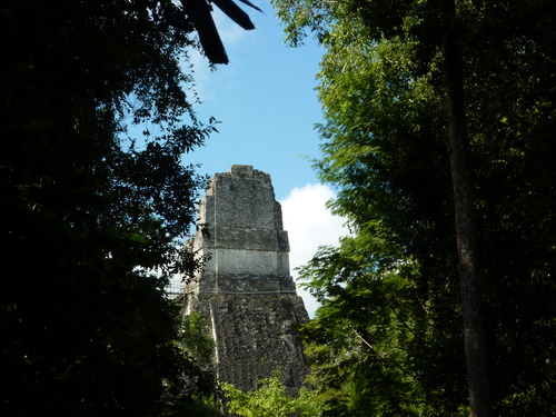
First we met Evan, a Canadian doing the trip on his own. He spotted the bikes, we started talking and decided to ride to Tikal the next morning together.Tikal is another "must do" backpacker pyramid touristy site.
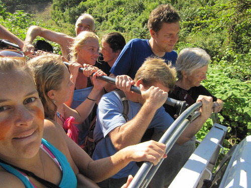
Trip down to caves at Semuc Champey. The tour 'bus' from the hostel, get on and hang on. Single track dirt road winding around steep hills all the way!
 The cave tour. All done by candlelight. In parts this involved swimming one-handed while holding your candle over your head, and jumping in pools while again attempting not to extinguish your candle. Followed up with swim in beautiful outdoor natural pools.
That was an experience, we have just finished 5 days of Spanish "immersion" lessons. Five hours a day of one on one tutorials, and around 2-3 hours of home work a night.At the same time we have been staying with a local family to get the full experience.
We chose Quetzaltenango (Or Xela, pronounced Shayla, by the locals) because it was ;-
a) At a high altitude (7600 feet), so no Malaria issues which meant we could come off the medication for a week
Performance in the Parque Centro, Quetzeltenango, Guatemala.
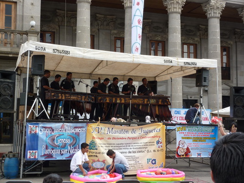 Marimba is the national music of Guatemala, and is played on large wooden xylophones with a group of players. Each player holds up to 2 beaters in each hand. What follows is an incredibly well sychronised multi-layered performance of complex pieces of music. When we arrived they were giving 'White Christmas' the marimba treatment!
The water is loverly, Surf's up !
We had a choice between Volcanoes or Beach. We both felt it was time to visit a beach.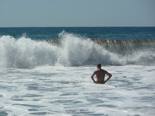
It has taken us over three months to reach the Pacific, and it happened to be our 100th day on the road, so a birthday of sorts.
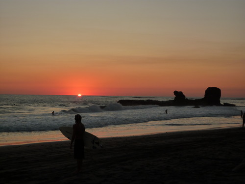
El Tunco beach, El Salvador. Looking over the Pacific.
Pengy considers theories of evolution and why there are a lot of surfers but no penguins on Central American beaches.
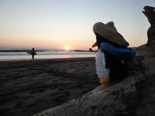
And then the sun went down, as it does every day........
Our plan for Costa Rica was to head straight through in the "Inter Americana" highway that cuts through the capital, San Jose, and then into the mountains.
We stopped over night just across the border ( a four hour crossing from Nicaragua) in Liberia and had an early start at 08:00.Initially the road was good, but then as it hit the first mountain range the number of trucks and tailbacks increased, and our speed dropped as it was overtake, overtake, overtake.
We feel naked.
After kicking our heels for a week, the bikes have been handed to the air freight company in Panama, along with $1800USD.
Now we just need to get our flight to Colombia in the morning, and play the 'get the bikes out of storage' game.
The Cargo company did worry us a bit though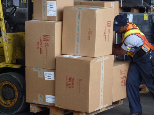
Note the "This Way Up" arrows on the "fragile" cargo he has just dropped. For the 2nd time.
The hotel we have stayed in has been like a bikers magnet
The Airport abbreviated name says it all.
BOG, well it appeals to my sense of humour.
Its not a bad airport, we just had some fun and games after landing. At first things went smoothly, we had no problems with customs, the tourist information lady was easy to understand and directed us to the cargo depot.
After a bit of going backwards and forwards between people they finally told us that the bikes were still in Panama. Not a lot we could do, other than go to the hostal we had booked into, the Cranky Croc.
Cuidad de Panama, from the 'old town'.
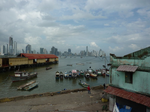
A city of big contrasts, where tin roofed shacks of the poor prop up the modern tower blocks of the rich, and the old rubs up against the new.
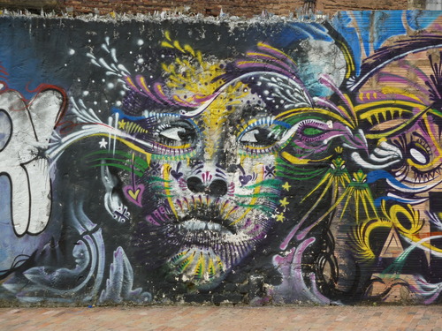
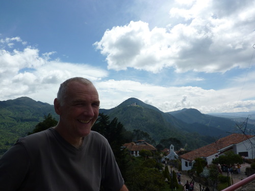
Bogota, Columbia. 2 of numerous photos I took today. Well, you have to when you're in a new continent!
1. Graffitti wall near our hostal.
2. View from mountain to east of Bogota. Look! Its the foothills of the Andes (foothills being at 9000ft.............)
 >
>
Progress in Colombia continues at a snails pace.
We headed North for San Gil and then Santa Marta, on the Carribean coast, as everyone at our Bogota hostel said it was a good route to take to get to Cartagena.
What no one mentioned was the number of cars, buses and trucks crawling up and down the winding mountain roads to get north. We took 8 hours to do 330kms (210miles), and when we arrived at the hostel in San Gil we discovered the road north was 'temporarily' closed beyond the next major city (Bucaramanga) due to land slides.
Probably the most common road sign in Columbia.
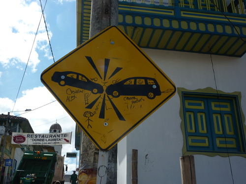 With all the mad overtaking going on, its not a matter of 'if' but 'when'. Although Peru is worse, apparently.........
Salento, a little village on top of a hill, in the heart of Columbia's coffee growing area.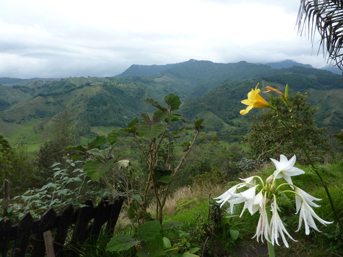
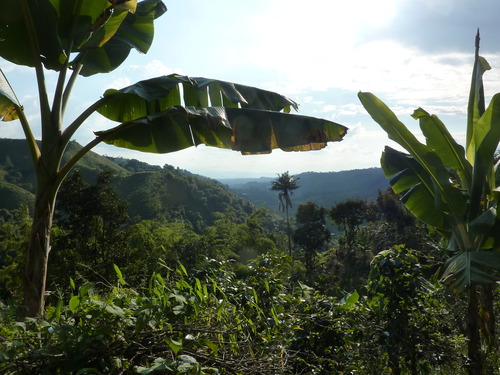
Its seems to have been a long time coming, the nearer we got, the slower we traveled. At times we even managed to venture further away.
But today, we finally crossed the equator.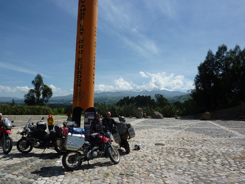
As we approached the last few miles I, rather childishly, had my hiking GPS in the tank bag and was able to watch the "minutes" and "seconds" tick down as we got nearer.
Typically we were not the only ones on motorbikes there, two Texans had arrived just before us.
From near the Amazon basin to the sea, all in one day.
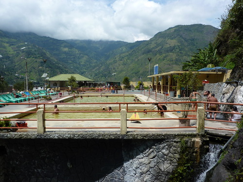
We had stopped for a couple of days at a nice Spa town called Banos, which sits in the shadow of Tungurahua, which last erupted in May 2010.
The town is about 60km from the start of the Amazon basin, but as the hostel offered sauna treatments and thermal baths we opted to stay and play in the water.
We seem to be re-planning the trip almost on a daily basis now.
Having taken our time coming through Central America (because we were enjoying it and we were avoiding the prolonged rainy season in Costa RIca, Panama and Colombia), we are now concerned about the rainy season we will hit in Bolivia. As many of the roads are unpaved, this may well mean having to not go to the Salar De Uyuni as the salt flats will be wet and the roads there un-passable (for us).
Our headlong dash out of the mountains towards Nasca to see the "Worlds Highest Sand Dune" and the Nasca Lines (un-explained detailed drawings in the desert, a bit like crop circles, but bigger and older) was interrupted by something neither of us had expected.
A sea of sand dunes, with an oasis.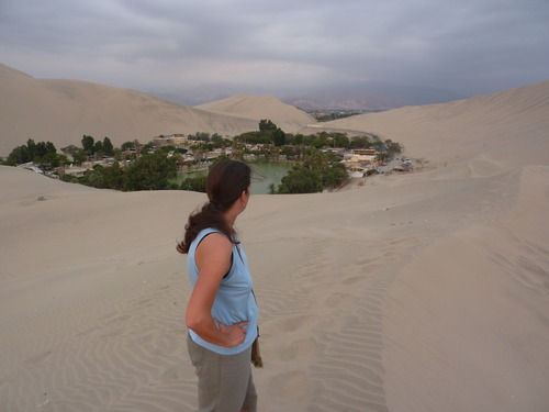
Jean had two wishes for this trip, other than the penguin thing.
* To meet an Andean woman wearing a "bowler hat"
* To have a conversation in Spanish with her.To get to Bolivia we had to head back into the mountains and leave the desert behind for a few weeks. We had been warned that rain was expected higher up and within an hour of turning east rain clouds formed. A timely change into wet weather gear was accomplished on a flat open plain.
Uyuni, the worlds largest salt flat.
We had written it off the route, due to its possible inaccessibility during the wet season (dirt roads only), but Jean decided she would brave it.
So, we selected the straightest and flattest route, and hoped for no rain.
The tarmac turned to hard pack, the hard pack turned to muddy sand. And in the distance we saw rain.
The road from Uyuni to Potosi, Bolivia.
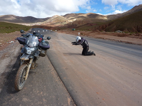 All hail the Bolivian road builders! For every metre of paved road they manage to build across this hugely scenic but very inhospitable terrain.
From Uyuni we wanted to head to Chile, the most direct route was 500 kilometres of dirt, with at least one stretch of 400 kilometres with no fuel.
So, to be fair to the bikes and ourselves we decided to head back to Oruro via Potosi which had much more tarmac, and then head into Chile at its most northerly border with Bolivia. A detour of about 1500 kilometres.
At least it feels like some one has.
Before crossing from Bolivia to Chile we filled up, but not before the attendant made sure we understood that as foreigners we would be charged double the fuel price, 60p/litre, we assumed it was the equivalent price to Chile to stop people coming over and sucking the tanks dry.
It had been 170 kms since the last gas station, and as it turned out would be 230kms to the next one.
Somewhere in Bolivia. The most common road sign seen here. And there's loads of them, llamas, alpacas, vicunas.........by the road, on the road, about to cross the road. At least they don't suddenly dash across in the suicidal manner favoured by moose and deer. They eye you up and then casually saunter over the road like someone crossing a main road in Liverpool city centre.
For many years now my email has carried a signature at the end.
"The internet is a huge and diverse community and not every one is friendly"
After our great experiences with people we have met on this trip via various internet resources: Christine in Virginia, Thomas in Atlanta, Pam and also Wes in Texas, Garry in Mexico, and Norm in Panama, who have all hosted us......
I now really think it is time I finally changed it.
When looking ahead to this part of the trip we thought the only choices were
1) Ruta 40 - mainly dirt road and high (very high) winds, tracking the east slopes of the Andes.
2) Ruta 7 - the Carretera Austral, 1200kms of dirt on the very scenic west slopes of the Andes, with ferry crossings, followed by Ruta 40.
3) Cross to Argentina by the Chilean lakes, go to the Atlantic coast and take ruta 3 south, then the same road back north.
Option 1 and 2 and been ruled out a long time ago.
Option 4, did not even exist. Until Santiago.
West of the Parque Nacional Bernardo O'Higgins on the coast of southern Chile. Pengy finally got to see lots of relatives (the Magellanic family branch) swimming past. Unfortunately they were a bit camera shy and kept diving for fish instead of posing properly for photographs.
View from the Puerto Natales ferry, rounding the base of the Peninsula Roca on the southern coast of Chile.
It's been over six months, somewhere around 19,000 miles with more highs than lows.
We set out with a target of Patagonia, and even though technically we have been in the region since the Chilean "Lake District" just north of Puerto Montt, we didn't feel we had truly arrived until we got to Torres Del Paine National Park.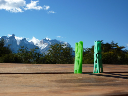
We managed to get the two Pegasos here as well.
Seno Otway penguinera, near Punta Arenas, Chile.
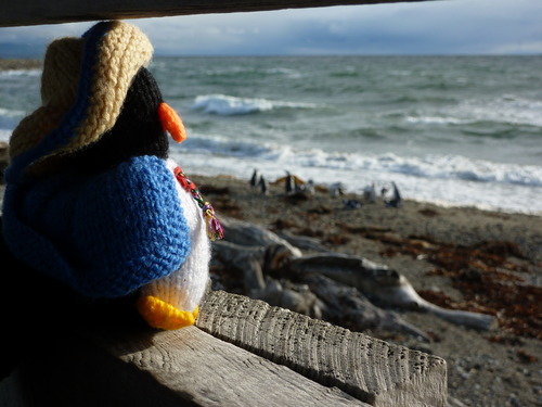
Pengy spotted his relatives returning home from the sea, after a long day fishing. When they had finished resting and 'socialising' they all waddled back to their burrows making a lot of noise and stopping from time to time for some beak rubbing and flipper waving.
Pengy then found a salubrious looking burrow and took up residence for a short holiday.
(for the Higgins family)
Bernardo O'Higgins, one of the main players in the independence of Chile, has tributes all over the country. There are main streets named after him, a national park, town squares, and numerous monuments.
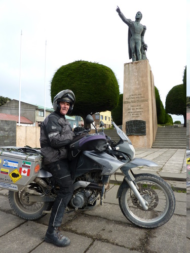
We have been very lucky on this trip, except for the actual breakdown.
A rapid search on the internet located Gonzalo at Motoescar in Punta Arenas who agreed to look at Jean's shock absorber if we could get it to him (240k away).
He then rang back to say he had a friend in Puerto Natales, with a truck, who was going to Punta Arenas the next morning.
Cerro de la Cruz, Punta Arenas.
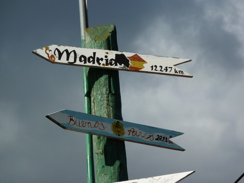
There's the route home, via Buenos Aires and Madrid. I just need a way of getting there!
An enterprising resident has used big poles in their garden to set up signposts to cities around the world. For the equivalent of $40 we could have ordered one for St Helens. However, we'd sooner spend the money on food, beer and getting my bike fixed.
I think I did, once, but I got away with it.
Yes, we are now in the home of beef and claimants to British sovereign territory.
Jean's bike is finally fixed, last adjustments made at 10.00 this morning and then we high tailed it out of Chile. 9 days in Punta Arenas was enough for us. There are just so many times you can walk up and down the same promenade.
With out the aid of Gonzalos at Motoescar we would have been there much longer. His final fix was to get a friend to fabricate a new seal.
After four days of progress north seeing nothing but flat pampas stretching from one horizon to the next, we finally reached the Welsh region of Patagonia at Trelew and decided to have a two night stop.
This meant that we had a chance to visit the largest penguin colony outside of Antarctica. Much to Jean's joy, although we are in the last 2 weeks of the fledgling season before they all migrate north to the sea off Brazil, there were still penguins to be seen.
Lots of penguins.
At the entrance as I was paying I heard Jean shout "look... penguins! "
But still not out.
After all the bad roads we have crossed :- The gravel, the mud, the sand and the ripio.
A roundabout on tarmac in Argentina is the scene of my worst spill so far.
Its not as if I was going fast, around 35mph (60km/h for any Canadians still reading).
We were going straight on, I entered the roundabout , looked to my right to see if any vehicles were approaching from the next exit and then .......
.... sky, road , roundabout, bike, spin.
On the road all kit is useful, however some kit is more useful than others.
By far the most useful and utilised is gaffa/duct tape for its ability to stick anything back together again.
However we carried and collected a few other items that have been invaluable to us.The Washing Machine
Clothes were mostly washed by jumping up and down on them in the shower while applying Dove soap, but sometimes a more thorough wash was required and there was not always a handy launderette in some remote places.
Thats two continents down, at least one to go. No more bikes have fallen over recently.
It has been a quiet week, especially with me limping everywhere.
We spent most of the week sleeping and socialising in the garage at Dakar Motors, who have a workshop with a 'hostel' attached.
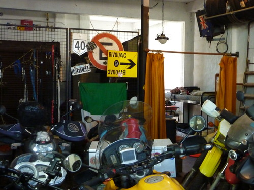
Basic, but functional, and shared with other bikers and travelers.
We managed to fill one night, along with about 40,000 others, at an Iron Maiden stadium concert.
We left Buenos Aires in the autumn and 12,000k later arrived in Madrid in the spring. It took us 12 hours in the air to travel half of what took 7 months on the ground.
The steak in Argentina is as good as its renowned to be. We shared a slab with Cindy and Geert at a parilla (BBQ restaurant) in Buenos Aires.
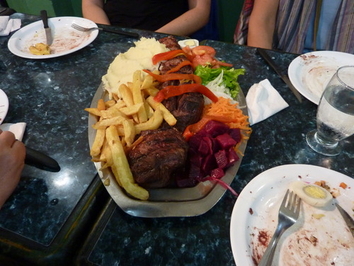
My first impression of Bueno Aires was that it was quite similar to Madrid. But now I've had a good look at Madrid again I don't think this is true
We managed to leave Buenos Aires without any (more) mishaps, and arrived in Madrid at 05:30. As it was dark we could see straight away the moon was back the right way up, and waning in the correct direction. The bikes flew to London before joining us by Sunday.
In Argentina drivers would look at us as they failed to hit us, back in Europe they are looking at their mobiles.
When we crossed from Spain into France two things became immediately apparent.
The first was that we had finally entered a country where the road signs made logical sense (to us) with the same towns consistently listed, in the same order, and fair warning of a junction appearing. Spain had been little different from the Central and South American system of randomly changing what towns are signposted, with the added attraction of telling you you had just missed your turn off.
Not since the USA, with the exception of some parts of Chile, had navigating been so easy.
We've spent the last week drifting across the country visiting friends and relatives , from Plymouth to Surrey and then Sheffield, before turning west across the Pennines with one last stop at Rawtenstall where I was presented with a solution to the coke bottle/straw issue.
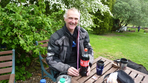
We're heading back to South America, this November.
Since finishing the Two Pegs trip I've definitely had a sense of something missing. A need to hit the road again. We had plans for spending a large chunk of the winter in Spain and only taking time to come home if any work came up.
It is different this time, packing, and feels all wrong. Normally when we go away we get the bikes out, fill the panniers and then either ride away on them or have them crated and join them a week later on some far flung continent.
Instead we found our selves presented with a pile of clothes and motorbike accessories on the lounge floor like this.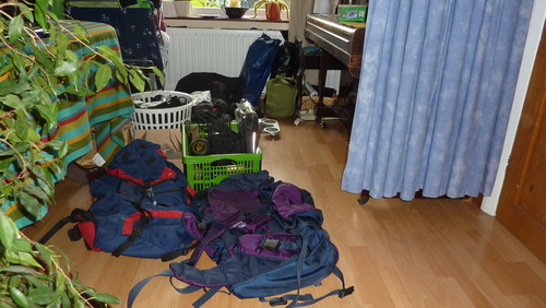
The clothes were easy, they fit into 2 small "canoe" bags each (the small green thing under the piano leg).
When planning to do some bureaucratic activity, like trying to obtain an official "tax" number and have vehicle documents put in your name, it is best not to arrive in the capital city on a national holiday. Especially one that occurs on a Thursday, so everything shuts down for 4 days.
Our friend Juan, who we are buying the bike off, picked us up from the airport and took us to our apartment.
The apartment is situated in the centre of Santiago and is very secure. To our right we have the city police station (Carabineros de Chile). With riot wagon.
"Sometimes you just have to go with the flow." (TM @ bdp 2010-)
Over the last week we have not really felt in control of anything going on with the bike. We just had to put our faith and trust in those that were helping us.
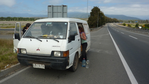
Fortunately it was not the bike, it was a friends van. We had been into La Ligua on an errand of mercy with Lorraine, who we have been staying with. As we left La Ligua I commented on the smell of oil and water coming from the van. Lorraine comfirmed it always smelt that way, so I stopped being nosey.
10k later on Ruta 5, the PanAmerican, the van spluttered and died.
I went up into the Chilean Andes at the youthful age of 49, and came back down the other side into Argentina at the start of my next half century. Crossing the Andes was significant for us, back in 2011 we stayed on the Pacific side all the way down, with jaunts up onto the Altiplano, but never actually crossed them.
That is one itch scratched.
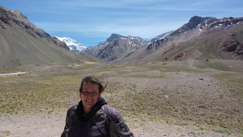
At the top of the pass, with snowy Aconcagua peeping in the background.
Shortly after arriving at our hostel in San Agustin, and after filling the bike with fuel from the much needed gas station, we were told about the local football match that was about to kick off.
With nothing else to do that evening, we wandered down to the "stadium".
In a natural rock bowl the "crowd" ( a few hundred, but this was probably most of the town) was gathering. Cars and motorbikes were parked right next to the perimeter fence for a really close feel.
Bo-pengy (cousin of Pengy) awoke from suspended animation in the bike pannier in Argentina, and started the search for potential Bolivian relatives. As Bolivia ceded its coastline to Chile in 1904 after the War of the Pacific and became a land-locked country, this is likely to be an ultimately fruitless search.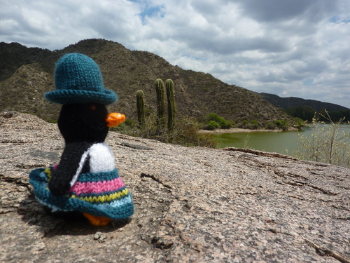
Note to Gibbo: yes I have brought another b****y penguin! Hay uno problemo?
And this time it was the bike.
With perfect timing the bike died outside an hotel. I didn't know that it had until I came to move it to the car park an hour later. The ignition didn't even give a whimper. The man who I was meant to be following to the garage re-appeared as I was stripping the fairing to check the wiring.
It took longer to take the fairing off and replace it than i did to find and fix 2 loose wires. This may have been a record diagnose and fix time for me.
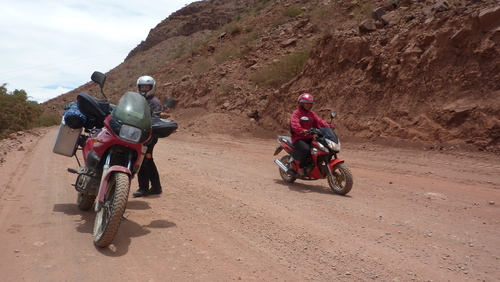
Why is it that you can spend ages choosing a good spot to get "that picture". The one that shows what a rufty tufty overland adventuring biker you are. Some nice gravel, rutted road, rocks and plenty of colour.
And then a little old lady comes round the corner on her scooter.
While sitting out the altitude sickness in Potosi we mulled over what to do and where to go next.
Which was a bit daft really, as we both knew where we wanted to go. The Salar De Uyuni.
Nearly 2 years ago we visited it in the wet season and were mesmerised by its beauty, surrealism, and tranquility.
The fuel can (OK, orange juice container) has finally been used.
Not because we are short of fuel, nor because there are no gas stations.
While we were having dinner with our friend Jorges back in Tarija, we talked about football as well as bikes.
I was interested to know how good Bolivian football was and how their leagues compared to the the rest of South American and the world.
Jorge explained the size of the leagues and how the team names did not always reflect the city. For example "The Strongest" is a team from La Paz and "Universitario" is from Sucre.
All the wings seem to have fallen off, maybe we should start praying....
The day started so well.
The sun was shining, the sky was a deep blue dotted with white fluffy clouds and lake Titicaca shimmered.
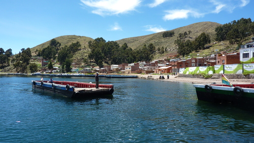
On Christmas eve we watched our bike fork seal being repaired on the roadside by the only bike 'mechanic' in town, with the aid of a hammer and screwdriver. General opinion was not to attempt the job ourselves, as we did not have the proper tools or workshop environment. We have plenty of screwdrivers, but obviously the big hammer was our missing specialist tool.
Then we saw Father Christmas ride past on his sledge while doing the samba (he speaks Spanish as well).On Christmas morning one guest cooked pancakes for everyone at breakfast and Santa left a goodie bag for each of us.
We left the hustle, bustle and booze of Iquique behind to head back up into the peace and quiet of the desert. The party crowd had arrived for the new year which meant the town and the hostal had stepped up a gear.
The owner of the Sunny Days Hostal in Arica, Ross, had suggested the Oasis of Pica, back up in the Atacama desert would be an ideal place to chill out and relax while we sorted out how to spend our time in Chile.
The camping gear finally came out as the cost slashing started.
For 4 days we attempted to say good morning to Ricardo, the mechanic. Unfortunately he never arose before midday, and on a Saturday it seemed 15:00 was his waking hour. Our hostal was conveniently next door but one to his house and workshop, so we could just put our heads out to see if he had surfaced.
Camping with sleeping bags and ground mats is the way forward. After our nights in the desert and on the beach, using our bike clothes for padding and warmth, in future it's ditch the sleeping bag and take the ground mat.
We enjoyed one last blast out into the Elqui valley, in the foothills of the Andes, tasted Pisco Sours (brandy, lime, sugar, ice), supped wine, star gazed and also navel gazed.
We have been drawn back to South America once again, for some more "unfinished" business. Back in 2011 we took the boat from Puerto Montt to Puerto Natales to avoid the Carretera Austral , I said I would be back one day to ride it. Now that day has arrived.
We will start in Santiago, Chile, head to Puerto Montt and the start of the Carretera Austral, then head down to Villa O'Higgins through the Patagonian Fjords and then cross the Andes into Argentina to sample the wind blasted Ruta 40 as we ride back north.
Finally after all these years, it had to happen. We have never had luggage problems before, only motorbike ones. Usually we arrive in a country, and our bikes don't.
This time due to a little snow in Manchester our flight was delayed, and at Paris we had 20 minutes to catch our connection. We were able to run the length of the terminal, after clearing security, to be the last aboard, and dripping with sweat because I was wearing my bike jacket, my boots and carrying my helmet. However our luggage cannot run.
The building of the Carretera Austral was begun on the orders of General Pinochet (a nasty man who caused the deaths of thousands of people and was a friend of Margaret Thatcher) in the 1970s and was finally completed in 1999.
Despite his reputation, one town has a memorial to him.
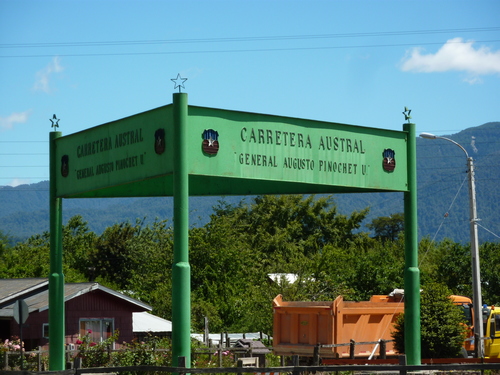
The last leg to the end of the road requires a final, free, ferry. The downside is that the ferry is 120kms from Cochrane, the last decent sized town, and leaves at 10.00, 12.00 and 18.00.
As we were over 200 kms away none of the options were open to us as our average speed is around 35/40 KPH on the ripio. So we made a small detour to Calleta Tortel.
Our loop coming north, back up the east side of the Andes in Argentina, looks like being shorter than expected.
We stopped in the Chilean border town of Chile Chico for a rest, after riding for 12 continuous days. The town is on the side of the 2nd largest lake in South America, Lago General Carrera (or Lago Buenos Aires if you are Argentinian, as the border line splits the lake between the two countries).
We are back in Sanitago now. The bikes have been delivered back to Ride Chile, maybe not as clean as when they left, or with all their nuts and bolts still attached.
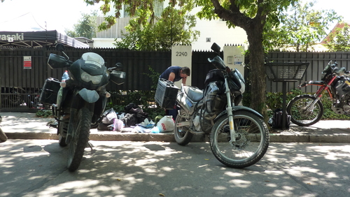
Overall we had very few problems, other than bits falling off, the biggest issue was Jean's fork seal going on the first day of the ripio. But like a trooper, she just rode on.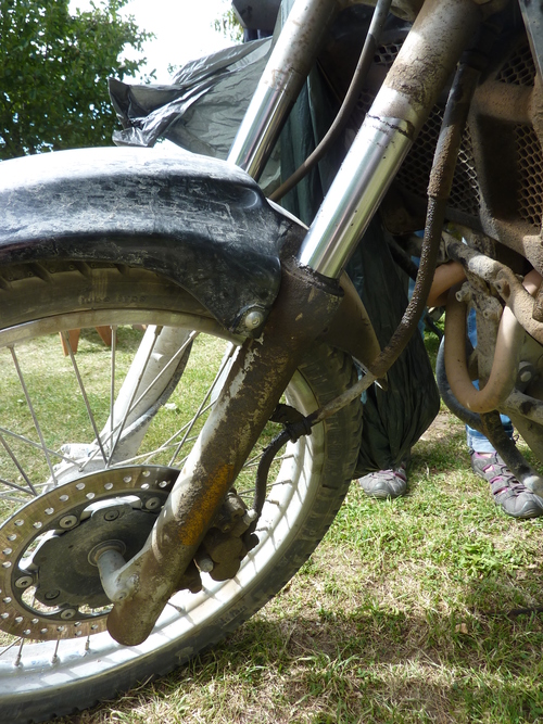
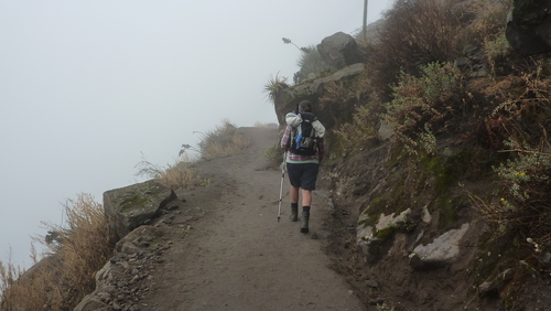
Without the bikes, our transport and temporary home (the tent) were not available to us any more. We were now exposed to a whole new experience, getting from A to B using timetabled transport and having to book accommodation by that schedule.
Using a combination of planes, buses, collectivos (multi user taxi service) and taxis we made the haul from Santiago (Chile) to the Colca Canyon (Peru) in 3 days.