Scafell Pike
A short adventure on two feet.
At the Inn in Nether Wasdale four guests were setting off to scale Scafell Pike after breakfast, equipped with a day's provisions in rucksacks.So I asked the barman, "That mountain, can you just walk up it, or does it require real climbing, hands as well as feet?"
"No, you can just hike up, it's part of a hiking route."
But this is England's highest mountain, I thought. There must be a catch somewhere.
Anyway, I set off for the Wasdale Head car park at its base, just to do a recce, you understand, just to see the scenery. Carrying nothing, I climbed over the first stile and crossed the first field. I realised I'd left my water behind but had a few Brazil nuts, my camera and jacket. That'll do for a quick recce.
Three and a half hours later, somehow or other, I'd arrived at the top.
Once you get going, there doesn't seem to be a reason to stop, apart from the physical aches and twinges. But I was full of Dharma and Heruka Empowerment from Conishead Priory, and it did a good job.
Plus, there are the motivating people you meet on the way up.
"Hi, you look like you're out for a Sunday stroll."
Well, yes, I did feel a bit conspicuous - no rucksack, water bottle or provisions.
I encountered a couple of serious climbers laden with ropes and climbing paraphernalia, headed not to the top but to the high vertiginous rock cliffs off to the right.
"You're nearly halfway, you'll get there no problem."
"How are we doing for time?" I asked.
"Don't know, but these lads will know."
We asked a group just passing.
"Quarter past twelve."
"There, you've got plenty of time for a nice easy climb to the top."
They pointed out the tricky section up ahead, the 'Vertical Scramble' at a place called Mickledore, up above Hollow Stones.
"After that it's straightforward, except the route isn't very clear. But there are plenty of people on the mountain so that'll be alright. Do you have a map?"
Yes, I had a map.
So onwards and upwards.
Someone said to remember that you can't see the actual summit until you're just five minutes away, "So that's always a nice surprise!"
And it was.
Especially as I had neither intention nor even less, expectation, of undertaking this whole enterprise when I stepped out of the car park a worrying distance below.
On approaching the 'Vertical Scramble' with an aching tiredness setting in, I thought for a moment of Shackleton on his 1908 expedition. He called a halt to his march to the South Pole with just 97 miles to go, after walking and hauling sledges 750 miles from Cape Royds. He turned his men round and headed back, sensing that a safe return would become unattainable otherwise.
But there was a lot of camaraderie on these slopes and the unexpected goal was achieved. Not without disappointment though. A knowledgeable hiker on his way down had assured me there was an ice cream van at the top - you can't believe anything you hear these days.
So, the photos:
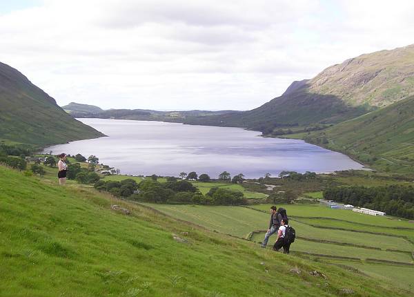
Wastwater from a little way up the climb.
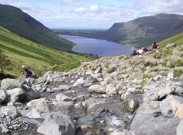
Small stream to cross a little further up.
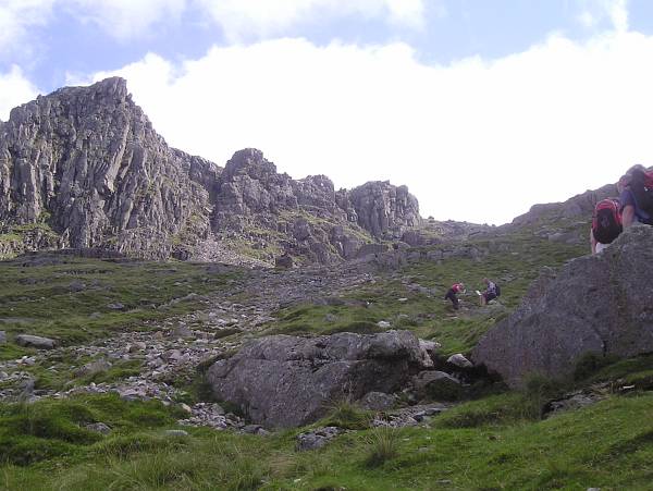
The summit is way out of sight way above this lot.
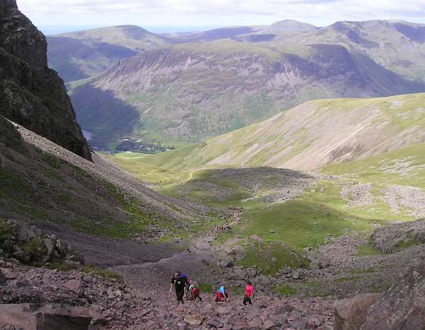
And only a tiny triangle of Wastwater is left in sight.
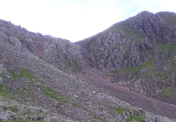
The 'Vertical Scramble' at Mickledore. In centre of pic.
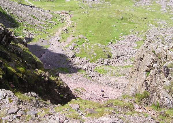
Looking back down the scramble.
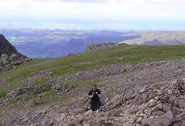
Shortly after, in the far distance, Sellafield (Windscale nuclear) comes into view, the Irish Sea beyond.
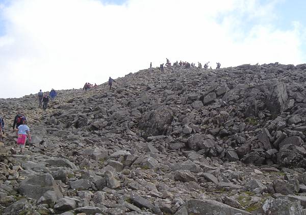
Quite suddenly, the crowd at the summit appears. What a welcome sight!
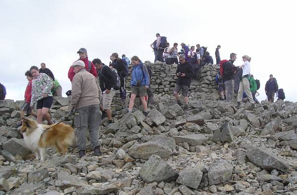
The dog wonders, "Why??"
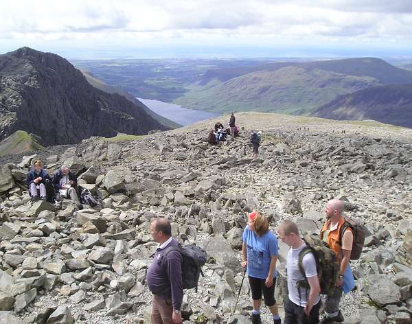
The views from the summit look-out. Roughly west, with Wastwater visible again at this height.
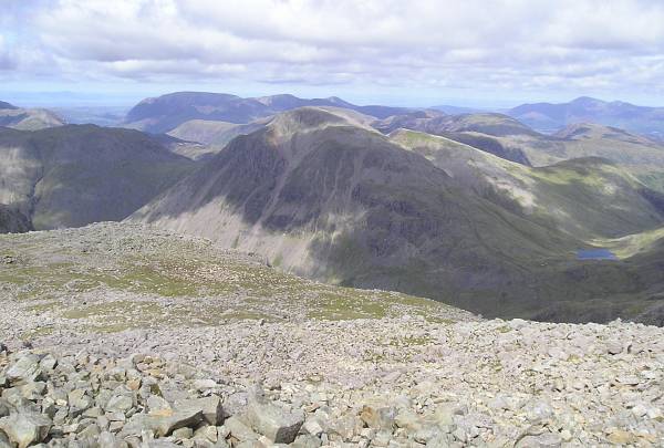
North
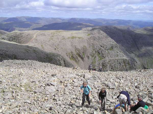
East
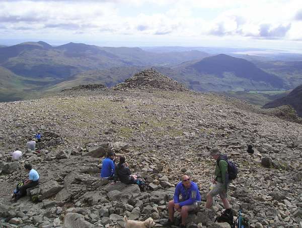
South
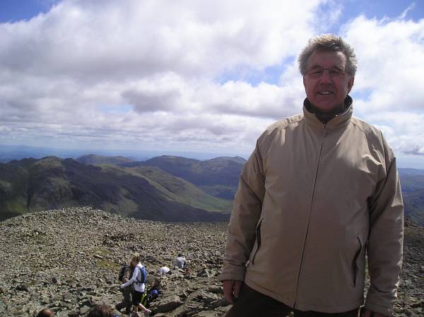
Everyone asks one another to take photos.
Eventually it was time to start the long trek down. Chats with other climbers, the appearance of a second route joining my one near the top, and a look at my map, revealed that there are two routes. I'd completely missed the alternative one on the way up. It was slightly longer but avoided a descent down the tricky scrambling path, so that was alright then.
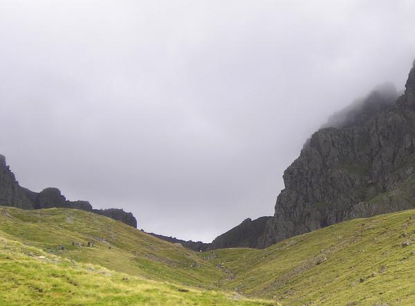
By the time I'd got some way below 'Hollow Stones', a look behind revealed that the low clouds had now descended to these crags a long way below the summit.
Total round trip is a shade under six miles, with elevation gain of 2900 feet (just over 1/2 mile). Very leisurely if you take all day, and an excellent way to spend the day if you find good weather in the Lake District.
That's the key I suppose - the weather. The Lake District is said to be the rainiest part of England at any time of year. Including these couple of weeks. Today's was almost the best weather of my visit, so it's just as well I ventured to the bottom of Scafell Pike and took advantage of it, but even then the clouds descended later in the day (although staying dry).
I'm puzzled though. Touring around all these lakes and mountains, there are campsites everywhere. And a lot of them are full. In the wettest part of the country.
Why's that then?
Well, see below. After my quick first-time visit up here I think I can safely say, like the rain and the campsites, there are more pubs, breweries and tea-rooms to visit than in any other bit of English countryside. There's always one nearby so you can escape the rain.
Back at the Screes Inn in Nether Wasdale I felt a touch of deja vu. Apart from my legs no longer working, the railways and rivers of East Africa sprung back to mind. I couldn't make head nor tail of the London Underground map pinned up in the bar.
Not only was there no Victoria Line, but no Victoria Nile nor Circle Line either:
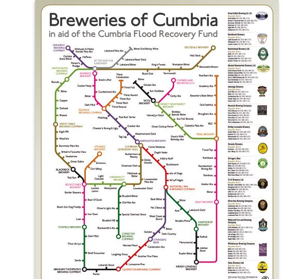
No, this is an imposter, a map of Cumbrian micro-breweries, guaranteed to confuse Londoners everywhere.
(And the children)
Perhaps they don't know that the Circle Line is actually the shape of a bottle of beer on its side, with Aldgate at the bottleneck end, and The Best 12 in London at the bottom of the neck. Imagine this is the inside of your engine the next time you're bowling along on your bike.....
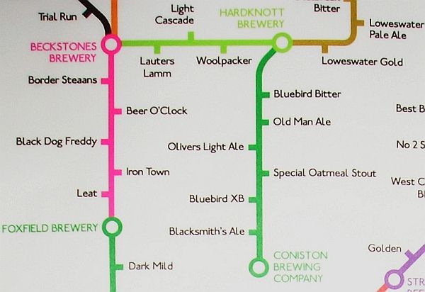
You'll see here that the Coniston Brewing Company produces an excellent beer called Oliver's Light Ale.
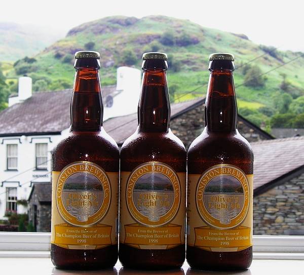
I'll have to have a serious word with that Grandson of mine......
But Cumbria truly has a remarkable collection of independent breweries. In Ambleside I had a superb pint of Laughing Gravy, from Ulverston. It features in the previous posting on this blog and the posting for 10th June 2009.
He's right here, nipping Ollie's trouser leg:
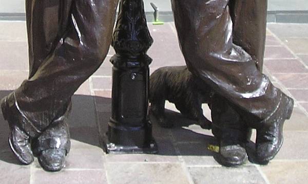
Stan's dog Laughing Gravy who features in the film of the same name.
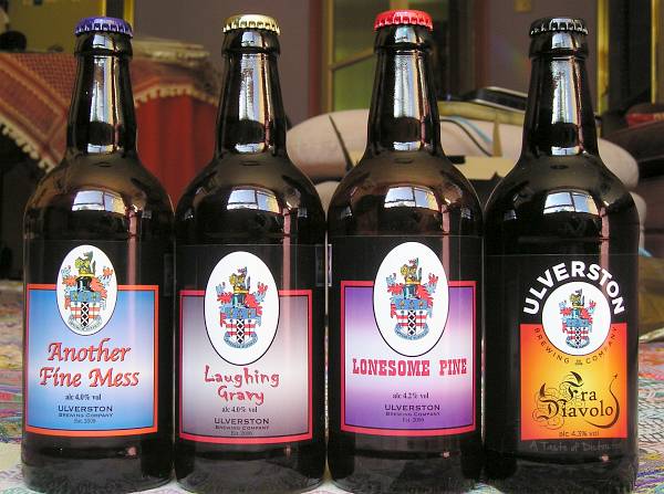
A small selection of Laurel and Hardy titles now re-born in Ulverston beers.
Right across the road from the Screes Inn is the micro-brewery 'Strands Brewery'. One of their brews is called Errmmm (brewed for the undecided).
I sampled some.
"What does it taste like?"
"Errmmm...."
How come I've never been to this part of England before??
Sorry, Michael.
