Whyteleafe, Surrey UK to Cape Town
Follow this story by emailA Travel Story by Ken Thomas
Surrey to South Africa Overland
A Travel Story by Ken Thomas
Surrey to South Africa Overland

Over four years ago, BCE, I decided it would be quite a good idea to climb upon my motorbike one day, nip down to Dover for the ferry, and head off for Cape Town.
(Note: BCE Before Charley and Ewan).


Since I started learning Spanish many years ago, I've always thought it a wonderful language, full of romantic quirkiness. My bachelor Spanish teacher (in Spain) would emphasise to us foreigners, with some glee, that the Spanish for 'wives' was the same as the Spanish for 'handcuffs'.

esposa [es-po'-sah]
noun
1. Spouse, wife, consort. (f)
noun, plural
Did anyone see that press release from Aerostitch in the US?
I bought their tank panniers and other stuff through their website, so now I receive the usual regular sales emails.
Well, they've just announced the arrival of.........
............ the *must-have* bikers' bling of 2009 .........
the Remote-Controlled Zipper!


As this Cape Town adventure is still five months away (only five months??? Oh s*^#*!!), and recent preparation only comprises ordering a new starter motor for the TTR (an acknowledged weak point), here's a brief account of part of our previous trip to Istanbul by Ducati 900SS. A sort of reflection before heading off across the Bosphorus again.
I would guess that lots of present-day bikers inherited their biking bug from one or other of their parents, probably their dad. The same with me...... So this is a bit of an indulgent look at his story.

Down the pub the other evening, a couple of friends asked why I've fitted a trombone to the front of my bike."What trombone, where?"


I see there are 'Yoga for Motorcyclists' sessions at the Horizons Unlimited June meeting in Ripley, and I'd recommend them to anyone. If you associate yoga with 'happy-clappy celebrity' nonsense, you should go along and see and do the real thing for yourself.

Ive been practising yoga for more years than I can remember, about eighteen I think.

The box I'm planning to bolt onto the rack is an old NonFango plastic one. I have a newer version NonFango box on my Honda Dominator. It used to be on my Ducati that took us to Moscow and Istanbul carrying luggage for two. Also to the Pyrennes and Spain, to Paris, and to Lisbon, all with luggage for two, and to North Cape and 3000 miles around eastern Europe carrying luggage for one.

No, its not Tennis and its not Cricket. And its been a long long time since I ever had regular contact with the Wimbledon & District Motorcycle Club, but I still see a few old-time ex-members down the pub now and again. Im sure one of them plays the trombone
..Anyway, the Club is giving me a problem.
Im one of the proud owners of the solid steel, heavily chrome-plated, enamelled, individually numbered machine badges that were made back in the 1960s.

A lengthy project, spanning too many weekends, has just come to a conclusion. A successful one we hope but only time and the African terrain will tell.

"The mode of locomotion should be slow, the slower the better, and be often interrupted by leisurely halts to sit on vantage points and stop at question marks."
Carl Sauer, the president's address to the Association of American Geographers. Montreal, Canada, April 4, 1956.
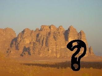
Very nice quotation that. It seems we should expect plenty of interruptions on our journeys. Ted Simon says that too.
And question marks.

The Horizons Unlimited meeting at Ripley the other weekend was a brilliant affair, a chance to do a minor dummy-run on all the equipment and systems.

Firstly the luggage. I wanted to take all that I would be likely to carry on the Africa trip, so I loaded it all up.

Well have the good news first.

At last, we have a new arrival in our little paddock.

After much searching and viewing and rejecting and searching again, Beau has just chosen and brought home his bike for this great trip.

My memory being like a happily gurgling drain, it's no longer capable of handling this adventure. Toooo many things to remember and to think about.
So I'm employing what might be called the 'Classic Expedition Planning Method'.

Ive had a kind request to reveal the full story of our visit to the Isle of Man International Six Days Trial many many years ago. Which would link in nicely with all the debate on the HUBB about soft luggage v. hard luggage, and the danger of the former bursting into flames if too close to the bikes exhaust.
Well, its not only soft luggage that can have that problem.
Went to the dentist the other day. Was due a checkup anyway, but common advice is to have your teeth checked before a long trip to far-away places.
The man with the big drill and pliers persuaded me to have the remains of a tooth removed. A large piece had broken off of it about 8 years ago.
A direct off-road route for bacteria straight into your jaw! he said.
So he wriggled and jiggled with his pliers, surprisingly gently, and announced, All done!
Give Me My Eleven Days Back!
What I omitted to say, when deciding on the 14th September to start this trip, is that my calendar is a little bit second-hand - Ancient even.
Here's the page for September:
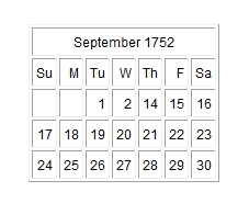
Yes, it's for 1752, but I did say it was old and has been recycled a lot.
Today's the Second, so tomorrow's the Fourteenth and we depart on the great adventure.
Hope everyone is ready.
Last Entry in this category, 'UK Preparation'.
The day of departure has arrived after living in oily overalls for what seems like a couple of years. Probably it has been a couple of years.
Preparation is done, luggage is loaded, trial runs undertaken.
Final configuration is here:
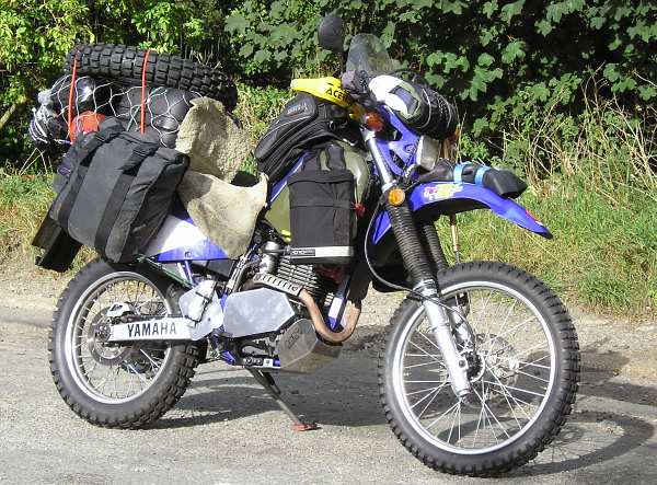
and here:
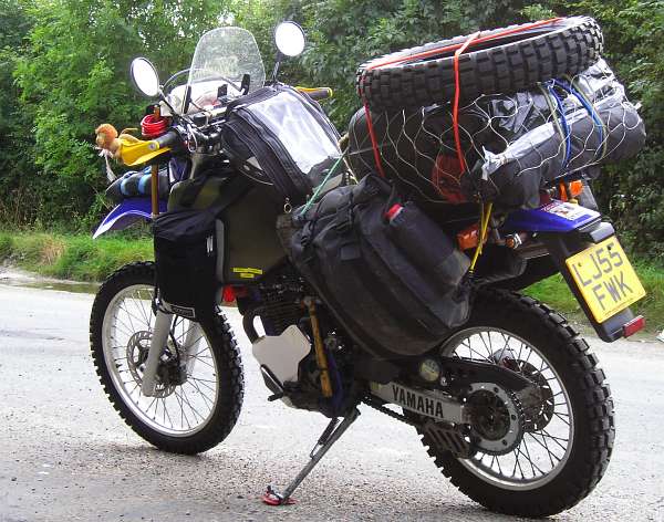
The last run round the block yesterday.
Welcome to the 'Departure and Europe' category.
We are making our first tentative steps, a little slowly.
We spent two days in Dresden seeing a friend of Caroline's and two nights here visiting Terezin (a nazi concentration camp town) just north of Prague.
Not much time to find an internet place good enough to post photos, and no real photos anyway. Next stop is Prague, then Budapest, Romania, Bulgaria and the Black Sea coast, probably another week away.
The day before yesterday we arrived safe and sound in Istanbul, after reaching the Bulgarian Black Sea Coast a few days before.
We have a few members in our Hall Of Fame now.
BAT Motorcycles of Biggin Hill
Firstly a big thanks to BAT, who we rate as the world's experts on grey-import bikes.
They effortlessly found and supplied a wide range of spares for Caroline's Serow and Beau's non-UK TTR.
As it turned out, this particular Serow is a one-off model made only for one year and only for the Japanese market, yet BAT had a spares book for it (entirely in Japanese but that doesn't faze the staff in the slightest), and of course a spares book for the TTR also in Japanese.
On the Monday after our arrival in Istanbul we headed off to the Syrian consulate where the information we had previously gathered was confirmed. That is, we need a letter of recommendation from our own consulate. The British consulate charges 68 pounds for this, a pro-forma standard letter which just needed our names inserting and printing off on the office printer. This is about three times the cost of the Syrian visa itself. The Canadian consulate charges slightly less for their letter.
Turkey certainly is when it comes to its people.
We recently heard from John, our Australian aquaintance on his way home on his 250cc Honda.
He was robbed at gunpoint in central Turkey a couple of days after leaving us outside of Izmir.
We don't know what sort of robber it was, but it took place close to a police barracks. The villain was immediately apprehended, but it delayed John by a few days for all the legal processes.
What a difference to our time in Edremit!
We wuz almost robbed too. Then a day later one of us actually was robbed..... more later.
We have gained the fabled Syrian border, where visas are indeed available on request, at least for Brits and Canadians.
We are in Aleppo for a couple of days, mainly to obtain Syrian cash from ATMs (not many outside large cities) but it's also an Islamic city worth seeing.
Firstly, in the area of the city with the cheap hotels, parking is tightly controlled so we have to find paid underground parking for the bikes. That's done now, and ATMs found (only about four, even in a city this size), so we have been sampling the wonderful cafe life and street foods of the city.
And a nice Aleppo interlude crept into our day.
We spent longer in Aleppo than we first planned.
Circumstances made sense to undertake a major laundry session, (sleeping bags) so while that lot dried we investigated more of the souks. Including the one selling leaf tea where we bought a couple of handfuls from the box with the most elaborate Arabic description on its label. We'll try it when we next pitch the tents, probably at Krak de Chevalier.
We also had time to visit the main mosque in the middle of the souks.
Travelling south from Aleppo we spent a damp day in Hama, the home of many old wooden Arabic water-wheels or Norias, wondering whether to dodge the showers and head for Krak des Chevaliers, or not bother and stay in the dry.
In the end, with the sky brightening, we headed east on a minor road just to see where it went. But the heavens opened sending us scuttling back to the hotel.
So the next day it was off to Krak des Chevaliers, rain or no.
Ask a Policeman.
Here's one for Grandson Oliver:
Where's your Dad when we need him?
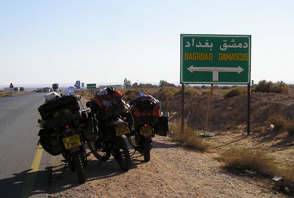
Signpost on the Road to Damascus
This one gave us some difficulty in deciding. So, no messing about, no easy option, we turned left.
Not exactly in our plans.
One hundred yards down the Road to Baghdad was the first petrol station we'd seen since leaving Palmyra.
All filled up, it was, I'm afraid, back to the easy option and west to Damascus.
It was a funny thing, but our entry into Jordan was similar to entering Syria. Irish weather.
Rain clouds loomed in with no warning, giving us a good, or at least a bit, of a soaking. So we stopped for the day earlier than planned, making a quick halt at the ancient ruins of Jerash and skirting around Amman, before heading to Madaba via Mount Nebo and a first sighting of the Dead Sea.
Throwing common sense to the wind, and being a regular swimmer, McCrankpin dived into the Dead Sea as though it were his local pool, attempting the impossible: to get under the water.
And here he learneth today's biblical lesson: incredibly salty water in eyes nose and mouth is verily an uncomfortable sensation. Yea, it hurteth like hell, and requireth an emergency rinse from the bottle of water brought along for his after-Dead-Sea-swim mini-shower.
Verily it is a strange experience, standing halfway out of the water, both feet a foot above the sea bed.
After Wadi Mujib we reached the hot springs at Wadi bin Hammad for the night, where we almost sparked an international diplomatic incident.
When travelling through strange places in the manner that we are, you can never predict what the effects of your presence will be, other than there will be some effect, however subtle. And it's really necessary to be aware of it.
When we arrived at the springs the warden showed us a small spot to camp with our bikes alongside. The spot also included the bonfire patch.
'Match me such a marvel save in Eastern clime,
A rose-red city half as old as time.'
Those words, and these photos, will have to suffice. There's not much I can say, other than it's a magnificent place, huge. We visited over two days and only saw maybe a third of it, the best being the climb up to the monastery and the ambience at the top.
Again, the grandeur and atmosphere are difficult to adequately describe.
But it draws you in incessantly.
We camped in Rum village, and I intended firstly only to walk to the end of the tarmac at the edge of the village. No camera, water or anything.
Here, there's a gentle slope of large boulders at the base of the massive rock edifice to the right, which I climbed a little way to get a better view into the desert wadi ahead.
Don't want to tempt fate in any way, but mechanical problems have been pretty small to date.
Here's a summary for those with a mechanical bent who may be interested:
(A bit boring for everyone else)
First off, Beau's petrol tank started showing the first signs of a pinhole leak way back in Germany, or thereabouts. From the rusty patch where the front of the seat rubs against the rear of the tank.
We fixed that with some proprietary tank repair glue but it didn't last.
So many photos, so little time for updates.
Photo just added to earlier entry:
The Roman Amphitheatre at Bosra, southern Syria.
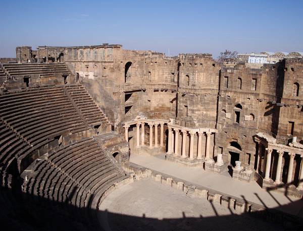
Latest Photo update 17th December:
Syria
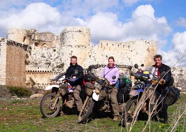
Three Riders outside Krak des Chevaliers.
After a very relaxing week at a comfortably remote beach we were ready to leave the Softbeach camp at the amazingly early hour of 12 noon! And we didn't have tents to take down and pack!
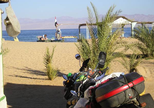
Beach-front living, and parking. Mountains of Saudi Arabia in the distance, looking east.
Ras Mohammad National Park is one of the world's leading nature reserves encompassing a wide range of terrains on the southern tip of Sinai.
Including a mangrove swamp, desert, numerous bays and beaches, and what is claimed to be the best preserved coral in the Red Sea.
Christmas Day in Dahab turned out pretty good.
We decided to snorkel the Eel Garden reef, a recommended site north of the town.
But we found a strong-ish current heading south. It was also quite a way out to the edge of the reef, the 'Garden' in the name of the place, and an incoming swell was making swimming in the shallow water above the reef shelf less than leisurely.
The main experience in visiting the Giza pyramids has nothing to do with the pyramids themselves.
But firstly, many many years ago, I attended a lecture given by a chartered Mechanical Engineer at the Institution of Electrical Engineers in London. The speaker was a serious amateur Egyptologist and his lecture had been published in magazines of the time and carried by BBC radio. He gave an irreverent but comprehensive debunking of all the romantic folklore written about the construction of these things.
Hooter - Attack - Yield
The spectre of driving on the roads of Cairo seems to have some legendary status. Not surprising, as none of the road rules of the West exist here. The most extreme example I suppose is occasional vehicles driving the wrong way on dual carriageways, at night, with no lights. (It's common during the day). We've seen this enough times to have done it ourselves, in daylight, and with a dirt verge on which we can keep out of the way. It can save a lot of extra mileage.
Some readers of these tales will know that I've often sung the praises of the books of Anne Mustoe and her adventures.
She rode a bicycle around the world after retiring in her late fifties, hardly having pushed a pedal before. This was followed by an inspiring book of her journey. Then, in her sixties, she did it again in the opposite direction followed by an even more impressive book.
Not satisfied, she cycled bits of the world in much more detail, followed by books on those explorations in South America, India and Europe.
We arrived in Luxor yesterday (Jan 17th) after riding around the Western Desert for the two weeks since leaving Cairo.
On a different note, our route around the Western Desert took us through El Kharga and then onto the direct Luxor road, only recently opened to foreigners.
Years ago there were fatal attacks on archaeological sites in both these towns with devastating effects on the tourist industry, which still hasn't recovered. Many hotels and camp sites are pretty empty and appear to be struggling to survive.
So as we approached this general area the present security situation started to become apparent to us.
We are now just a ferry ride from Sudan, having ridden down the east bank of the Nile to Aswan and a typical (grubby) small hotel in town.
Now we are knocking on Sudan's door.
This morning we arrived at the ferry ticket office to find a couple of travellers already there who we had met previously in Cairo. A few minutes later two more couples appeared.
Mr Salah, the ticket manager, explained that the Tour D'Afrique has filled a ferry and vehicle barge, so there will now be two of each sailing for Sudan. He then dispatched us to the traffic court, followed by the police office.
We arrived here in Khartoum about four days ago, and have been pretty busy since.
Oil changes, filter changes, new rear tyre, repacking, and still no sight-seeing yet.
Except for the 'Whirling Dervishes' at the Hamed el-Nil Mosque in Omdurman. More later.
We are camped in The Blue Nile Sailing Club which is right on the south bank of the Blue Nile.
Ken's tent
Still camped in Khartoum, we were able to see the Friday prayer ceremony at the Hamed el-Nil Mosque in Omdurman.
This is preceeded for some hours by singing in the Mosque, and then for even more hours, until sunset, with an intense ceremony of drumming, chanting and trance-inducing dance by the participants on the large and dusty forecourt. This includes some of what is usually referred to as 'Whirling', but this is only a small part of the proceedings, and no one wears those classic white voluminous robes normally associated with 'the Whirling Dervishes'.
Still in Khartoum. Very nice place. And the prophesy of Beau riding his drum kit across the Sahara has come true.
About five days ago, Hiula and Eva arrived on their bicycles. Hiula is from Mexico City, and his girlfriend, Eva, is from Germany.
We camped with them in the desert on our first night out from Wadi Halfa.
Well, it seems that the 'Hiula And Beau Duo' was formed that night, in the Sudanese Sahara.
Last night's planned jam session certainly happened. The band from last week's wedding (The Bleeding Hearts), along with students from the School of Music and Drama, and Duo Hiula and Beau got together at the Blue Nile Sailing Club for a fine session of set pieces and improvisation.
Normally, as the night sweeps in over Khartoum, it cools just a little from the heat of the afternoon. Last night it cooled not at all.
The photos:
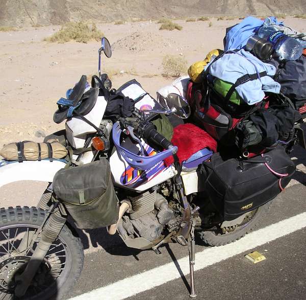
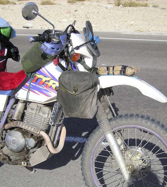
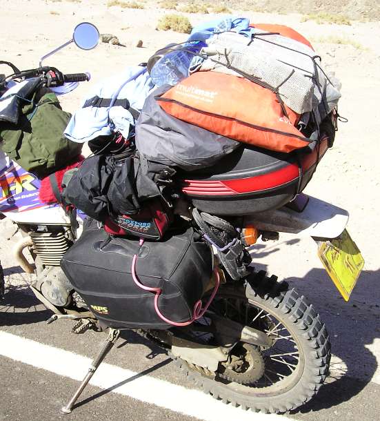
For anyone interested in close-ups, here are some photos of the bikes loaded up, in Sinai, after three months of juggling and jiggling all the luggage:
Beau's TTR250 'Open Enduro'
At the dusty Ethiopian border crossing the customs man holds my passport in his hand:
"Welcome! What country you from?"
"Britannia."
"Ahh, Paula Radcliffe!"
What a refreshing change from "Wayne Rooney," or "David Beckham."
But I couldn't for the life of me remember the name of the Ethiopian Olympic champion, even though his photo was on the wall of the immigration building in this border town of Metema. (I say 'building', actually a two-room mud-brick hut).
"Haile Gebreselassie!" my questioner rescued me.
I've had my shoes polished by shoe-shine boys in a few 'third-world' parts of the globe, but have avoided it so far on this journey.
You never know, someone may be reading this to research their own overland journey, so I'll try to remember to log GPS info of useful places hereon. I think everything up to now is logged elsewhere on the HUBB.
Sudan
Another country - another map.
And another decision - what to do with the map for the previous country?
It's been like this since Turkey.
It's a serious question.
You can't continue to carry all the maps for past countries, you'll need a travelling library for them all.
But there's something chillingly final about disposing of the map for the last country.
How will you return home??
It must be a time of life thing, leading to all those philosophical meanderings.
After Gonder we stuck our toes in the water of the Lalibela road by taking the turn-off at Werota. We expected to find a gravel road under major repairs but found new tarmac instead, and learned that it extends about two-thirds of the way.
Roadside scenes on the way to the village of Werota
We are in Addis Ababa, after a ride through the ever-changing scenery from Bahir Dar, and an overnight stop at a pretty smart hotel in Debre Markos.
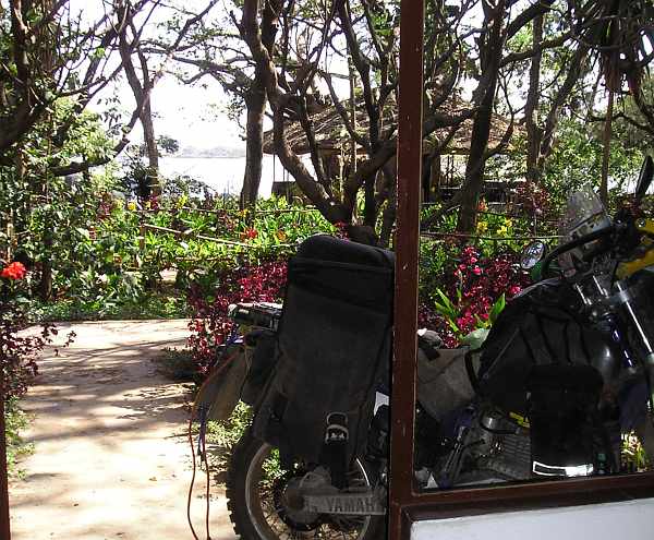
View of Lake Tana from hotel room in Bahir Dar.
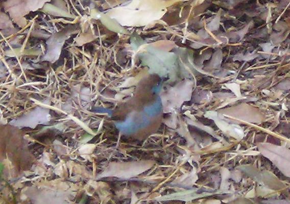
Many birds of a colour were pecking around in the hotel gardens. And fairly tame at that.
We obtained Kenyan visas in Addis, the three-month variety, so that will be helpful.
We also have three-month visas for here in Ethiopia. But at the border we could only get one-month customs permits for our bikes so we have to move on.
And there are reports of rain further south.
We have arrived in Isiolo, northern Kenya, after five entertaining days on The Great North Highway.
And a lot has happened since sitting in an email café in Awasa, Ethiopia.
Marsabit to Isiolo.
Travellers say this section is even worse than the previous, Moyale to Marsabit. We were keen to find out. Well, we had no choice really.
It started off OK, as it did when leaving Moyale.
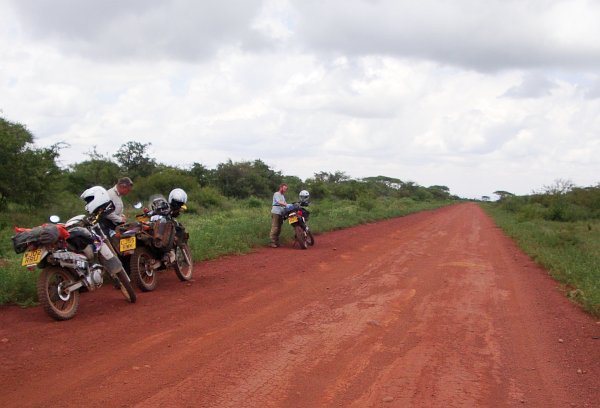
Reasonably comfortable.
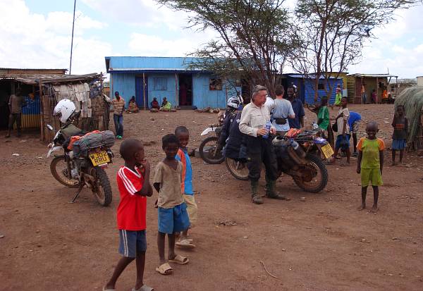
With little villages and tea houses again.
We headed south-west from Isiolo into the Rift Valley and its many lakes.
There's plenty to see and do, not the least zig-zagging across the equator about five times in ten days.
Our first sight-seeing stop was Nyahururu and Thomson Falls, a scenic Rift Valley water fall. A few days later we arrived at Lake Boringo, to the north, and Robert's Camp located on its shores. Both had been recommended to us quite a few times.
After leaving Lake Naivasha we stayed in Nairobi for six days working on the bikes, in particular Beau's starter mechanism. Internet there is pretty expensive, and now we are at Tiwi Beach on the Indian Ocean coast, south of Mombasa.
We are back in Nairobi after a couple of weeks on the east coast. But internet is even slower, so an update with photos will follow later.
When we first arrived in Nairobi a few weeks ago, Bodo and Sabine, and Kathy and Jonathan were also here in their trucks, so we had a session of comparing and swapping photographs.
Mainly photos of the Trans East-African Highway, the Moyale to Isiolo 'most-discussed road in all Africa'.
So here's a selection of their photos:
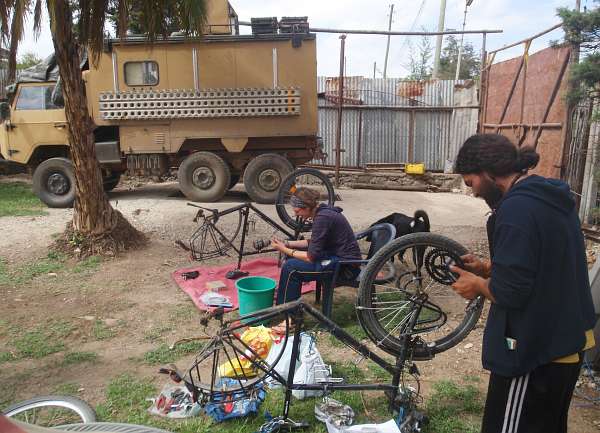
Huila and Eva service their bicycles in the campsite in Addis Ababa before the long trek to the Kenyan border, and THAT road.
A couple of weeks ago we left Nairobi for Tiwi Beach on the Indian Ocean coast, south of Mombasa.
The road there took us between two National Parks, not completely fenced, so wildlife sightings can be expected almost anywhere.
About halfway to Mombasa a herd of zebra seem to live permanently by the roadside - they were still there when we returned a week later.
And a little further on something large was rummaging around in amongst the trees on the right hand side of the road.
It's the middle of the day here at Jungle Junction and I've just made some tea in the kitchen with the help of a torch.
This is now the serious rainy season.
A noisy thunder storm is circling overhead blocking out all the daylight, the power has gone off, and there is no mains water.
It's still raining here, so I'm still biding my time.
And have found that it's quite a lot of work trying to organise and back-up all my photos, in addition to the ones that Caroline left with me and others received from fellow overlanders.
So here's a few of those, just to make use of them.
And some recent photos of the English weather here at Jungle Junction.
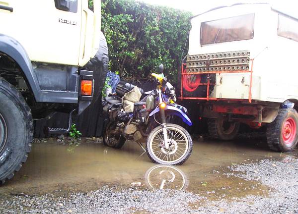
Now the flood has receded from the driveway, I can almost reach my bike.
That's about the third day in a row I've said that, so I left Nairobi this morning for the ride to Kericho, in the direction of the Ugandan border.
At the Kericho Tea Hotel my repaired tent worked fine, and it hardly rained while I was there. But the ground everywhere is so waterlogged and muddy that camping isn't a very comfortable option so I found a very nice small hotel in town where I've been for a few days.
A few friends and acquaintances have asked, What news of Caroline and Beau?
As well as the sad news about Les recently there's been much happening with my daughter and son-in-law.
Take a deep breath -
About two weeks ago Caroline had an interview by telephone with the British Council in Khartoum, for teaching and examining English.
They offered her the job straightaway - "Can you start Monday?!" crackled down the phone wires.
They realised that was a bit impractical and it became Monday week.
I'm in Bungoma, near the Ugandan border. It's another ordinary town, a bit like Kericho but a shade bigger, and not even in my guidebook. So that's good.
The sort of place I usually end up staying in for a while.
I've wandered around, and like Kericho, saw no other white faces. There's nothing for tourists here.
I suppose both towns could be considered the Kenyan version of Caterham, about the same size more or less as Caterham, Caterham on the Hill, Warlingham and Whyteleafe.
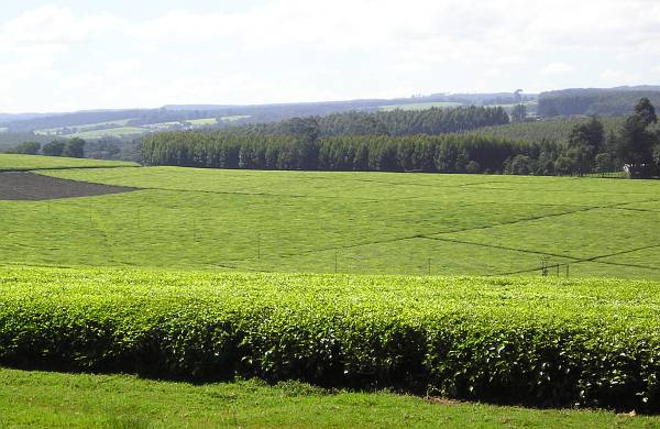
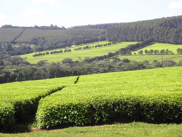
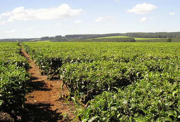
After quite a few days in Kericho with its pavement tailors, I continued with my plan to stay at the Naiberi River Camp near Eldoret as it comes highly recommended. The sun was shining on departure, so here are some photos of the tea estates around the town.
Crossed the border into Uganda yesterday, all straightforward. But difficult to get used to all the zeros on the money. About 2700 shillings in a pound. I lived almost half my life with twenty shillings in a pound. It doesn't matter how often you hear "Eleven thousand two hundred shillings," - when the word "shillings" reaches your ear, your brain is immediately unable to process any number higher than twenty. A bit of a problem.
The corridor between the border and Jinja, a big resort area, looks fairly prosperous compared with the more down-to-earth towns in western Kenya.
A couple of days ago was Les's funeral. I was in Bungoma, thoughts in Henley on Thames.
And my research for my way south to Lake Malawi and thence Zimbabwe reminded me of another anecdote from our regular meet-ups.
I was in Zimbabwe for a short visit in 2001, but didn't see the Great Zimbabwe Monument. I want to ride there this time because, I think, it gives the lie to what was taught in English schools (at least mine) in the 1950s about British colonialism in Africa.
Or: Moyale-Isiolo Meets The Equator.
Arrived in Kampala a few days ago, where there are at least three possible onward routes.
North to Murchison Falls (probably hot and steamy); east to Fort Portal, with gorillas, (but US$500 to see them and still their numbers are dwindling), chimps (becoming habituated to humans they say in the guidebooks) and also hot and steamy; or south west to Kabale and Lake Bunyonyi which sounds more my sort of place. It also provides a straightforward route to Rwanda on the way to Lake Tanganyika.
Or: The Road To Malawi.
I'm now in Kabale, on the edge of Lake Bunyonyi. Haven't visited the lake yet, probably tomorrow. It's about two miles away.
I took the short ride last Saturday from Kabale to a campsite on the lake. It's billed in the tourist leaflets as 'the prettiest lake in Uganda'.
There are a lot of lakes in Uganda so I suppose you'd have to ride round the whole of the country to judge that, but it certainly is a picture.
So here are some pictures.
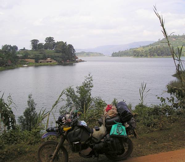
First sighting of the lake. It's long and not very wide and its shoreline zigzags around a myriad little bays.
It's not very far from Lake Bunyonyi to Kigali, capital of Rwanda.
So here I am.
I've received many recommendations to visit the Kigali Memorial. But I was sure that it wouldn't be for me.
But again, even local people here say I should go. It's in nice grounds they say, which sounded worth visiting without going into the museum.
So today, not only did I discover that there's internet here at the Solace Guest House, I also went to the Memorial for the Rwandan Genocide.
It was still my intention not to go in the museum - I'd already heard what's in there - I'd just go around the grounds and gardens.
From Nyakasanza the next morning I set off south to the T junction at Nyakanazi fifty miles away. This would be decision time.
Right for the two hundred mile dirt 'main road' to Kigoma, or left for the tarmac to Kahama, Dodoma and thence Malawi.
Yes, we're back on the right side of the road again. That is, the left-hand side, where traffic should be, after the fastest border crossing so far.
It's not surprising this lake was one of the centres of 19th century African exploration. It's almost like an inland sea. So I visited Ujiji and the David Livingstone monument.
Some photos from the site:
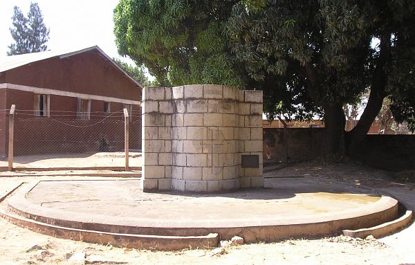
Livingstone monument. Small museum behind.
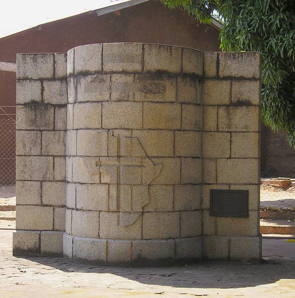
The inscription above the outline of Africa says "David Livingstone."
Or - Scenes From the Road, Kigoma to Nyakanazi Return Journey.
(I've been a while without internet, and am now in Singida, roughly in the middle of the country. But we'll continue where we left off).
By the time I reached Kahama I was pretty tired. That is, very tired. But I found decent oil at a garage and inside the hotel compound was a suitable place to do an oil change, which was due. I've been living on this bike for ten months now, maybe four or more to go, so I realise more and more that discipline with servicing is the key, and when I find myself in a suitable location to do it then I should. Or must.
After Anthony departed, Christopher returned to say cheerio. I said I hoped to see Anthony in the morning at the music shop.
"Ah, I know where that is, it's in the centre of town. I'll come by here in the morning, if you're still here I'll show you."
Another thing I'm learning about Tanzania is that it's an 'early to rise' country. As soon as the sun is above the horizon, TVs and radios come on full volume, loud conversations start and the town is alive. So you tend to be ready to leave fairly early.
Just as I was leaving the hotel car park in Singida a Tanzanian visitor came to chat about my journey, and it turned out he was another civil engineer building roads.
"We're building a lot of new roads here, where are you going?"
I told him.
That roundabout in Nzega was truly a remarkable sight and I wish I'd taken a photo.
It was like emerging from dusty bushes and dirt tracks into a smart European town, a "through the wardrobe" experience. And really, my first thought was, "Well! What sort of town is Nzega?"
Some scenes from the Rubeho mountain range. There was plenty of dirt and gravel road to be negotiated, where the tarmac had been removed to place huge great drainage pipes underneath. This road follows a tiny high pass between the Rubeho and Udzungwa ranges.
After staying in pleasant and compact Dodoma a couple of days it was time to head off and explore the road to Morogoro. As far as I can tell, it's tarmac all the way to Cape Town now, unless I get sidetracked down dead-ends again.
A little before the Nguru Mountains there's a lot of volcanic scenery:
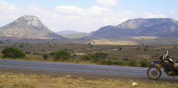
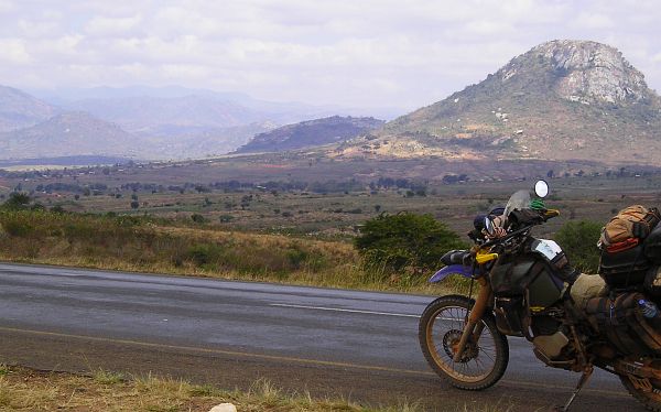
Then we climb up into the Nguru range:
I suppose the sun is uncharted territory, so here's another sunset, near Iringa, across the farms of the rural Southern Highlands.
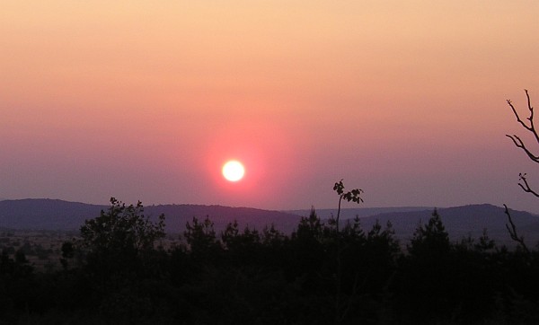

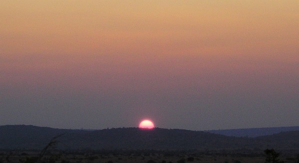
I was hoping for an early departure from the campsite near Iringa, to reach Tukuyu in good time. But two visitors had arrived the day before, who passed by while I was loading the bike that morning.
Another simple border crossing, and here we are, in Rumphi, Malawi. And zero cost, no visa, no road tax etc. There was even an ATM next to the Malawian immigration window.
Very European in nature, Lilongwe is a fairly compact capital city with the sort of traffic jams that come as quite a surprise after following the lakeside road all the way from Rumphi and the beach-resort town of Nkhata Bay to the north. That road was all tarmac, with hardly another vehicle for miles and miles and miles between the villages.
Well, he said his name was Matthew. But as he was Dutch, he's unlikely to be Matthew Bradshaw I suppose.
I stayed a week in Lilongwe. There was no work to do on the bike so I did very little, except research the route ahead to Harare in Zimbabwe via Tete in Mozambique, and thence to the Great Zimbabwe Monument. I gathered a list of places to stay from the internet and details of the route, all main tarmac roads.
You see, I have no guide book now. The last one I had was for "East Africa" that Caroline left me in Nairobi. It lasted until Tanzania. Now I'm relying on the internet where it's available, word of mouth, and my maps. And maps of Africa are a movable feast to say the least.
To make sense of these last three postings, I'll mention that I'm compiling them as I go along, more or less, but have no means of putting them on this website.
I'm still in Chimoio, for three days probably, leaving tomorrow (Sunday 15th).
And like Tete, there's no internet.
But it's a nice place, different to other smallish towns, and a bit ragged in a well-worn sort of way. The best I can manage is to say it's like a place that lives its life out on the streets. And it has some atmosphere.
I didn't get very far after leaving Chimoio. I had a recommendation to stay at Chicamba Lake, about halfway to the Zimbabwean border and only about one hour away.
From The Great Zimbabwe Monument.
I suppose that's an appropriate collective noun for so many photos.
So I'll try to keep the words short. Not always successful on this blog.
"The postings needn't be long, but it takes a long while to make them short."
These photos were taken over two days, the first dull, dark and cloudy, the second bright and sunny.
Phew........ where do I start??
It's been a roller coaster journey, nothing to do with going up and down hills, and here I am in Masvingo, Zimbabwe.
It's not difficult to see why Bulawayo became the favorite home town of many, if not most, of the British colonialists during Zimbabwe's time as Southern Rhodesia. It certainly is a very pleasant place.
Having the layout of a typical mid-west US town, wide streets and pavements in a simple grid formation, low rise buildings, parking for all the cars that might need it, a spacious City Hall, and room for everyone with public parks dotted all around (even a 50-metre swimming pool). It's easy to spend quite a while here. And there's plenty to see further afield as well.
No, not leaving Bulawayo just yet, but have completed some exhaustive research on where on earth to go next.
Another country, another change. After the verdant and colourful vegetation of Zimbabwe, Botswana is a bit bare by comparison.
Dry flat savannah traversed by straight flat roads, all fairly unremarkable. But cattle and goats still roam the highways.
No balancing boulders or whalebacks - they almost stop dead at the border.
After a few days in Maun it was off to Ghanzi. A little more colour in the scenery with the trees, but really, another long boring straight stretch. We crossed the Ngwanalekau Hills (why should I be the only one trying to pronounce these names?) and Tsau Hills, but as far as I could see, all was as flat as a pancake.
Which was not surprising as we were back in salt-pan country, one of them being called, according to my whimsical map, Peter Pan, just inside the Kalahari Game Reserve.
I'm reviewing the situation.
It'll be decision time again in Windhoek (Namibia), on which route to take thereafter.
Firstly, I stayed a few days longer in Ghanzi (Botswana). It's a cultural centre of the San bushman tribes. I read a little about their situation in the Ghanzi public library.
I haven't completed the north-to-south traverse of Africa yet, but I have done the east-to-west.
(Or should that be, an east-to-west. Hardly the widest part).
Windhoek was a bit time-consuming. It seemed to take forever to come out of the western side of the city and eventually reach the bypass, and the decision that had to be made.
There was also the Kalahari.
A tale of two days.
Let's start with the worst of times, part one.
Here I am in Keetmanshoop. Plans in disarray, trying to make sense of the options available.
From Keetmanshoop southwards the road was more of the same, like this:
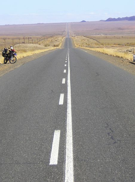
This road, all the way from Windhoek, is called the B1, and that's about all it deserves to be called.
Any name more descriptive than that would be an overstatement.
Or maybe the Trans-Nowhere Highway.
Nothing to take note of, except it became colder and colder, needing a stop to put on the winter woollies. Hence the photo above.
Crossed into South Africa today, hopeful of twistier roads.
No luck.
And I now think Einstein got it wrong.
He claimed there's no such thing as a straight line. Because time and space are all curved (he said).
Well, look at the picture:
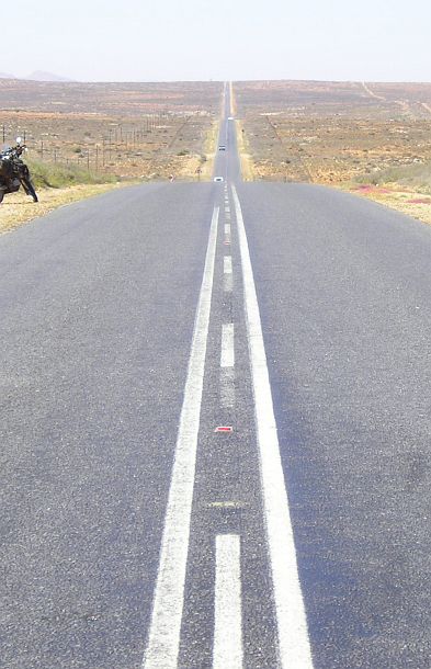
The camera never lies.
The new front tyre is all done and dusted, so I can go off the tarmac again. All being well, will depart tomorrow for Clanwlliam with the idea of heading for Lambert's Bay on the Atlantic, and thence by a mixture of tarmac and gravel all the way down the coast to Cape Town.
There are a few things to see on the way to Clanwilliam so that might take a couple of days.
After fitting the tyre I took the road towards Kleinsee, also on the coast. Along the way I got equipped with a phone line.......
Wandering around Lambert's Bay, I half expected to see Mack and the boys pop up somewhere, hatching some hare-brained scheme to earn a bob or two, or to do someone a good turn.
Anyone who's read John Steinbeck's Cannery Row, or seen the film with Nick Nolte (brilliant music from Big Joe Duskin and others) will now know what Lambert's Bay is like, I hope.
If you don't know Cannery Row, then this might give an idea of the place:
In the tourist information office, in the windows of various shops, and outside the museum, is the following notice:
There's an acronym commonly used by foreign travellers in Africa, that I've mentioned before somewhere: TIA.
"This Is Africa."
To pin on any situation that doesn't immediately fit any sort of western expectation.
Which is more-or-less everyday, and why most foreign visitors are here.
Well, here's another - TINA - "This Is Not Africa."
The day after visiting the cargo area:
"Hello, is that Bradley?"
"It's Ken here."
"I came in yesterday to have my TTR weighed and measured for London. 223kg."
"That's right. I've booked my ticket now, back to London. For 27th October."
"When do you want me to bring the bike in for crating?"
"OK. See you on the 26th. Bye."
Next stop, Antarctica.
Or for me and H.M. The Bike: Cape Town and London.
On the empty road from Caledon to L'Agulhas, and more so on the emptier stretch from Bredasdorp, a few people by the roadside give a knowing wave, or thumbs-up.
It seemed quite an occasion. I wonder how many bikes per week rumble down this road?
I'm on my way back north to Cape Town now, stopping here in Hermanus for a few days, then Cape Town a few days, then the airport to have the bike crated, and me installed on a flight to Heathrow.
Phew! I took a bit of a rest there. Eight days or so at the "suidelike punt van die vasteland."
And a very nice place it was to spend some time in. The tiny village of L'Agulhas, the tinier hamlet of Suiderstrand (population less than a hundred), and the slightly larger village of Struisbaai (only one pub but a couple of restaurants).
The tarmac road ends at L'Agulhas, you can go no further on it, but a little gravel track continues past the lighthouse and marker cairn and then another four miles to the very end of the road at Suiderstrand. So it's nice and remote.
It's not really 'Africa', but a jewel in South Africa's crown must be Pringle Bay. A tiny seaside hamlet down a dead-end road just beyond Betty's Bay, where I had stopped for tea on the way to Cape Town.
I almost didn't take the turning, except the view seemed to indicate something worth seeing beyond.
A little village of houses (mostly holiday homes) and a shop or two squeezed between the mountains and the jagged Atlantic coastline. Just about every road leading away from the shops takes you to a seafront scene like this one. I took all these photos from the same spot.
Took a little ride round the town the other day, while it was dry. The next day the rain was pretty torrential but my sheepskin seat cover, I noticed, dried out very quickly. More of that later.
A few visitor photos:
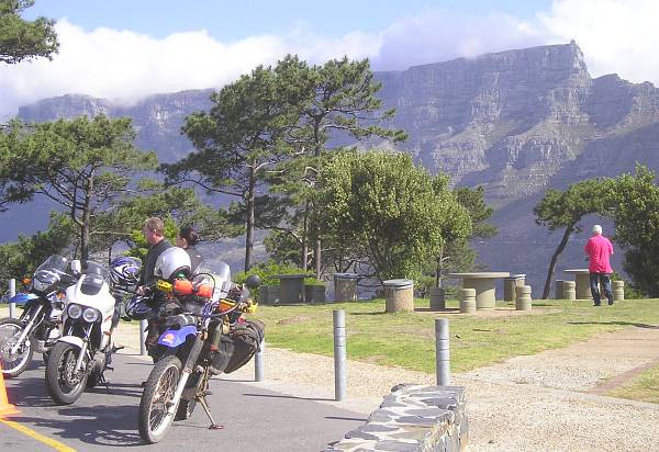
Table Mountain from Signal Hill, with some local bike company.
How do these things happen? Is there a message in there somewhere?
The bike has run faultlessly the last 20,000 miles across the continent of Africa.
It must like it here. The petrol's cheaper I suppose. Or there's more sunshine than back in England.
Returning home after a journey like this one, more than a year, in strange places, is like moving house without moving out of one.
Entering through the front door is like moving in for the first time, except it's not empty, it's full of stuff.
Your stuff.
And you don't know what a lot of it is for, nor remember where any of it is.
So it feels like utter confusion. But it isn't, because everything is where you left it.
On Monday, I nipped down to Gatwick, hired a van, found the BA Cargo depot and collected H.M. The Bike. It had been put on a flight four days later than originally booked, for reasons I don't suppose I'll ever find out. But that was no problem, it gave me a bit more time to clear the decks and settle things down a bit before its arrival.
The collection was all pretty uneventful, although about two and a half hours in all.
And a little unreal - there's no customs office here. It's in Salford.
The clearance all done by computer, on the Gatwick agent's account with HMCR.
It's been a fairly dull and dismal time since returning from the great journey. It really beats me how the continent was ever called 'Darkest Africa'.
More on that in a minute.
After 'Darkest Africa' we have darkest winter. Only four weeks to the solstice then the days start to get longer again. That should be good.
I need to build up some enthusiasm to return to the garage in these dark and damp times. The Aprilia needs its fuel injectors cleaning, a job that needs good light which means good sunshine. Something a bit easier might be to give the Dominator a once over and take it for an MOT test. Maybe during the week, rain permitting.
Friends ask, "What was it like when you arrived home after so long, put the key in your front door for the first time and went inside?"
No, not that one. This one: "Who's Rustus McCrankpin?"
I'm glad you asked.
Here's the short snappy answer:
I've never much liked washing bikes, it's far more difficult than washing a car. You always rap your knuckles on something, an exhaust bracket, engine bolt, sharp edge of a petrol pipe clip.
The first you know is when you wonder, "What's that red stuff in the bucket of water?"
Occupational hazard.
But where's the engine?
This'll be a continuation, more or less, of yesterday's posting.
Firstly, I have it on good authority that the method of measuring the snow in that last piece is accurate.
We now have over a foot, as can clearly be seen here. No need to find something to lean the bike against:
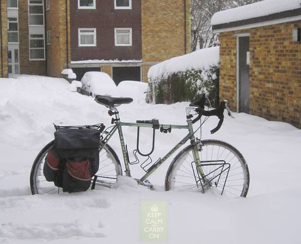
Marinoni bicycle, from Canada-to-Mexico days, pressed back into service.
Suzuki GSXRs in the desert for the Solar Eclipse of 2006.
Not part of this Whyteleafe to Cape Town journey, but it does feature the Sahara and some motorbikes.
So as the weather here hasn't been at all conducive to straightening out my toolkit sufficiently to put anything but my bicycle back on the road, I'll offer a piece I wrote a while ago after watching this marvel of nature in the Sahara.
Be warned - there are no photos of the GSXRs.
"Welcome To My Sandpit"
Have been loading larger photos.
They now go back as far as Tanzania. Much better than the previous small ones.
(Links to different countries are down the right hand side)
We have photos of motorbikes, bicycles, trains, a ferry, an airplane, Nile sailing boats, papyrus canoes, ships in the Suez Canal, camels and elephants, a Transit van, but not many of the true Kings of the African Road, the buses.
I found a few amongst the back-ups.
So, some African buses in full flight, mainly in Tanzania:
A short while ago I was directed to this website:
Ithaca
Here's the text of it:
ITHACA [1910, 1911]
by C. P. Cavafy
It's high time to inject some new news into this blog.
This weekend Caroline departs Khartoum for pastures new - Juba - the capital of the new country of South Sudan.
There, she has a two-week project to set up new English classes for members of the new civil service of this new country.
She'll fly there, via Nairobi of all places, which is two countries away (new or old). It seems so many people are now travelling from Khartoum to Juba that no seats are available on direct flights for the foreseeable future.
The sun was two hours late this morning. It was supposed to rise at 4:52 but didn't show up until 7am, through a chink in the cloud.
Not a very good performance. Its wages should be docked. Or maybe the salary of those astronomers who organise all this stuff - the rising of the sun and the passage of the stars.
Or are the weather forecasters to blame? I don't know.
There are quite active discussions from time to time in forums on this website and others, about what really is an adventure in our modern age. Countries mentioned in this blog include Egypt, Libya and Syria.
"Let's have some words and pictures!" I've emailed to Caroline and Beau as they depart Nairobi, around Tuesday 5th, towards the Tanzanian border and Mt Kilimanjaro.
News from Caroline and Beau.
After spending a little while taking their bikes out of storage at Jungle Junction and fitting new tyres, Caroline and Beau met up with an Australian group of overland riders.
That led to them dropping the idea of riding off to Tanzania and instead teamed up with the Ozzies. They rented a minibus between them and headed out to the Masai Mara to see the annual migrations.
This isn't possible on two wheels, so four wheels have to be organised one way or another.
By hook or by crook, Caroline and Beau are back in Addis Ababa.
There were spots of bother with both bikes, although they completed the Isiolo to Moyale road in two and a half days. An incredible time by my reckoning - must be a record of some sort. No falling off either.
A short adventure on two feet.
At the Inn in Nether Wasdale four guests were setting off to scale Scafell Pike after breakfast, equipped with a day's provisions in rucksacks.So I asked the barman, "That mountain, can you just walk up it, or does it require real climbing, hands as well as feet?"
"No, you can just hike up, it's part of a hiking route."
But this is England's highest mountain, I thought. There must be a catch somewhere.
"Off on your travels again?
Where to this time?""Across the Ganges?
The Silk Road?
The Road To Mandalay?
The Gun Barrel Highway?
You've still never seen Grasmere, have you? Kilnshaw Chimney?
Nor Scafell Pike.
Around the world you go, and never seen the magnificence of your own doorstep!"
While I was enjoying the Lake District, riots were going on in London. And elsewhere.
But riots have been occurring in London, and in Engand, for centuries. It's not really a new thing.
But that's no excuse, and it's very sad.
Equally sad is all the rubbish that is said and printed in the media, most of it to serve one of three objectives:
To increase newspaper sales,
To increase viewing figures,
To make political capital.
Caroline and Beau arrived home in Khartoum today, just in time to rush to the bank with a sackful of cash.
I don't have a full report yet, but Beau's bike must be going pretty well now for them to have made such good time.
After departing Addis Ababa early on Saturday, they crossed into Sudan at Metema on Monday, wild camped on Monday night and arrived home around midday today, Tuesday.
My first home was a small bomb-damaged rented terraced house in London's Pimlico, where my parents and grandparents lived. By the time of my arrival, the post-war renovation of London was well underway, led by a new estate of high-rise flats going up on a flattened corner of Pimlico, one block from our home.
It's called The Churchill Gardens Estate, and is the only post-war social-housing project built according to the imaginative plans of Professor Patrick Abercrombie.
"One centimetre."
"I have a half."
"Spot on up here.""Forward eight."
"Left two now."
"Back four."
"Eighty-three on the gantry ... eighty four ... eighty-five ... mark!"
"Need four degrees left."
.......The cockpit moves .......
"All go?"
"Alignment set."
"Right. All back! All still, don't move!"
I was right about that B1 road that stretches down the length of Namibia. It's so straight you can go faster than the speed of light. Warp 1.0001414 in fact.
A group of scientists in Switzerland, next door to their colleagues searching for the Higgs boson particle, announced on Thursday that they had caught a whole load of neutrinos, red-handed, exceeding the speed limit. They clocked them leaving Switzerland and arriving in Italy so quickly they must have been going at well over the speed of light.
At Last. HM The Bike is back amongst its subjects - mud, sand, ruts, stones, holes, good dirt.
And when you go to Guildford by bike for radiotherapy, there's only one way home.
Starting here after the daily dose of sub-atomic particles:
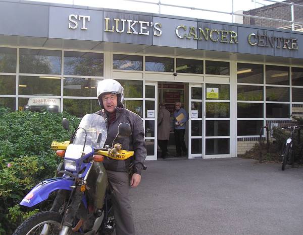
Then continuing from Shere, taking London Lane, on the left by the cricket field.
Yes, there's a hamlet called Little London just south of Shere, this is the lane that leads to it:
I took another couple of alternative routes between home and Guildford, so below are a couple of photos.
But firstly I read the other day about two lads who are soon to embark on an adventure on two scooters to raise money for Cancer Research UK. And would you know it, their 2,300 mile Round Britain Route includes a ride from Caterham to Guildford, the same route that I've been trundling along every weekday for the last 8 weeks. More info below.
Had a particularly enjoyable outing through more Surrey byways on my latest trip to Guildford.
There's a huge patient support centre at St Lukes with a wide range of activities and therapies, some free, some almost free. So I joined the art class. One morning per week, everything provided, making for a much more relaxed visit than when undertaking treatment there.
Ideal for getting lost and muddy on a motorbike on the way.
To The South Pole.
And at last I was off, with a Ryanair ticket. I wondered what airport they would deliver me to. Southend? Southampton? South Of The Border? Down Mexico Way?
No, it was Cork.
And just beyond Killarney lay my destination.
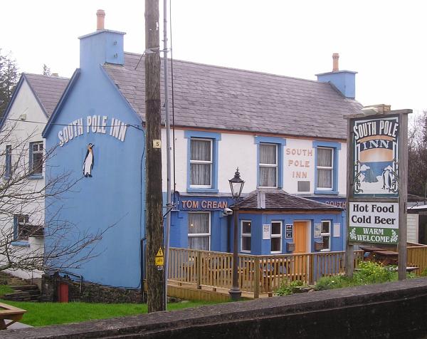
The pub that Tom built.
He was born here:
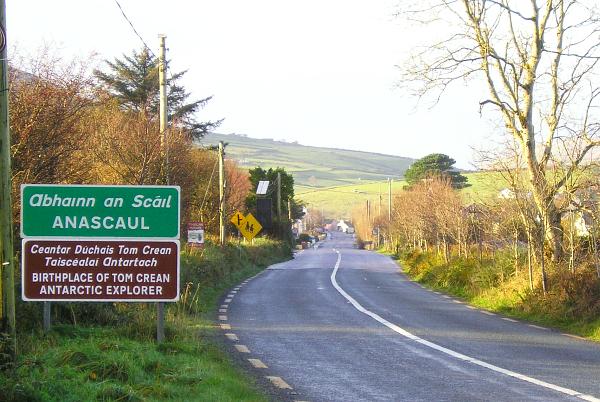
You never know what simple adventure may lie round the next corner.
But first, last night I saw a brilliant staging of 'Tom Crean - Antarctic Explorer' at the INEC Theatre Killarney.
Slightly updated from the version I'd previously seen, which in turn had developed from the first performance I ever saw, in the tiny lecture theatre of the Scott Polar Museum in Cambridge, about eight years ago.
A little jaunt of photos around a bit of South West Ireland. Mainly in the rain and mist and wind. (Severe gale 9 on the BBC shipping forecast - longwave 198kHz - what a great institution! Not only for those at sea, but when you're clinging to the edge of land as well).
The title of this entry has nothing to do with the area, but I couldn't think of a better one.
(Except Way Out West, but that's Laurel and Hardy who we've had twice already if I remember right).
It's that time of year - the shops full to bursting with stuff - when the Magician of the Skies, the Lone Pilot with the Biggest Flight Plan, has to be tracked down to make sure his map has the grandchildren's chimney clearly marked for the Big Night.
But where to find him? Where to start?
A chunk of my brand new adventure came to an end last week, pending pit-stops over the next few years for engine and frame checks, and hormone top-ups in between.
The Doc says there's nothing detectable of my old prostate tumour and the checkups will be every six months for now.
Phew! I hope not to do that sort of journey again. Plain old two wheels (or four, or two feet,) will do in future.
The North West, that is. I'm going to use the reference to Way Out West in a previous posting as an excuse to include this youtube link.
It sort of introduces a trip I'll be doing over Christmas and New Year. In that there may be a lonesome pine where I'm going, but there'll definitely be no trails or lanes or tarmac or motor transport. Nor much else.
Wherever you find yourself in the towns of Jordan you'll hear recordings of the Quran being sung. Everywhere.
From someone's radio, from computers sitting idle on desks in offices, from cars in traffic. And from Mosques of course. It was always very melodic and relaxing as the sounds drifted all around.
Here's an example.
Beduin entertainment at Wadi Rum.
And at Petra, inside The Monastery.
Next, dependant on time and internet access on the remote Holy Isle, is Egypt.
Have managed 154 entries on this blog. How did that happen? I never imagined it would become such a labour of love. I just try to keep it going by scribbling down mundane events with hopefully different or odd angles.
It certainly prompts strong memories of the journey from time to time, and occasional intense desires to be back on the African continent.
One of the triggers for that is music.
I collected quite a bit along the route, was introduced to more on the way, and already had a good smattering of African tracks on my MP3 player as a starter.
For an adventure.
On the day that Scotland becomes independent, I'm going to get myself by two wheels to Berwick-Upon-Tweed.
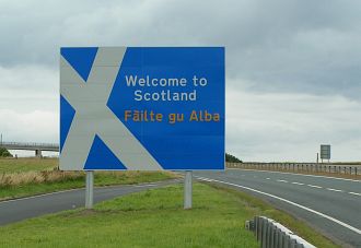
Or even The First True Border Toon a few miles to the west.
I'll try not to leave my passport at home.
The end of a wonderful two weeks on Holy Isle. Christmas and New Year.
And it's difficult to say what makes it so good, in the midst of the constant winter gales, rain storms, and little occasional sun.
To start off, maybe it's best to say what the island doesn't have:Mechanised transport of any sort. (Except - see below)
Roads
Shops
Mobile phone service
Internet
TV
Radio
News
Outdoor lighting
Amplified sound
Alcohol/cigarettes/drugs
Fast food
After two brilliant weeks on Holy Isle I nipped across Scotland to Edinburgh to stay with my cousin Geraldine for a few days. Now her Dad, like mine, was a motorbike-and-sidecar family man so she's no stranger to adventures on 2(3) wheels. And maybe that heritage led her to the idea of driving north to visit the commune at Findhorn near Elgin.
Well, the weather reports from up north told of snow gates being closed on some of the roads, so Geraldine had an inspired vision of an alternative outing.
There's a wide range of music to be found in this big country. Here are just a few samples from Youtube.
A piece composed by Yasser Abdel Rahman.
The Temple of Horus. Amir Khosrowshahi plays the Egyptian Ney (reed flute).
Ancient ritual music with modern instruments.
'Masreat' (Egyptians) by Omar Khairat.
And another piece played by Amir Khosrowshahi on a ney made by himself.
I've had a soft spot for the ney ever since seeing it played by skilled Iranian musicians during the Rumi Festival in London many years ago.
Well, we were pretty well immersed in musical interludes in Khartoum, resulting in daughter Caroline, and Beau, deciding to live and work there.
Here's a selection of Youtubes. Including a clip I uncovered featuring the two of them.
'Meroe' sung by Rasha Sheikh Eldin. Featuring the pyramids at Meroe.
Friday afternoon prayers at the Hamed el Nil mosque in Omdurman (across the river from Khartoum).
Some Sudanese hip hop at Papa Costa restaurant in Khartoum, where Beau and Huila played to a full house.
There's an old motorbike tradition called the Dragon Rally. Held each year, middle weekend of February, on the slopes of Snowdon in North Wales.
You go with the thickest riding jacket you can find and a cheap sleeping bag - on account of not being able to afford an expensive one back in those days.
1967 that is.
There's an amazing variety of music to hear in Ethiopia - so many colourful styles. All, as far as I can see, unique. And not widely known outside the country.
We were lucky enough to be in Addis Ababa when the Goethe Institute arranged a big open-air concert to celebrate a hundred years since the first recordings of Ethiopian music.
There are dozens of great youtubes of popular artists. You may like these few.
Continuing on this musical journey we reach Kenya.
As I've trawled through lots of East African music on my MP3 player, and assembled these clips together from Youtube, they've triggered a huge number of memories of the trip. Especially some of these following tracks.
But before the music we'll start off with this video. It's filmed at Jungle Junction in Nairobi, the overland travellers' popular stopping place and 'Home from Home'.
And it must have been shot shortly after Caroline and Beau had returned to England but before I departed for the west and Uganda.
Three were riding Honda C90s.
And these three, just four weeks later, arrived on their C90s at Bansang Hospital in The Gambia. (Yesterday as I write this).
After an epic ride from London, across the Sahara and halfway down West Africa.
You can read about it here.
And donate here to the project if you wish.
And read Belle's Blog here.
Now back to Bodmin Moor, and the beasts and ghosts.
For the four weeks or so I was in Uganda, the World Cup was on every TV. No one was tuned to music channels. But you could still hear a bit in the urban streets and cafes.
Which reminds me of an incident that shows how Africans always seem to look after each other and everyone else.
(I'm pleased to see there's an Australia-to-Germany trip report on this forum saying the same thing).
This incident happened in the crowded bar of the camp site in Kampala.
I only stayed in one place in Rwanda - Solace Ministries Guest House in Kigali.
I thought I'd only stay 2 days, enough to find a cash machine if one existed, but on the second day I decided that wasn't enough and stayed about a week.
There's something about the place that took hold of me and kept me there. It's a support and refuge centre for those traumatised by the Genocide. So it's set up to be very welcoming and accepting of anyone who arrives.
Have been on a journey to the Arctic Circle. It had been temporarily moved right down to Stoke-on-Trent, and my first destination was Northwich. Which is sufficiently further north to almost qualify as the North Pole. I took clothes for May.....
I put my little Yamaha on display at the Thundersprint Saturday Bike Show, here.
I had always fancied visiting the annual Thundersprint. And as it was on the way to a Horizons Unlimited camping weekend on Loch Ness the following weekend, then this was the year to do it.
Yesterday was the Transit of Venus, earlier today was the Transit of East Surrey.
The Transit of East Surrey occurs every six months.
The Transit of Venus occurs every 110 years or so. In pairs, about 8 years apart.
It's when the planet Venus passes directly between the Earth and the sun, making it visible as a silhouette against the face of the sun.
Most of the music that I heard in the streets and the bars and cafes of Tanzania, I was told, is Congolese in origin.
And some Kenyan as well.
So I'll try to stick to Tanzanian stuff here.
Well, I didn't go to Zanzibar - so here's what I missed:
(Although the skyscraper scenes are Nairobi. For contrast I suppose.....)
Some Tanzanian jazz - the Jamhuri Jazz Band.
After entering Tanzania, I took the long dirt road to Kigoma on Lake Tanganyika.
You can get a train there as well. The Central Line, but not as I know it, (the one where I grew up).
A few events over the past few weeks. Starting with a brilliant Horizons Unlimited get-together in Hampshire.
Small and perfectly formed, about eighteen of us there.
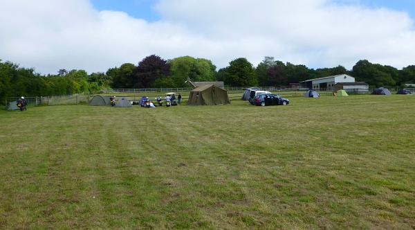
Wide open spaces. Some sun at last.
We were at a Hampshire golf club, but well away from the fairways and greens.
Steve arranged a green-lane ride out for the Saturday morning. Not a high demand for that, just Steve and me.
It's a well-established bit of advice. The best exercise to minimise any after-effects of prostate treatment - radiotherapy or surgery - is walking.
So I do quite a bit now.
Which takes up a lot of time, so other things have to take second place.
A while ago I happened upon a map of local footpaths and bridleways and made an interesting discovery.
I can walk all the way from home to one of the best pubs around almost entirely on footpaths, and almost in a straight line. Making it a much shorter distance than going by road.
The final part of the test was to park the 40-tonner as close to the pedestrian as possible without touching him. Or without him even realising I was there in the huge articulated lorry.
This test checks that you're able to use the front-view mirror to see if anyone is loitering on the crossing in the blind-spot right in front of the bumper, and to manouvre right up close. Without this mirror the pedestrian is completely hidden from the driver's view - that is - my view. So I have to show I can use it properly and keep out-of-sight pedestrians safe.
- to the past week.
It's not far from Manchester to a huge jolly tourist attraction in the Pennines.
Just across the border in West Yorkshire.
No passport or photo ID required.
So I'm now in a bustling real-life filmset full of eager visitors.
Brought about by a simple little TV programme that just happened to wander along aimlessly, ambling around for nearly forty years, with an anarchic cast of bus pass holders who knew how to live life properly!
And for good measure I journeyed here on my own bus pass. So there!
Some photos -
Back in the 1960s, having left school and started out in the world, one of the first discoveries that I made was about Art, and going to college for it.
I went to a modern College of Art and Technology in East London. These were fashionable in those days and could eventually lead to a degree in Engineering or Art, if you'd otherwise opted out of 'A' levels as I had. The 'art' at these colleges was slanted very much towards the commercial end of the subject, art for design, advertising, theatre and so on.
When the Student is ready, the Teacher will appear.
One of the most fundamental proverbs of human existence.
I first saw this in a book by the 'notorious' Indian guru, Osho. (Notorious because he died rich and famous, having gained a place in the Guinness Book of Records for owning the greatest number of Rolls Royce cars of anyone living).
My visit to Ireland is a four-handed affair.
The first was the family history bit in County Mayo, over the past few days.
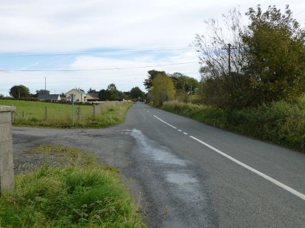
Much work on this has already been done over many years by relatives, which led me to the Culnacleha Crossroads.
Here
One hundred years ago this week, an Irish American, Carl Stearns Clancy, set off from Philadelphia with his riding companion Walter Storey, on a pair of 4-cylinder Henderson motorcycles, with a map that would guide them right round the world.
Clancy's friend pulled out in Paris, but Clancy himself completed the journey and is now considered to be the first motorcyclist to ever ride around the world.
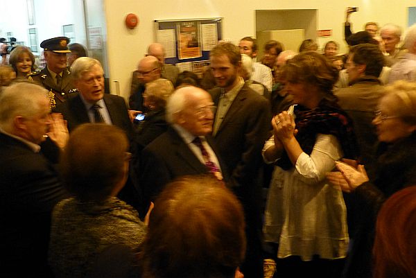
It seems a little incongruous to be taking wine with the President of Ireland. Surely it should be Guinness?
He is a poet and writer after all.
But the wine was good, and the good President got the event off to an excellent Irish start in the small town of Athy.
The last time I was here in Annascaul, I didn't quite find the house where Tom Crean was born. I found what I thought was the location, but the track was impassable with churned-up mud. My single pair of shoes had to last me the rest of the visit and RyanAir back to Gatwick.
Substantial wellington boots were needed.
On this visit I still had no boots, but Mike was with me.
He's been here before, and navigated us to the same spot that I closed in on last year.
The path was OK and we found the house.
To cram Family History Research, The Clancy Centenary Ride, the Shackleton Autumn School, and a pilgrimage to the South Pole Inn, all into one little trip to Ireland resulted in what felt like a real epic voyage.
So there are some reflections and contemplations to be mulled over.
On the very first day, I learned the correct local pronunciation of my old family name.
"C'nyon." And slight variations.
On almost the last day, in the South Pole Inn, a family from Dublin was having lunch. The mum was very well-travelled particularly in Africa. But in Ireland as well.
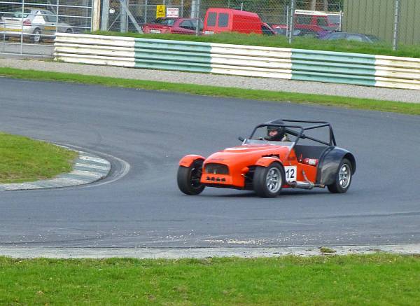
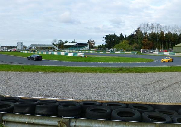
Heading south from Dublin, the road to Athy passes near to Mondello Park, a motor racing track that hosts some major Irish motorcycle events. But alas, on the day I was passing, a track-day for cars was in progress. Almost a waste of good tarmac.
So some photos for my son Richard who's strictly a 4-wheel man, not two.
Continuing the Antarctic theme for now.
November heralds the start of the Antarctic summer.
So a new programme of events gets underway, starting with the AGM of the Friends of the Scott Polar Research Institute.
In Cambridge.
Where it's winter.
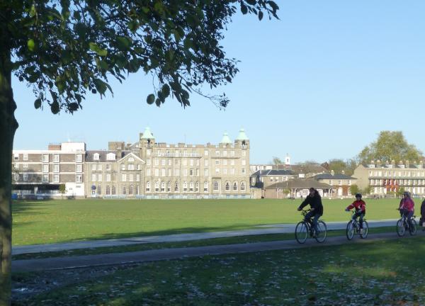
So, to keep warm, there's a buffet get-together.
Under a nice warm polar bear skin in the cosy SPRI lecture theatre.
It's been a while since the previous entry.
Well, Melbourne to Donington is a long way.
There may be a glut of postings now, playing catch-up.
(You wait weeks for a bus then four hundred and seven arrive at once.
That is - the 407 bus, it takes me to Caterham or Croydon whenever I fancy using my bus pass).
Did anyone see this back in February?

Learn To Play Day, every March.
I had never heard of it.
But there was an advert for it shining out of the local free paper, like a beacon.
A message.
"When the student is ready, the teacher will appear."
Probably the 3rd or 4th time I've used those words in this blog.
It'll appear again I'm sure.
Like a lot of good things, the wonderful art class at the Fountain Centre in Guildford came to an end at Easter. The teacher had done a great job not only of guiding us over a year or more in producing pieces both amazing and strange, but also in having our work exhibited in a small art show in Guildford's Royal Surrey Hospital.
But as one door closes another opens.
"Low wages, bitter cold,
long hours of complete darkness.
Safe return doubtful.
Honour and recognition in event of success."
That advert, according to polar folklore, was placed in The Times newspaper by Shackleton for his 1914 Trans-Antarctic expedition.
Despite the $100 prize still being offered today for anyone able to prove this advert's existence, no one's ever found it.
But I can vouch for the truth of at least the headline, the title of this maddest of entries.
A bit of a bagatelle from the Emerald Isle. My visit over the last couple of weeks.
I never expected to find an elephant in the bush in southern Ireland. But they're there if you look.
Some photos from Jungle City Clonakilty
This one was on Inchydoney Island, a short walk from Clonakilty.
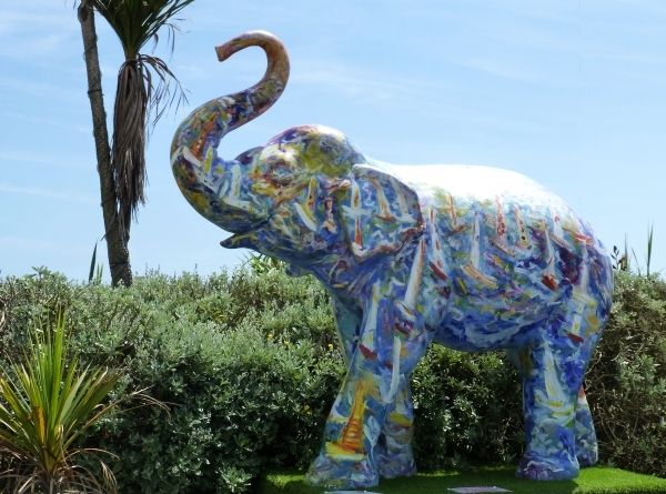
From bagatelle to picture book.
In Kilkenny, on the way to Athy, tea was called for.
Something else was calling me as well, not sure what.
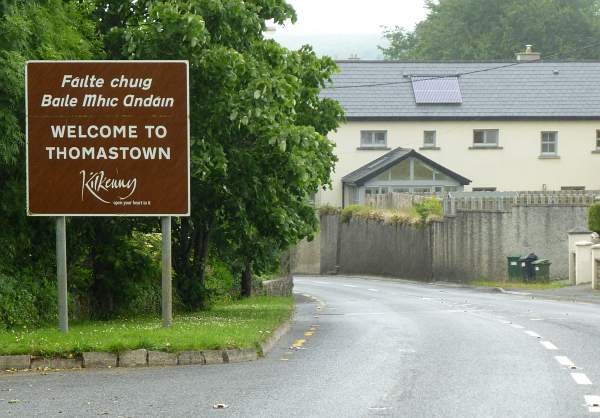
Maybe it was just a postcard in the newsagent's shop.
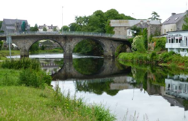
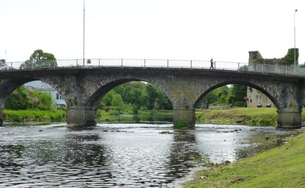
Bridge over the River Nore.
It seems, the older the bike, the greater the excuse to celebrate when it passes an MOT.
My little Yamaha of Cape Town fame still waits hopefully - for when I can get body and soul together for the messy job of changing the front brake hose. Soon, soon.
But the Aprilia, I hoped, needed nothing done. And its MOT time of the year had come round again.
This weekend was the Bemsee-MRO Championships at Brands Hatch.
(Click to open the PDF if you're asked).
And fellow ex-Wimbledon Club member Pete had a spare ticket that he kindly slipped into my pocket.
I hope things have been better today at Brands Hatch than yesterday. And Pete has had some proper fun on the Rudge in the parade laps.
I've not been there today because I've been here.
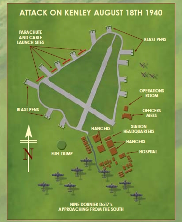
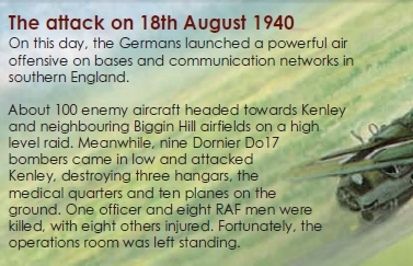
Last year, Steve arranged the first Hampshire HU mini-meet at a very well-appointed golf club out in the rolling countryside.
Such a pleasant little event it was, that Steve laid on a re-run last weekend.
Very nice too.
There was no missing the location, with or without GPS, down a little B-road.
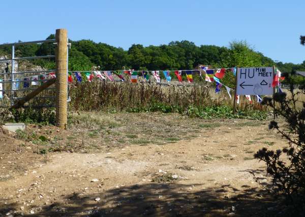
Complete with the world's flags strung out to welcome the world's travellers.
Well, it's been a long time since the previous look at music along the way. That was Tanzania.
So here's a selection of Youtubes from Malawi.
In actual fact, Malawi is popular with western tourists, specially gap-year students. They fill a lot of the hostels. So a lot of the music to be heard while travelling is from the 'western world'.
A selection of images here to begin, and two Malawian musicians, Denis Yolamba followed by Benson Phiri.
I'm sure this qualifies to be in a blog about motorcycle travel.
You definitely lean into all the bends throughout the 800-mile round trip. Almost needing knee-sliders, would you believe?
Not only that, but there's a poem about the journey that I learnt at school while helping my Dad service and repair his 1950s 600cc Panther sidecar outfit.
From a Railway Carriage
Faster than fairies, faster than witches,
Bridges and houses, hedges and ditches;
And charging along like troops in a battle
All through the meadows the horses and cattle: