12. Huamachuco to Caraz
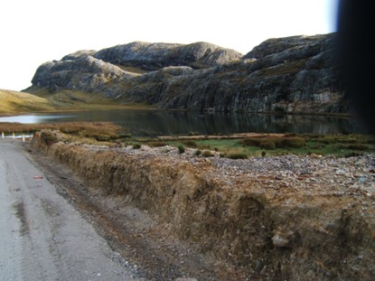
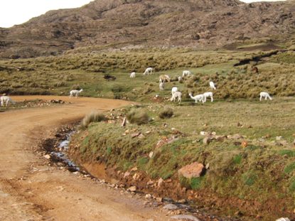
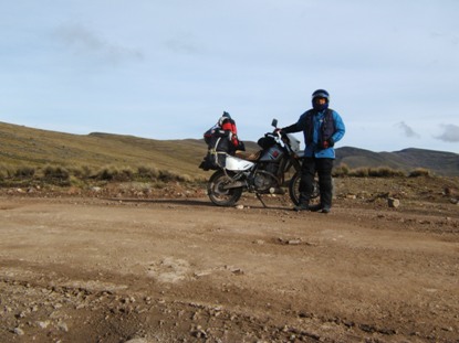
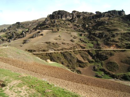
The journey from Huamachuco to Caraz, Tuesday November 11/08, has been the hardest in my trip. I left Huamachuco at 5:30 am to try to get Caraz, 370 km away in my accounts, with only 65 km paved at the beginning and 50 km at the end. And I had no true references of a part of the off road, which appear in one of my maps without distances, and didnt appear in the other one. I estimated the distance, but you will see in the pictures why cant do that in these high mountains with deep canyons.I choose this route because it was the route Simon Bolivar, The Liberator, used in his Peruvian campaign, April 1824, in order to meet the Spaniards loyalists. Time ago I knew the route he used to climb the cordillera coming from the eastern prairies, to Bogotá in the altiplano. It is an almost vertical trail in the rocks. Been the army composed only for people from the prairies, you can imagine their strength climbing a unknown mountain, and after that, crossing for three days the Pisba bleak plateau where only small high-altitude grass can survive. Its said he used to whip the almost freezing men who didnt want to walk to save their lives. Wives went also with those brave men, those who gave us our freedom. I was looking for something similar in these bleak mountains I crossed on Tuesday.
The first part, from Huamachuco to Quiruvilca, was excellent. I climbed from 2.800 m to a plateau 4.150 m. With 5°C, I used my electrical jacket but not my gloves. The off road continues with good surface across the plateau and next descend to Santiago de Chuco, a lower land.
.
.
Amigo: ahora puedes leer la historia completa en mi libro "La Suramérica que recorrí". Ve a www.palibrio.com. Las fotos, míralas aquí.
.
.
Qué día tan TESO el de ayer Martes!!!
Salí de Huamachuco a las 5:30 am para tratar de llegar a Caraz. Serían 370 km, de los cuales sólo 65 al comienzo y 50 al final serían pavimentados. Los 255 restantes eran una incógnita porque no tenía referencias apropiadas. Es más, en uno de mis mapas, había un trecho que no existía, aunque en otro del Ministerio del Transporte, sí aparecía (era una vía reciente), pero NO tenía kilometraje, el cual estimé, pero van a ver en las fotos porqué lo que uno mide en el mapa y le aumenta digamos 50% para curvas, resulta no ser tan cierto. En el caso de ayer, 30 km estimados ( incluyendo curvas ) se convirtieron en 70 reales, ah??. Pero mas adelante les hablo de este tramo.
Escogí venirme por esta zona porque fue el camino que Bolívar usó en su campaña hacia el sur en busca de encontrarse con los realistas, y yo en mi romanticismo, siempre quise retomar sus pasos. Ya habíamos subido desde los llanos colombianos a Pisba cuando veníamos con Luís Eduardo y amigos, y pude admirar cómo gente enseñada a sólo pradera, subió por semejantes riscos y peñas como es esa cordillera. Y después la atravesada del mismo páramo hacia Sogamoso, qué gente tan tesa!!! Algunos años después volví con Marta a Sogamoso y se me ocurrió mostrarle todo el páramo hasta donde ya empezara a bajar hacia los llanos; pues, nos mamamos de andar y andar sin ver mas que espartillo y arena sin que apareciera el final, hasta que nos devolvimos. Entonces sentí que nuestra libertad fue muy costosa, pagada con los sufrimientos de esos valientes y sus acompañantes femeninas. Algo así vine a buscar a estas montañas.
El primer tramo, entre Huamachuco y Quiruvilca, fue excelente,. Se sube de Huamachuco que está a 2.800 m hasta un páramo a 4150 m, que no estaba tan frío para ser las 6 de la mañana, 5°C, llevaba mi chaqueta conectada, pero no los guantes, Ahora sé que para esas temperaturas necesito los guantes eléctricos porque siempre sentí frío. Empieza el destapado pero muy bueno, el piso mas o menos parejo en tierra fina, y se continúa por el páramo para bajar luego a Santiago de Chuco que es un poco mas templado.
-------------------------------
I continued descending to Angasmarca, off road but good conditions. At certain moment, I probably committed the mistake of abruptly swerving while riding on the central ridge of the road, so the front tire skidded. In a reflex response, I sent my right foot to ground to stop the fall, Suzi bounced to the left side, put my left foot on ground, and finally she got straight. I think the fall toward de right side was too prolonged because the height of the ridge, so when my foot made impact on ground, the bike was already too tilted. It was my right knee who paid the toll. The hard pain made me to think it was broken. I stopped and dismounted, but when I supported my self on the knee, it moved or displaced toward the left. I felt to ground feeling my knee was smashed. I sit on ground and tight it. The pain on the internal side matched the direction of the displacement: internal ligaments were stretched or probably broken. I immediately remember my brother Fidel who suffer an accident in a cycle and had to got surgery to fixing the broken ligaments. And there I was, throw on ground, far away from any town, alone, and with a thousand thoughts. - How will I live from here? - By which means and where am I going to be fixed? - And what about Suzi? - And how much time would it take the incapacity? - And so, what about the trip? I maintained my knee stretched with both hands for about five minutes and prayed to God, FEELING He was with me. He would provide my wellbeing. I asked Him with deep faith, my knee were not to get spoil. I stand up, put my helmet, and with care to do not promote another lateral displacement, rode the bike and left. I was not full comfortable for braking but maintaining the knee against the tank prevented any lateral movement.
I rode first slowly, next with more trust. The road began to deteriorate, some times as wide as just a car, others because the big rocks, others because loose stones, and so on, I had the whole day all kind of surfaces. I was riding comfortable, but the main concern was what would happen if I had to lowering the right leg again, so I took care, especially on right U curves, that were thousands. I was sweating, as filling the lesion impact, so I began to deep aspiring, feeling God was with me, and concentrating in sending positive and restoring energy toward the knee. I felt better, and remembered to take an analgesic. In Angasmarca I stopped in a small store to buy a pop, got the pills from my bag, and took two of them. I continued for kilometres and kilometres of endless curves, up hill, down hill, wooden bridges, wading streams, muddy holes, some of them of a kind you know you are entering them but you are not sure you will leave on the other side. The surface change with the geology as there is not a graded gravel but just the material from the banks. You find big stones, small ones, rounded and sharpen gravel, sand, silt, mud, fine coal, indeed wooden debris from sawing activity just on the road.
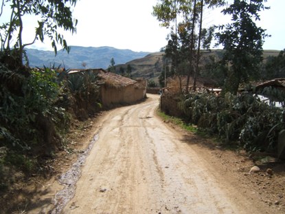
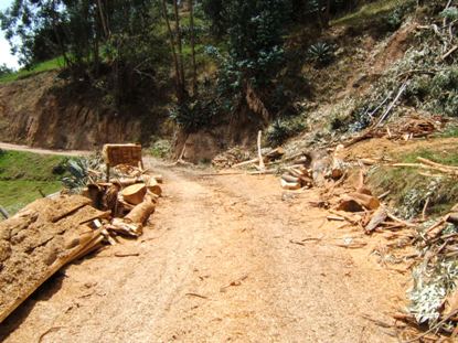
Continúo bajando hacia Angasmarca, la carretera en tierra muy pisada, digamos buena. Pero súbita e inesperadamente, en un tramo bueno donde iba como a 50 km/h, eso calculo, tal vez cometí el error de quebrar el timón mientras rodaba por el caballete central y la moto se me derrapó de adelante. Reflejamente bajé el pié derecho para detener la caída, la moto rebotó pegando un bandazo para el izquierdo, bajé el pié izquierdo y finalmente la moto enderezó. Creo que la caída hacia la derecha fue muy prolongada porque si iba por el caballete, además de la altura de la moto, el pié demoró mucho para tocar piso, y cuando lo hizo, ya la moto estaba muy inclinada. Fue la rodilla derecha la que llevó del bulto. Salí del percance con un fuerte dolor en ella, pensé que me la había quebrado. Pasé como pude el puentecito (ya verán en las fotos cómo son) y paré. Me apeé, pero cuando me apoyé en ella, la rodilla se me fue de para adentro, se desgonzó hacia el lado izquierdo. Caí al suelo y sólo pude sentir que mi rodilla estaba destrozada. Me senté en el suelo y me la apreté fuertemente. El dolor era por el lado interno y como hacia ese lado fue que se fue, lo lógico era que los ligamentos internos eran los que habían sufrido, al menos se habían estirado, o tal vez se habían roto! Inmediatamente me acordé de Fidel J, cuando un carro lo hizo caer de la bicicleta que yo le había prestado, se rompió los ligamentos internos y transversos, qué se yo, y se tuvo que ir para cirugía a que lo remendaran. Y allí estaba yo, tirado en el suelo, lejos de cualquier centro poblado importante, solo, y con mil pensamientos encima. Cómo voy a salir de aquí ? En qué y para dónde me voy a ir a que me remienden ? Y la moto, qué ? Y, cuánto tiempo tomará la incapacidad ? Y el viaje entonces qué ? Me mantuve la rodilla apretada con ambas manos como por 5 minutos y me encomendé al Señor, SINTIENDO que Él estaba conmigo. Él proveería mi bienestar. La noche anterior había asistido a misa en Huamachuco, tratando de reemplazar la dominical a la que no pude asistir en Caxamarca por incompatibilidades de horarios. El evangelio se refería a Cristo diciéndoles a sus discípulos que el asunto era PEDIR CON FE, y entonces cualquier cosa podría suceder. Pues eso fue precisamente lo que hice, pedirle al Señor con MUCHA FE, que mi rodilla no fuera a quedar desbaratada. Me paré, me puse de nuevo toda la parafernalia, y cuidándome de no pisar en falso para no ir a promover otro desplazamiento, me monté y arranqué. Sentía cierta incomodidad para mover el pié para frenar, pero al mantener la rodilla pegada contra el tanque evitaba cualquier movimiento a favor del daño.
Empiezo a rodar, al principio muy despacio y luego con mas confianza. La carretera empieza a deteriorarse cada vez más, a veces del ancho escaso de un carro, otras por piedra salida, otras por piedra suelta, en fin durante el día tuve de todas las clases de superficie. Manejaba confortablemente, pero la mayor preocupación era qué iba a pasar si tenía que bajar la pierna derecha de nuevo, por lo que me cuidé especialmente en las curvas en U hacia la derecha, que fueron mil. Empecé a sudar frío, como a sentir el impacto de la lesión, entonces empecé a respirar hondo, a sentir que Dios iba conmigo, y a concentrarme en enviar energía positiva y restauradora hacia allá. Me repuse y caí en cuenta entonces de tomarme alguna pastilla. En esas llegué a Angasmarca, un moridero como casi todas las aldeas, paré en una tiendita, me bajé con mucho cuidado y trabajo, tuve que desamarrar las maletas, que afortunadamente ya están amarradas en forma muy sencilla, para buscar los analgésicos. Menos mal la bolsita de Hello Kitty de Helena María, que nos ha servido de botiquín por años, la he metido de última en la maleta correspondiente. Dos Ibuprofén me tiré y guardé el frasco en el chaleco para la próxima dosis 4 horas después. Me guardé también parte de la gaseosa porque no quise terminarla. Seguí pegado de mi Dios y sintiendo que tal vez la lesión no era muy grave. Kilómetros y kilómetros de interminables curvas, subidas, bajadas, puentecitos, vadeando quebradas, uno que otro charco largo y profundo, de esos que uno sabe que entra pero no está seguro si va a salir. El tipo de suelo cambia con la geología pues es con el mismo material de la barranca con el que medio se trata la superficie, no hay homogeneidad. Hay piedra grande, pequeña, gravilla bien gradada, tierra, pantano, carbón fino, y hasta residuos de aserrío porque asierran en la vía.
----------------------------------------------
At certain moment I had a microbus in front of me, the driver happily dusting me not allowing me to pass him, not even in wider sites. As we were climbing a zigzag, I had not other chance of choosing a right curve, which he used to drive by the left, to pass over him by his right side, by the steepest and hardest part of the curve because over there the stones are loose. When I was sure he drove out by his left, I shifted to 1st and went to the wall, remembering I had not helping right leg. So I had to lowering my foot, but nothing happened, it supported the weight. Now I was more optimistic.
I reach the village I was thinking was Mollepata, where the unknown length would begin. Curiously, a sign says: Bienvenidos a Mollebamba ( Welcome to Mollebamba ). I asked and the lady said Mollepata still is two hours ahead!! I consulted my GPS and it confirm Mollepata is ahead. This Mollebamba didnt appear in the maps nor in the GPS. Again riding, I began going down by a very steppe road. Going down, zigzag, yellow soil. I am in the unknown length, back there somebody told me it was a short ride to Pallasca, GPS says Im close, but it doesnt show the track. It was 2:00 pm, I took another analgesic. In the other side of the canyon, a small track begins to appear. I asked somebody and he said yes, its my route to Pallasca. Closer to the bottom of the canyon, a kind of illusion comes to me. Is the road on the other side paved?. It seems because it looks gray. No way, there are not paved roads on the middle of nowhere. Passed the river by a wooden bridge and began going up by my paved road. Hum! It is the narrowest road I have ridden in my whole life, with very well pair of marked tracks, with the most sharpen rocks I have seen, an0d with very loose gravel on the central an lateral ridges. And go up hill by a more than twenty hairpins, and very tight curves because the ascending is up a wall. Obviously, the cliff always was half meter from the tire. They were the hardest, roughest and most suffered 12 km in my life. My knee was feeling better, but I completed two hours without meting a car, and I had fear of cutting a tire in those knives. Finally I reached Pallasca. Now, there were only 66 km to get pavement.
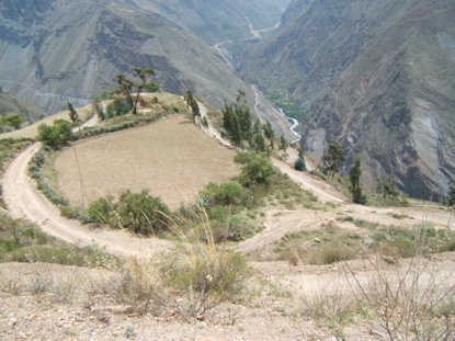
See the descending, and also check out the road in the other side, that was my paved road. Click on Image
image
Este es el descenso, mi via pavimentada esta al frente. Haga click en Imagen
Tablachaca Bridge. It links 2 departments
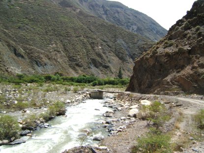
Puente Tablachaca, une 2 departamentos
En cierto momento tuve adelante a un microbús cuyo chofer venía feliz echándome polvo y sin dejarme pasar ni siquiera en tramos donde se podía fácilmente. Como veníamos subiendo un zigzag, no tuve de otra que escoger una curva hacia la derecha, en las que él acostumbraba abrirse, para pasármele por dentro, por la parte mas pendiente y difícil de la curva porque allí la piedra está mas suelta. Cuando estuve seguro de que él se abrió, puse primera y vámonos por esta pared, acordándome de que no tenía pierna izquierda para ayudarme en caso necesario. Pues ., tan de malas que tuve que bajar la pierna, no muy fuerte, pero no pasó nada, se sostuvo. Ya ahora estaba más optimista.
Llego al que esperaba fuera Mollepata, el pueblo (caserío mejor) donde se iniciaba el tramo desconocido en los mapas. Pero curiosamente hay un aviso que dice: Bienvenidos a Mollebamba. Pregunto y me responden que Mollepata está todavía mas adelante, como a dos horas!!!. Prendo mi GPS que me confirma que Mollepata está mas adelante. Este Mollebamba no aparece en el GPS y tampoco en mi mapa. Continúo, y paso otro caserío antes de llegar al propio Mollepata. Como hay desviaciones, me cercioro de que estoy tomando la carreterita correcta. Y empiezo lo que se dice a bajar! Baje, zigzag, siga bajando por camino de tierra amarilla. Estoy en el tramo desconocido, pero atrás me dijeron que ya faltaba poco para Pallasca, y así me lo confirmaba el GPS, pero éste no me muestra la carretera, sólo el pueblo. Son las 2 pm y me tomo otro Ibuprofén. Este tramo no existía hace algunos años por lo que dos departamentos, La Libertad y Ancash, estaban incomunicados. Al otro lado del cañón del río se empieza a dibujar una carretera, pregunto y me dicen que debo subir por ella. Ya mas abajo noto que la carretera parece (¿?) ancha y pavimentada, pues se ve gris. Eh, no podía creer que en semejante soledad pudiera haber pavimento. Llego al río y el puente que comunica los dos departamentos, es de madera, el sitio se llama Tablachaca. Y empiezo a subir por la que creía era pavimentada, que ahora era de una piedra gris, la mas filuda y suelta que yo haya visto en mis 25 años de edad. Ya llevaba como dos horas sin encontrarme un solo vehículo. Y hágale para arriba por un zigzag interminable. Las fotos tomadas desde el otro lado mientras bajaba muestran mas de 20 curvas, todas supercerradas porque la subida es por una pared, obviamente el precipicio siempre estaba a medio metro de la llanta. Fueron los 12 km mas ásperos, luchados y sufridos que he recorrido siempre. Ya me sentía mejor de la rodilla, pero tenía mucho miedo de cortar una llanta en semejantes cuchillas. Finalmente llegué a Pallasca. Ahora sólo faltaban 66 km para llegar a pavimento.
----------------------------------------
A policeman told me the off road is not as bad asx the previous one. I began to descend again to the same river I had crossed at Tablachaca. Impressive rocks I pictured because I dont want to come back, ever. Reached the river, the road didnt improve. I got front wind, but in the corners and at the end of these V cuts, it used to come from unexpected direction, making the riding too dangerous because the loose high ridges of the road.
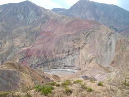
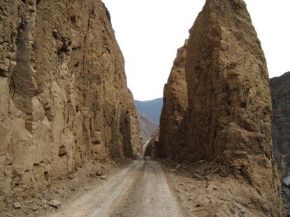
Pregunto a unos policías y me dicen que esos 66 km son malitos pero no tanto. Empiezo ahora a bajar y bajar, nuevamente al mismo río de antes, al del puentecito de madera en Tablachaca Rocas impresionantes que no me abstuve de fotografiar porque por allá no vuelvo ni a deshacer los pasos. Bajo al río y la carretera sigue muy dura, pero nunca como los 12 km del infierno.
-------------------------------------------
At 4:30 I touched tarmac, a very good one. After 10 minutes, I noticed the engine speed was not matching the bike speed, of course, after 10 hours riding on 1st, 2nd, and very occasionally in 3rd, I had forgotten the bike had 5th, I was going in 4th.
A las 4:30 toco pavimento, y bien bueno. Después de como diez minutos de pavimento, yo notaba que no me coincidían las revoluciones del motor con la velocidad a la que iba; pues claro, después de 10 horas en sólo 1ª, 2ª, y eventualmente 3ª, se me había olvidado que la moto tenía 5ª, iba en 4ª.
-----------------------------------------------
I got Chuquicara, a crossroad of 15 houses, where should be my take off to Caraz, again along an off road. As that day I forgot to take my for-good-memory pill, and may be so excited because the tarmac, I passed along. 15 minutes after, I was asking my self where should my way off be. Checked the map and augh!!!, I u-turned. I gassed up and asked the man about the road. He said there are 2.5 hours to get tarmac and other half to get Caraz. It was 5:00 pm. I would made it early night, and I wanted to get a site where a physician would check my knee out. The bad news: the road was too hard. I took the risk and left. I u-turned after the first kilometre. It was not sane to take that hard and unknown road, at 5:00 pm, after 344 km of hard track, after almost 12 riding hours been forked on Suzi, and with out an available leg to pushing!!
I spoke to the policeman in the checkpoint, he suggest to see the gas station man, he had small rooms. The rooms already were occupied, but he opened the tire repair room for me and brought a mat. Suzi and me were going to sleep with the compressor as company. A very organized man, gave the bathroom keys, every thing clean. I ate on the next door restaurant and tied a small plank to immobilize the leg, a thing I should have done just after the accident. I washed in the sink and went to the mat with my riding pants, I had not strength to take them out nor wanted to see my nude knee.
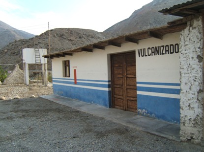
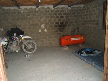
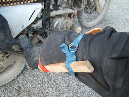
Llego a un cruce llamado Chuquicara, un caserío de 15 casas, donde era mi desvío hacia Caraz, pero como ese día me olvidé de tomarme la cucharadita de Kola Granulada y tal vez emocionado de andar en pavimento, sigo de largo. Al rato empiezo a preguntarme dónde sería mi desvío, saqué la hoja donde tengo escrita la curva, y ahhh, era en Chuquicara, 25 km atrás. Me devuelvo, echo gasolina, el grifero (aquí a las bombas les dicen grifos) me dice que son dos horas y media hasta coger pavimento, y otros 25 km hasta llegar a Caraz. Eran las 5 pm. Llegaría ya de noche pero no muy tarde, y yo quería llegar a un sitio decente a hacerme revisar la rodilla que seguía igual, delicada lateralmente pero sin problemas para montar. La mala noticia es que me dice: la carretera es dura! Me arriesgo y arranco. Al primer kilómetro me devuelvo. Imposible coger esa carretera tan dura, a las 5 de la tarde, después de 344 km de trocha, después de casi 12 horas de estar horqueteado en Suzi, y además sin una pierna disponible para empujar!
Le hablo al policía del retén a ver si me deja dormir allí, pero me sugiere que vaya al grifo porque allá el hombre tiene piecitas para arrendar. El hombre me abrió la sala de vulcanizar (que no está en servicio), y me trajo un colchón. Suzi y yo dormimos en compañía del compresor. Las piecitas ya estaban alquiladas a unos camioneros. Muy organizado, me da la llave de la vulcanizadota y la del baño, todo muy limpio. Como en el restaurante de enseguida, y me amarro una tablilla para inmovilizarme la rodilla lateralmente. Me lavo en el lavamanos porque no tenía alientos para desvestirme, iría a dormir vestido.
Escribo el resumen del día y tun, al suelo, al colchón de paja. Puse la chaqueta en la parte de arriba y no me quité los pantalones exteriores ni la tablilla, sólo las botas.. Descansé aunque desperté muchas veces.
--------------------------------
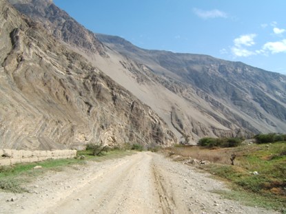
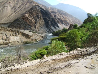
I woke up at 7:30, greased the chain, put a second plank in my leg, prepared and took of by 8:30. The estimated 2.5 hours the man told me up to get tarmac, actually were almost 4. The road would be too hard to make it at night and tired. It was very treacherous because the pair of tracks done by cars in many places and loose gravel in the ridges. This was especially marked along 35 narrow tunnels.
The only car I found in 2 hours
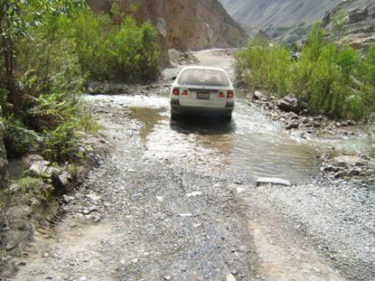
El único carro que encontré en 2 horas
The rocks are huge with variety of shapes. Click on Image
image
Las rocas son inmensas con variedad de formas. Click en Image
From the bridge directly into the tunnel
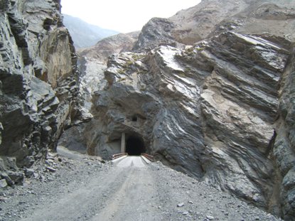
Desde el puente directamente dentro del tunel.
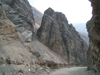
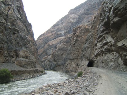
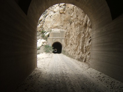
El Pato Canyon. I have found many speed signs along these 3rd.-level roads. They are very optimistic waiting for you surpassing that speed, when you hardly can get 25 or at least 30 km/h. Rough surface and narrowness prevent you going faster.
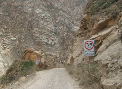
Cañón del Pato. He encontrado muchos avisos de límite de velocidad en estas carreteritas de tercer orden. Ellos son muy optimistas creyendo usted puede pasar ese límite, cuando a duras penas se logram los 25 o a lo máximo 30 km/h. La superfficie irregular y lo estrecho de la vía impiden ir más rápido.
A las 7:30 me levanté, engrasé la cadena, me puse doble tabilla, por lado y lado, organicé y arranqué a las 8:30. Las 2.5 horas que el hombre me pronosticó hasta el pavimento fueron casi 4. La carretera muy dura al principio, de donde me devolví, mejoró un poco, pero nunca para hacerla de noche, ni cansado. Muy traicionera porque en muchas partes se han formado los dos canalones de las huellas de los carros, y con grava suelta es muy fácil que la moto derrape. Esto especialmente en los 35 túneles estrechos que tiene en el destapado.
--------------------------------------------
FINALLY, I got Caraz by noon, installed in Hotel Los Pinos, and striped to take a shower before going to the hospital. Ohh Surprise!!, the knee, I was waiting were black as the ink and swelled as a ball, had no color but a small swelling. I went to the hospital were I got immediately attention. The doctor took my leg and began carefully- to try to laterally bent it, both sides, extended leg, 30 degrees bent it. I was very concerned the knee would fail. It didnt. The doctor told me I had a first degree ligaments stretching, something very easy to cure, just some resting. The most painful was the bill: 1.30 dollars. I have to say that in the northern countries, at this time, 24 hours after, I probably didnt know if the lesion was serious or light. A physician had never taken the risk of trying the leg, he just had ordered a half dozen of X-rays from the all the angles, and sent you to a specialist, who could see you in four months because our waiting list is too long. And the bill? Just $ 200 pllus another 200 for the X-Rays plates. I prefer the direct diagnostic of our physicians by touching and observing the pacient, instead of those sofisticated examens made by machines that have no contact with the pacient. Congratulations to our phyhsicians.
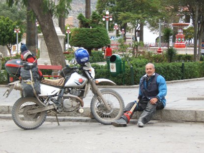
Bueno, FINALMENTE llegué a Caraz a medio día, almorcé, me ubiqué en el hotel, y me empeloté para bañarme. Y Oh! Sorpresa, la rodilla que me la imaginaba negra como tinta e hinchada como un balón, no tenía nada de color y la hinchazón era muy leve. Me fui al hospital donde me atendieron inmediatamente. El doctor me coge la pierna a torcérmela para los lados y yo haciendo fuerza para que no fuera a fallar. Y nó falló. Me dijo que tenía un esguince de primer grado (el más leve) que tuviera algo de quietud y que me pusiera una rodillera. Lo mas doloroso fue la cuenta: 4 soles, que equivalen a 1.3 dólares. Se parece a los países del norte, allá el médico nunca se hubiera atrevido a tocármela y menos a hacerle fuerza en el sentido en que ella fallaría. Allá me hubieran tomado media docena de radiografías por todos los lados, después me hubieran mandado donde el especialista traumatólogo que da las citas para dentro de 4 meses, y me hubieran cobrado por lo menos 200 dólares por la consulta mas otros 200 por las radiografías. Yo prefiero el diagnóstico directo, por tacto y observación de nuestros médicos, a los sofisticados exámenes y respuestas de máquinas que no logran observar al paciente tal como está. Felicitaciones a nuestros médicos.
------------------------------------------
My knee took a full resting day. On Friday 14, I went up to LLanganuco Lakes and continued climbing to Portachuelo Pass at 4712 m, although the weather was not cooperative. LLanganuco area is located in between Huandoy Mountain and Huascaran Mountain, the highest in Peru at 6168 m. On Saturday 15 I made another small tour getting a good set of pictures.
Tomé un día de quietud para restablecer la rodilla. El viernes 14 subí a la zona de las Lagunas Llanganuco y continué subiendo hasta el paso Portachuelo, 4712 m, aunque el tiempo no fue muy colaborador. Llanganuco se encuentra entre los nevados Huandoy, y Huascarán que es el mas alto de Perú con 6168 m. El sábado 15 hice otro pequeño tour donde logré unas buenas fotografías.
---------------------------------------------
Hotel Los Pinos,l looking at part of Cordillera Blanca (white range)
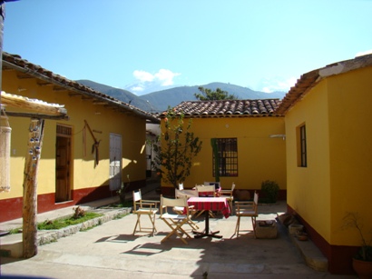
Hotel Los Pinos, mirando parte de la Cordillera Blanca
Nice place, quiet, mountain activities related, and a tasteful and very good served meals.
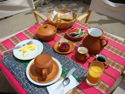
Rico lugar, tranquilo, relacionado con deportes de montaña, y una sabrosa y bien servida comida.
.
.
.
This was my sight from my room, fantastic.
image
Esta era la vista desde mi alcoba, fantástica.
.
.
.
Huascarán from the road to Pueblo Libre. This part of the year at the beginning of the rainy season, is not the best to get mountain pictures.
image
Huascarán desde la vía a Puerto Libre. Esta época del año, cuando están empezando las lluvias, no es la mejor para fotografiar la montaña.
.
.
.
Llanganuco Lakes
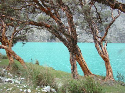
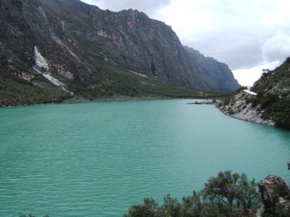
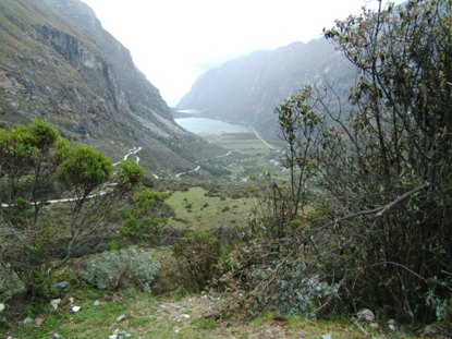
Lagunas LLanganuco.
.
.
.
Cimbing to Abra Portachuelo (Portachuelo Pass), I found this extrange sign (dangerous curves),
..
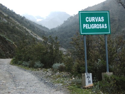
Trepando a Abra (Paso) Portachelo, encontré este extraño aviso,
..
.
.
.
.but I couldnt understand it,
.
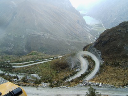
....pero no lo pude entender,
.
.
.
.
.not even when the truck had to go back before continuing dawn hill.
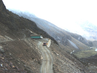
.ni siquiera cuando el camion tuvo que reversar para continuar falda abajo.
.
.
.
Portachuelo Pass,
..
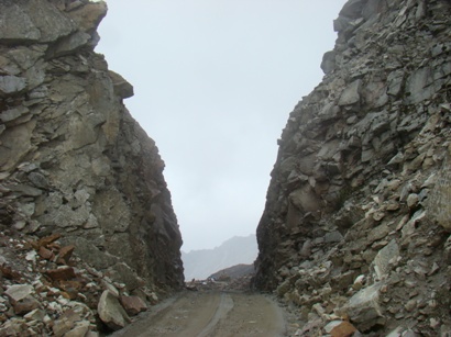
Abra Portachuelo,
..
.
.
.
..where my GPS showed 4712 m. Suzi was fresh as a lettuce, asking for more climbing, always running nice, smooth, and at low revolutions. - What a bike!!!
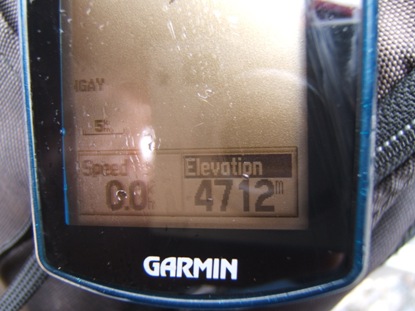
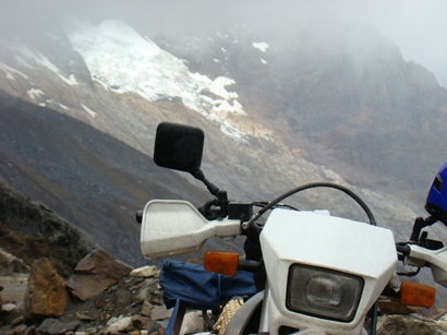
.donde mi GPS marcó 4712 m. Suzi estaba fresca como una lechuga, pidiendo mas trepada, siempre funcionando parejo, suave y a bajas revoluciones. Qué moto!!!
.
.
.
Coming down, I stopped at the lake to have some food and coca mate against altitude sickness. Mysteriously, my camera fired it self. When I checked out the picture, she smiled and sweetly told me we now were friends.
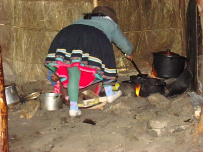
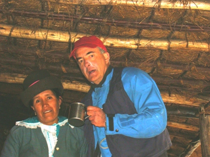
Regresando, paré en la laguna a comer algo y a tomar mate de coca contra el soroche. Misteriosamente mi cámara se disparó. Cuando miré la fotografía lograda, ella me sonrió y dulcemente me dijo que ya éramos amigos.
.
.
.
Mountains are dry and with nude rocks, but interior valleys with some water are splendorous.
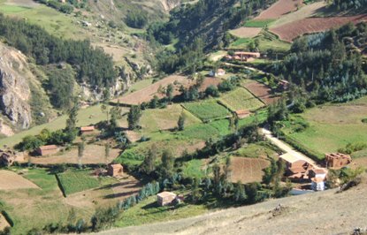
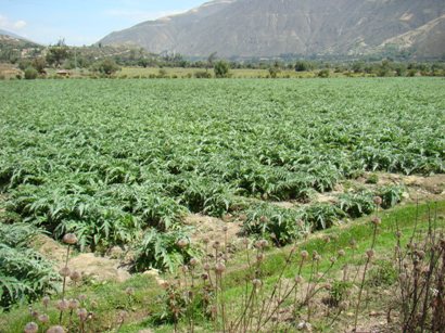
Las montañas son secas y con rocas desnudas, pero los valles interiors con agua son esplendorosos.
.
.
.
I guarantee these women do not need nannies, ever.
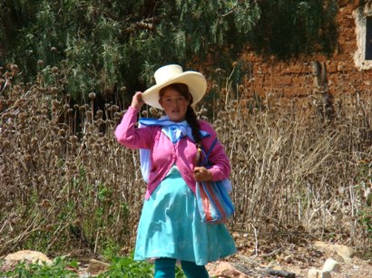

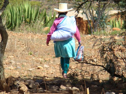
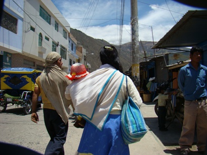
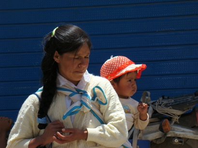
Les garantizo que estas mujeres no necesitan niñera jamás.
.
.
.
The fashion is sensational, but the shirt wonderful.
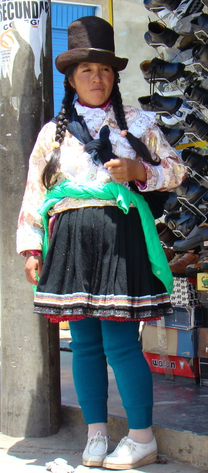
La pinta es sensacional, pero la blusa es un belleza.
.
.
.
Internet cafés and locations for calling to base and cellular phones, is a BIG business in these countries. It doesnt matter one is next door the first one.
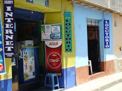
Internet cafés y lugares para llamar a teléfonos fijos y a celulares, es un GRANDE negocio en estos países, no importa que estén enseguida : será que así se sienten quienes usan los servicios?
.
.
.
In Caraz the verb to prohibit is well conjugated. In most of the parts, doesn´t.
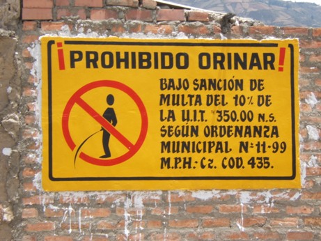
En Caraz el verbo prohibir es bien conjugado. En la mayoría de las partes, no.
.
.
.
If you want to see my general progress, click on the next image.
La imagen anterior muestra mi avance general.
.
.
.
Click on the following images to see my particular progress along Ecuador and Perú.
BLUE line means good paved road.
RED line means bad paved road, or graveled.
GREEN line means a VERY narrow road with no gravel, only with site variable materials: tilt, sand, rock, gravel, stones, mud, etc.
ECUADOR
image
PERU
image
Click EN las imágenes si desea ver mi avance en particular por Ecuador y Perú.
Línea AZUL significa carretera con pavimento en buenas condiciones.
Línea ROJA significa carretera con pavimento en malas condiciones, o en grava.
Línea VERDE significa carretera MUY estrecha, sin grava, con el material de la zona que es variable: tierra, arena, piedra, grava, roca, pantano, etc.
