19. Uyuni - SanPedroAtacama
.
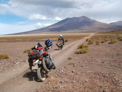
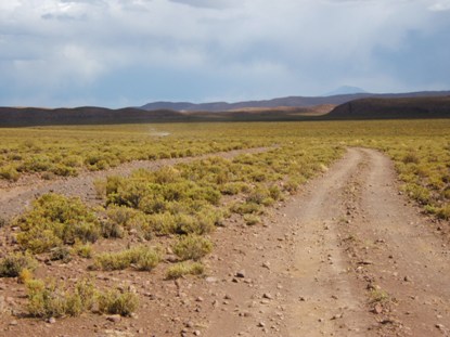
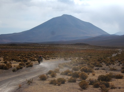
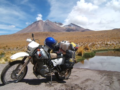
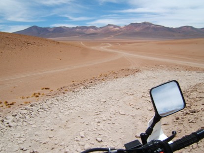
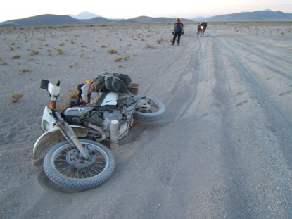
Leaving the hard surface of the Salar means going riding 70% of the time on a no-comfortable surface: corrugation combines with hard, soft and VERY soft/loose sand, and with deep and narrow tracks to make a diversity of riding conditions, most of them trying to send Suzi to lay on ground..
.
.
.
.
.
.
.
image
.

.
.
.
.
Amigo: ahora puedes leer la historia completa en mi libro "La Suramérica que recorrí". Ve a www.palibrio.com. Las fotos, míralas aquí.
.
.
Dejar la dura superficie del Salar significa estar rodando el 70% del tiempo sobre superficie irregular: el corrugado se combina con arena dura, suave o MUY suave o suelta, y con huellas profundas y angostas para hacer una variedad de condiciones de manejo, la mayoría de ellas tratando de poner a Suzi acostadita en el suelo.
.
.
-----------------------------------------
.
.
We headed for Chiguana looking for hostel, but it was only a train station with a military post with no services. They advised us going further up to Avaroa Station, at the Chilean border, about one hour far away. We did it just at sunset, and after 7 hours riding, finally Suzi went to rest before me. At Avaroa Station we found hostel and some food.
.
.
Después del Salar esperábamos encontrar hospedaje en Chiguana, pero eso era sólo una estación ferroviaria con un puesto militar. Allí nos recomendaron ir hasta Estación Avaroa, en la frontera con Chile, a una distancia aproximada de una hora. Partimos casi a la puesta del sol, y después de 7 horas de estar rodando, finalmente Suzi se fue a descansar primero que yo. En Estación Avaroa encontramos hospedaje y algo de comida.
.
.
-----------------------------------------
.
.
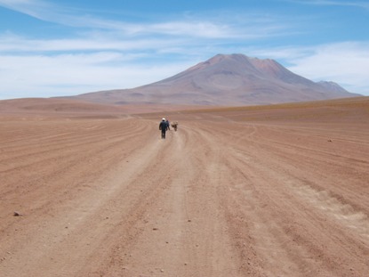
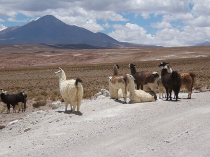
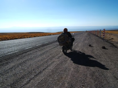
Sometimes you find along the road living company for a short time, but most of the time you dont.
.
.
Algunas veces te encuentras por cortos momentos con vida a largo del camino, pero la mayoría del tiempo no.
.
.
-----------------------------------------
.
.
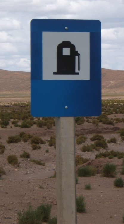
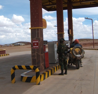
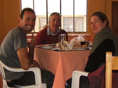
From Avaroa we had to detour 90 km to San Cristóbal to get gas, our tanks were almost empty. A lovely sign and the good news of availability welcome us after the crisis. So, we celebrated with a tasteful lunch before turning back to Villa Alota were we pass the night.
.
.
.
.
Desde Avaroa tuvimos que desviarnos 90 km hasta San Cristóbal a conseguir gasolina, nuestros tanques estaban ya casi vacíos. Un reconfortante aviso y la noticia de que sí había gasolina nos dieron la bienvenida, por lo que nos fuimos a celebrar con un suculento almuerzo antes de volvernos a Villa Alota donde dormiríamos.
.
.
-----------------------------------------
.
.
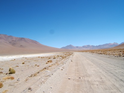
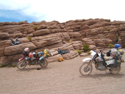
After Villa Alota we had to let the main road for travelling along tracks. A resting in the middle of the way.
.
.
Después de Villa Alota tuvimos que dejar la carretera principal para continuar por trochas. Un descanso en medio del camino.
.
.
-----------------------------------------
.
.
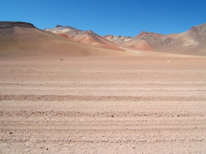
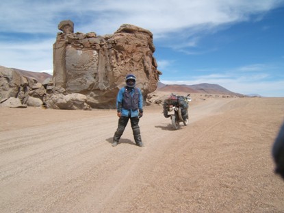
Different formations everywhere.
.
.
Formaciones diferentes por todas partes.
.
.
-----------------------------------------
.
.
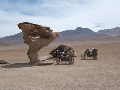
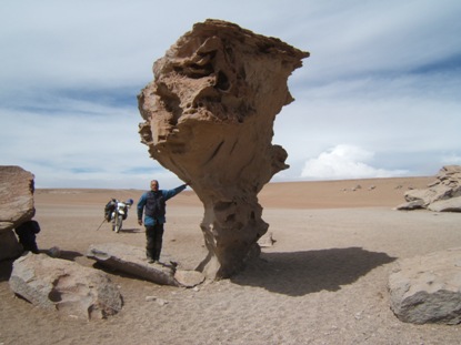
Arbol de Piedra (stone tree), a must to stop before reaching Laguna Colorada. After this site, we rode along a VERY soft sand for about one kilometre at the time we had an intense lateral wind trying to move the bikes out of the chosen track. Bikes absolutely lost power, so I thought I had both flat tires. No, but the tires were up to the rims into the sand. Going in first gear and helping with legs was the way the bikes could leave that lake of soft and deep sand, I believe it was pumice. That stress took out the rest of our strength, so we came to Laguna Colorada completely exhausted. Remember we were at 4.500 m. Because the poor hostelling on Laguna Colorada, we wanted to continue 4 km more to the next site, more frequented by tours. We couldnt. While registering at the park office, the lateral wind got stronger, so we couldnt ride more than 30 m, the bikes impossible of maintaining vertical on the track. It was December 24, some Argentineans were singing up to late night in the hostel, but we went to bed at day light.
.
.
.
El Arbol de Piedra, parada obligada antes de llegar a Laguna Colorada. Después de este sitio, atravesamos como un kilómetro de arena MUY suelta y suave (creo que era de pómez), al tiempo de tener un intenso viento lateral tratando de sacar las motos de la huella escogida. Suzi perdió tanta fuerza que yo creí que tenía las dos llantas pinchadas. No, las ruedas estaban enterradas hasta los rines. Pudimos salir de ese lago de arena supersuelta andando en primera y ayudando con las piernas. El esfuerzo nos arrancó lo que nos quedaba de fuerzas por lo que llegamos a Laguna Colorada completamente exhaustos, recuerden que estamos a 4.500 m. Como el hospedaje en Laguna Colorada no parecía ser muy atractivo, quisimos seguir otros 4 km hasta el próximo lugar que es mas frecuentado por los tours. Pero no pudimos. Mientras nos registrábamos en el parque el viento lateral se había incrementado tremendamente, por lo que no pudimos andar mas de 30 m, imposible mantener las motos verticales en la huella. Era Diciembre 24, algunos argentinos estuvieron cantando hasta media noche, pero nosotros nos fuimos a la cama a plena luz del día.
-----------------------------------------
.
.
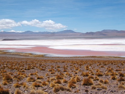
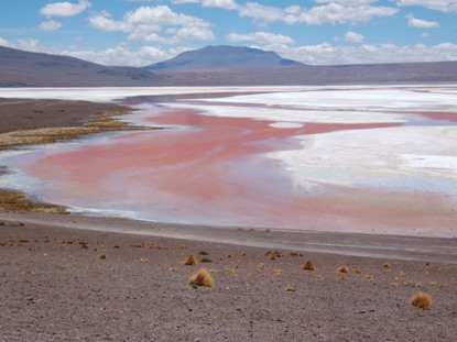
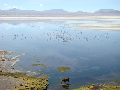
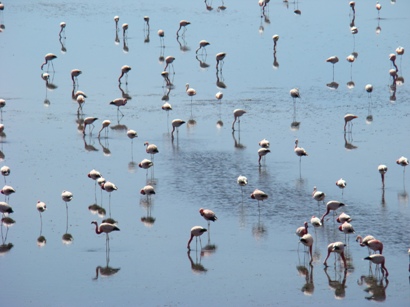
Laguna Colorada due his name to the algae color that grows in it. Thousands of flamingos live here.
.
.
.
.
.
Laguna Colorada debe su nombre al color de las algas que allí crecen. Miles de flamingos viven aquí.
.
.
-----------------------------------------
.
.
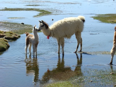
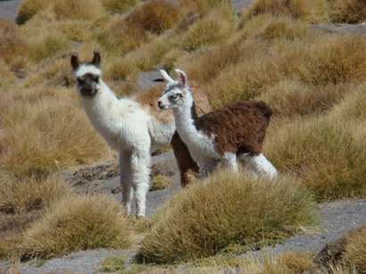
Llamas also enjoy the waters, hot spring in this side of the lake.
.
.
.
Las llamas también disfrutan de las aguas, que nacen calientes en este lado del lago.
.
.
-----------------------------------------
.
.
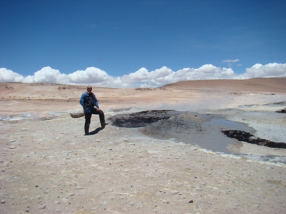
The geiser Sol de la Mañana.
.
.
El geíser Sol de la Mañana.
.
.
-----------------------------------------
.
.
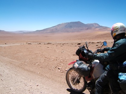
After the geiser we took a small track thinking it was a short cut. We were wrong, the track detoured us because after going around some volcanoes, it continued northwest while we should go southeast. GPS and compass did agree about direction but we couldnt understand we were riding in the opposite direction, you get lost in that kind of wilderness. The track we were coming was almost erased, but we didnt want to u-turn because it was too hard to ride. At this point we were at 5.051 m deciding were to go. After the next hill we saw a borax mine where we were instructed how to get the main road.
.
.
Después del geíser tomamos una pequeña vía que creímos era un atajo. Nos equivocamos porque después de rodear algunos volcanes la ruta nos desvió hacia el noroeste cuando deberíamos ir hacia el sureste. El GPS y la brújula estaban de acuerdo en cuanto a la dirección, pero no lográbamos entender que estuviéramos andando en la dirección opuesta; uno se pierde en ese terreno yermo. No queríamos regresarnos porque la ruta recorrida era muy dura. En este punto estábamos a 5.051 m decidiendo cómo seguir. Después de la siguiente colina divisamos una mina de bórax donde nos indicaron cómo llegar a la carretera principal.
.
.
-----------------------------------------
.
.
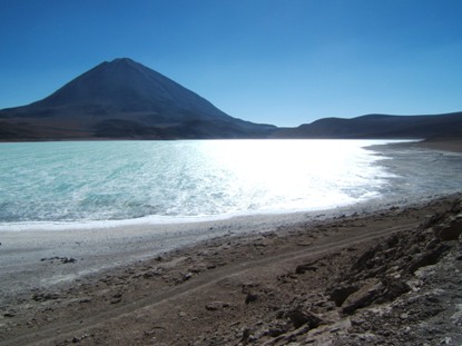
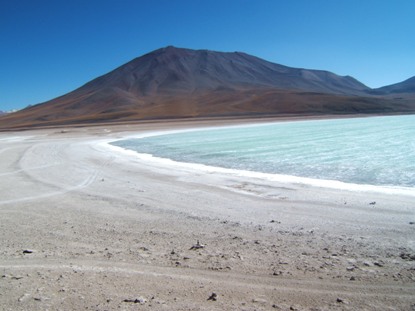
And finally, after a long ride, unique Licancábur shape appeared on the horizon and I knew it was behind the Laguna Verde. We were close to it. We couldnt appreciate the full color, due to arsenic in the water, because at this time the sun was behind the lake.
.
.
.
Y finalmente, después de un largo recorrido, la silueta única del Licancábur apareció en el horizonte y yo sabía que él estaba detrás de la Laguna Verde. Estábamos ya cerca. No pudimos apreciar completamente su color debido al reflejo del sol.
.
.
-----------------------------------------
.
.
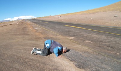
Encircling Laguna Verde is Bolivian emigration post. Six kilometres after we got Chilean pavement after 1.200 km of sandy tracks. 40 km ahead it was San Pedro de Atacama, Chile, where we slept before coming back to Paso Jama in the way to Argentina.
.
I have to say that this journey through the southern Bolivian Altiplano has been so far the hardest riding I have had. The non-end sandy landscape, with its dryness and solitude, where not even peasants with their herds lives as in Peru, make this part of the trip one of the more interesting, speaking about adventures. Lagunas, where some kind of shelter exists, are at distances of 5 or 6 ridding hours, absolutely no services in between, so you have to be autonomous in ALL things: gasoline, parts, food, water, weather protection, etc. For many people the high altitude, over 4.300 m for two weeks, is a problem I hadn´t because I have been in the mountain for almost two months, so I´m acclimatized. Too many things and ideas should be written and commented, but not time at this time, perhaps latter in a book or at least in a more complete report I´m thinking to do, especially for my grandchildren.
.
.
.
Bordenado la laguna se encuentra el puesto de emigración boliviano. A los seis kilómetros llegamos a pavimento chileno después de 1.200 km de trocha en arena. 40 km después es San Pedro de Atacama, Chile, donde dormimos antes de regresar a Paso Jama camino de Argentina.
.
Debo decir que esta parte del viaje a través del sur del altiplano boliviano ha sido sobradamente la mas dura del viaje. Los paisajes de arena sin fin, con su aridez y soledad, donde ni siquiera hay campesinos con sus rebaños como en Perú, hacen esta parte del viaje una de las más interesantes desde el punto de vista de la aventura. Las lagunas, donde algún tipo de habitación hay, están a 5 o 6 horas de viaje, sin absolutamente servicios intermedios, por lo que usted debe ser autónomo en TODAS las cosas: gasolina, comida, agua, protección ambiental, etc. Para mucha gente la gran altitud, a más de 4.300 metros durante dos semanas, es un problema que yo no tuve porque estando en la montaña por cerca de dos meses ya estoy aclimatado. Son muchas las cosas e ideas que podrían escribirse y comentarse, pero no hay tiempo ahora, quizás luego en un libro o al menos en un reporte mas completo que estoy pensando hacer especialmente para mis nietos y nietas.
.
.
-----------------------------------------
.
.
This is my ridden route from Cuzco to San Pedro de Atacama, Chile, where I stayed on December 25, 2008. If you can´t see the whole maps, please adjust them by going to the zoom window in the lower-right corner of your screen. Blue are paved roads, red are graveled, green are trails.
.
My plan was to ride back from lagunas area to Uyuni and east Bolivia, continuing the loop clockwise around South America. BUT, the hard ridding on sandy tracks, and going alone with no company, made me to desist about the plan. This time, Ill go counter clockwise loosing no place. Furthermore, this direction will allow me to see the Dakar Rally. So, Ill continue riding with Omer and Gil for a while.
.
image
.
image
.
image
.
image
.
Esta es la ruta recorrida desde Cusco hasta San Pedro de Atacama a donde llegué el 25 de Diciembre de 2008. Si no puede ver el mapa completo, puede ajustarlo yendo a la ventanita de zoom en la parte inferior derecha de su pantalla. Azul son carreteras pavimentadas, rojo son afirmadas, y verde son trochas.
.
Mi plan original era devolverme desde la zona de las lagunas hacia Uyuni-Potosí-Brasil, y continuar la vuelta a Suramérica en el sentido de las agujas del reloj. PERO, el duro manejo en esas trochas de arena, además de ir solo, me hicieron desistir. Esta vez, iré en sentido contrario a las agujas del reloj y no me perderé ningún sitio. Es más, esta dirección me permitirá ver el Rally Dakar. De modo que continuaré andando con Omer y Gil por algún tiempo.
.
