Ecuador And Peru (North)
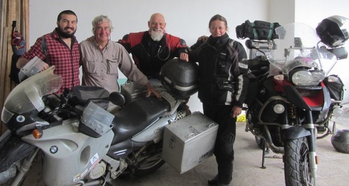
March brought in two personal notable landmarks. Three years ago, back in March 2009 I started this trip in Miami. Since then I have ridden 47,000 miles (75,000 km) around the Americas on my slow meander south (with a detour via Alaska). In addition; I somehow managed to reach the grand old age of sixty. To help me celebrate I met up with some friends of my brother in Cuenca, Ecuador, Australians Brian and Shirley are travelling from Ushuaia to Alaska on their BMW. We had been following each others progress and planning on meeting up wherever our routes crossed. It was good to have their company for a few days before they headed north and hopefully we will meet up again in Australia.
Alternative Hostel Owner Xavier, Myself, Brian And Shirley
I spent a couple of days (once again) trying to buy kerosene to clean the motorcycle chain. Eventually I gave up and took a litre bottle to a fuel station and had it filled with diesel for 25 cents (16 pence per litre or a bit less than $1 per US gallon). Having cleaned and lubricated the chain I was all set to continue south into Peru. The poor starting first thing on a morning that the bike has been suffering from for a while disappeared once I got back to sea level so the problem seems to be associated with high altitude.

Dirt Road Detour Around A Landslide On The Way To The Peruvian Border
For anyone thinking of planning a similar trip and attempting to work out a budget, I have spent £33,000 ($52,400) in total or an average of £11,000 ($17,466) per year. This includes flights, shipping the bike to the USA from England and shipping around the Darien Gap. The USA and Canada were obviously more expensive than the Latin America countries I have already visited. Budgeting is always difficult, I have met riders who spend considerably more than me and others who spend considerably less. For those poor souls that have to go back to work and therefore embark on trips of shorter duration the average monthly cost will be higher as the shipping costs and any flights are spread over the shorter period.
I had been told that the Ecuador Customs and Immigration offices were easy to miss when heading south into Peru at the Tumbes border crossing on the coast. The most common directions being Ride to the bridge over the river that is the actual border then turn around and ride back seven kilometres! Ade, a Canadian heading south ahead of me emailed the grid reference and I could see how it would be easy to ride straight past. This border crossing had a reputation for being a bit dodgy with a couple of villages in no mans land between the immigration and customs offices and lots of touts, money changers and guides wanting to help. There is now a new road and bridge which by-passes the villages and it must now rank as one of the easiest border crossings in the Americas. Customs and immigration are in the same brand new building and it was the first border in Latin America I have crossed where I didnt need any photocopies of documents. The Peruvian Immigration and Customs are in a similar brand new blue and white building with the compulsory SOAT vehicle insurance available right next to the Customs desk. The only minor hiccup was that along with the brand new buildings, road and bridge there seemed to be a brand new computer system that the officers were in the process of learning which slowed the process down a bit. As building work wasnt quite finished hopefully some signs identifying the buildings are still to come.
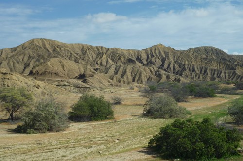
Peruvian Desert South Of Mancora
After the rains I had been through in Central America, Colombia and Ecuador I was looking forward to the desert of Northern Peru. Also, having spent several weeks in Vilcabamba and Cuenca sitting out some of the wet season it was nice to be moving again. The Pacific Ocean of northern Peru was the first coast I had seen since leaving the Caribbean in Colombia and it made a refreshing change to be at the seaside for a while. With stops at different surfing resorts on the way south I ended up camping at Huanchaco, to my mind the nicest place on that stretch of coast.
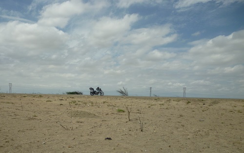
More Peruvian Desert
Traditional reed boats are still used for fishing off the northern coast of Peru. Historic examples of very similar reed boats have been discovered in many parts of the world, the earliest known example from Kuwait is 7000 years old. They were common in ancient Egypt where they were made from papyrus reeds. In Peru they are made from Totora reed which is cultivated along the coast and in Lake Titicaca. Peru, Bolivia and Ethiopia are the last three countries still to use this once common boat building material. Although the boat design may be 7000 years old the rest of the fishermans lifestyle is pure 21st century. He is likely to load his catch into a pickup truck and call his wife from his mobile phone to say he is on his way home!
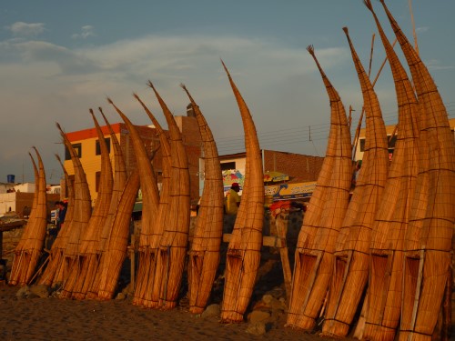
Huanchaco Traditional Totora Reed Fishing Boats
The sun usually made a spectacular job of setting into the Pacific Ocean as the last of the surfers made their way back to the beach. I joined the other tourists on the beach at sundown each evening for the free light show.
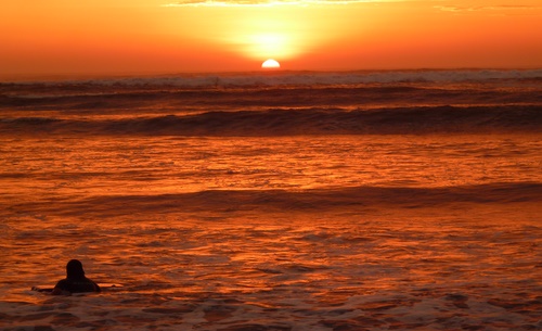
Huanchaco Sunset Over The Pacific As The Last Surfer Comes Ashore
I bumped into a number of different backpackers in Huanchaco that I had met in Ecuador and Colombia and arranged to visit Chan Chan, a pre Inca archaeological site with two of them; Ry and Vanessa from the USA. Chan Chan is the largest city of mud brick construction in pre Colombian America occupying an area of twenty square kilometres (7.7 square miles). It was built around 850AD as the capital city of the Chimu Kingdom which ruled the area until it was defeated by the Incas in 1470. Mud brick walls up to eight metres (26 feet) high have survived because of the dry desert climate although the site is now under threat as climate change and in particular El Niño is causing heavy rainfall and flooding in what has been a very dry area for hundreds of years.
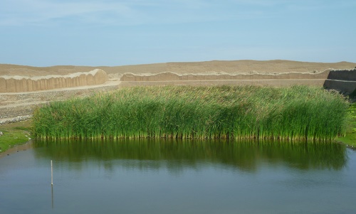
An Open Well in Chan Chan Archaeological Site
I had hoped to team up with some other riders to go through Duck Canyon (Cañon del Pato) , a hundred kilometres (62 miles) or so of which is a rough gravel track but I didnt meet up with anyone and figured that the locals are usually happy to help if help is needed. The GPS started playing up and would stop working altogether for a while. Fortunately, once you are in Duck Canyon you cant go far wrong as the canyon narrows and the only way to go is between the cliffs.
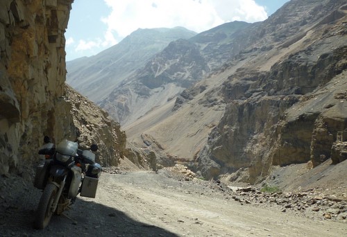
Duck Canyon (Cañon del Pato)
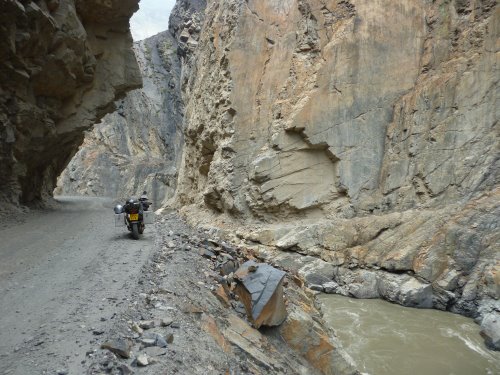
Duck Canyon (Cañon del Pato)
It was hot, dry and dusty but inexplicably there were a few short sections of mud. I approached the first and worst muddy section which was bad enough that normally I would have stopped to look for the best way through. However, glancing in my mirror I saw a four wheel drive car coming up behind me and made a quick decision to ride straight in and stick to the centre of the track so that if I got stuck I would be blocking the road and the occupants would have to help me. I had to put a foot down into the very liquid mud which was deep enough to pour into my boot but that was the only problem I had.
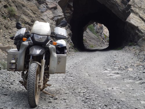
Duck Canyon (Cañon del Pato)
A very tired looking pair of cyclists were resting in the shade outside a Tienda (small shop), they were a French couple going in the opposite direction to me and had only seventeen kilometres (10.5 miles) of the rough gravel and the one section of deep mud to negotiate to get back onto a paved road. It had taken me over an hour to ride those seventeen kilometres. With the temperature rising as midday approached the cyclists were a bit daunted at having another seventeen kilometres of the rough stuff to go.
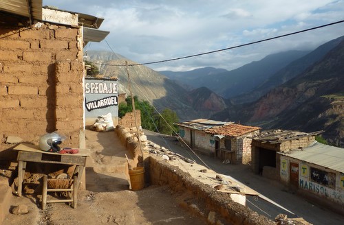
Some Rough And Ready Accommodation At Yuramarca With Most Of The Dirt Road Behind Me

Three Of The Many Tunnels In Duck Canyon
I arrived in Huaraz just before Easter and decided to stay over the Easter weekend as accommodation can be hard to find. Many Peruvians travel to visit relatives, go to pilgrimage sites or just to take advantage of a long weekend. Huaraz got busier as it got closer to the weekend and the hostel I was staying at was full. Huaraz is the trekking and mountain climbing centre for the Peruvian Andes. The town is on the banks of the River Santa which separates the mountain ranges of Cordillera Negra to the west and Cordillera Blanca to the east. The Cordillera Negra mountains stop the warm Pacific air currents from travelling further inland which keeps many of the Cordillera Blanca mountains cooler and capped with snow.
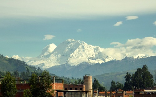
Snow Capped Cordillera Blanca Mountains From My Huaraz Hostel
There was a Semana Santa (Easter) procession through town on Good Friday similar to the ones I saw in Antigua, Guatemala last year. Pictures were created on the ground along the route using coloured sawdust and in some cases flower petals. These impressive artworks would then be trampled and destroyed by the procession walking through them. The procession was made up of a number of heavy floats carried on the shoulders of bearers with brass bands playing sombre music and children leading the way with their banners. Fridays procession commemorating the crucifixion was considered the main event of Easter. The procession on Sunday commemorating the resurrection was very low key in comparison. It seemed odd to me and I never figured out why the crucifixion was deemed more important than the resurrection.
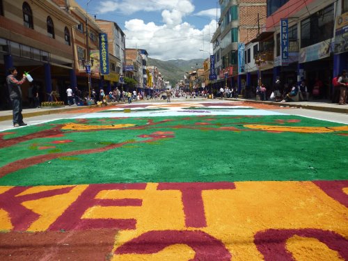
Semana Santa (Easter) In Huaraz
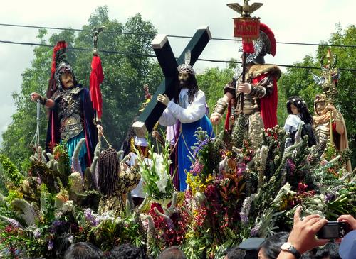
Huaraz Semana Santa Parade On Good Friday
I had hoped to bypass Lima but it looks as if my GPS needs repairing and Lima is the best place to arrange the work so my next stop will be the Capital City. I hope the GPS; which intermittently stops working cooperates and guides me through the city traffic.

