New Zealand South Island Part One
I never got to see Wellington as there was torrential rain for the two days I was there prior to catching the ferry to the south island. The campsite, like many in New Zealand had a kitchen and lounge area so there was at least good shelter from the rain.
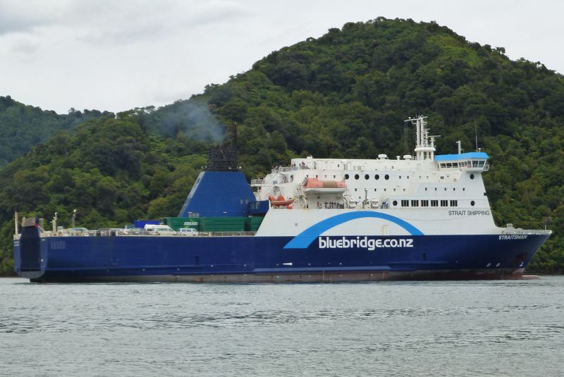
Ferry Reversing Into Picton Harbour In The South Island
There was no choice when it came time to catch the ferry but to roll up a saturated tent, load up the bike and ride through the rain to the ferry terminal. Thankfully I was given covered parking for the bike until it was time to board. I had been looking forward to the ferry trip as the boat has to navigate between islands on its approach to Picton on the south island and the ferry publicity photographs looked very scenic. When I spoke to some locals however; they warned me that it is often a very rough crossing as the Pacific Ocean funnels through the gap between the islands. My crossing wasnt rough but the rain reduced the visibility so it wasnt particularly scenic either. The rain had eased to a fine drizzle when I rode off the boat into Picton. I considered looking for accommodation with walls and a roof but as the rain had almost stopped and being all too aware of the budget constraints on long term travellers I erected the tent, still dripping wet from taking it down in the rain in Wellington. I dried off inside the tent as best as I could with a towel and hoped it would dry out during the afternoon. It didnt, but another rub down with the towel and a folded up tarpaulin between the damp floor of the tent and the mattress kept me dry. The following day the sun was shining and I finally got everything dried out.
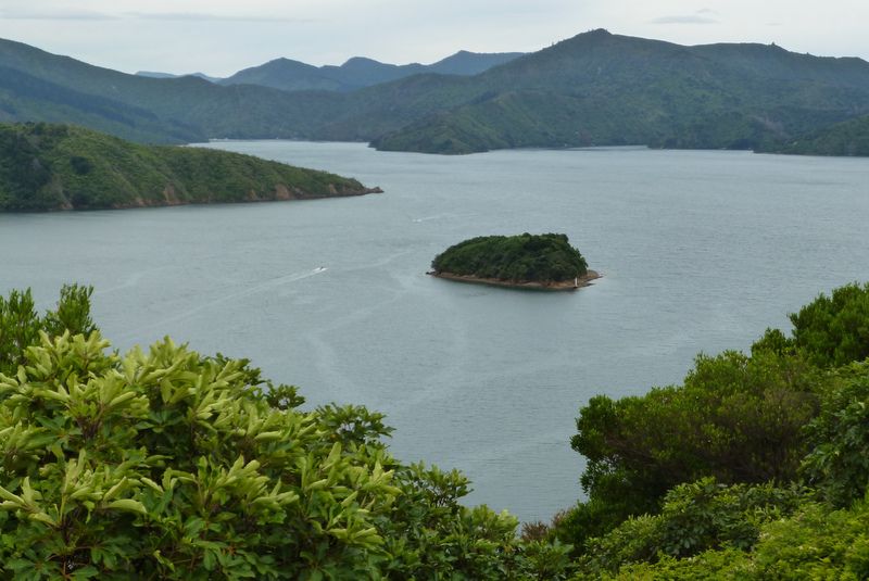
Queen Charlotte Sound, Picton
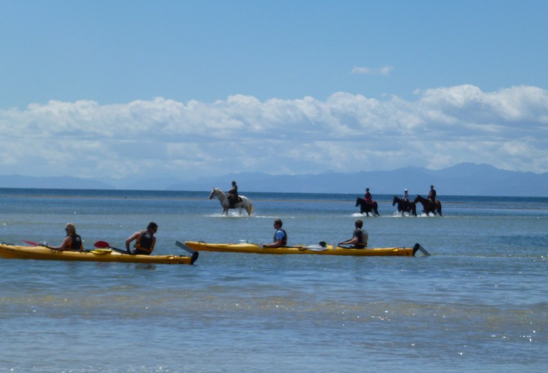
From Picton I travelled through Nelson to Abel Tasman National Park. The park is where Abel Tasman attempted to land in 1642, one hundred and twenty seven years before Cook but was driven off in a battle with the Maori. Tasman was a Dutch explorer and the first European to see New Zealand. At Marahau, the shallow sea was a hive of activity with a fleet of tractors towing boats in and out of the ocean, canoeists paddling in the bay and horses splashing through the water. The boats being pulled in and out of the water were mainly water taxis. They would take you to beaches with no road access and with a bit of luck pick you up later. They also dropped off and picked up hikers and canoeists with their canoes so that they could travel from one point to another rather than having to do round trips.
Canoeists And Horseriders Trying To Decide Who Has Right Of Way
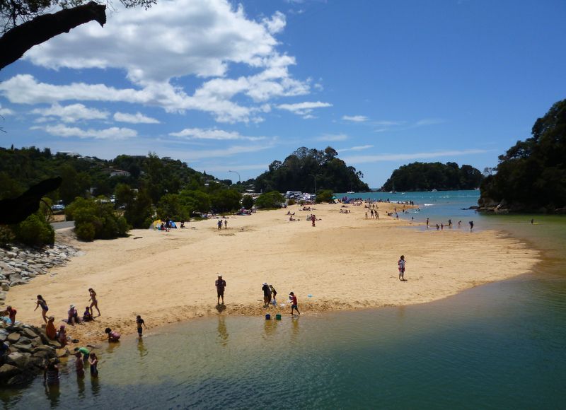
Kaiterieri Beach, Abel Tasman National Park
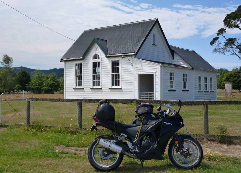
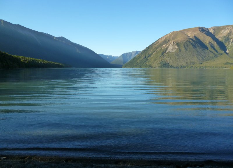
From Abel Tasman National Park I headed through the Motueka valley towards Saint Arnaud in Nelson Lakes National Park. The Saint Arnaud campsite was on the shore of Lake Rotoiti which was handy for getting evening and early morning photographs. Virtually all the campsites have a 10am checkout which I always battle to comply with. There never seems enough time to wash, pack up the tent and luggage; especially as the tent often needs drying out and have breakfast. I left Abel Tasman NP without having breakfast and stopped at the first rest area I came to which turned out to be tables and chairs laid out on the lawn of what was either a church or village hall although there were no other buildings in sight.
Motueka Valley Picnic Breakfast Stop
Nelson Lakes National Park has been successfully trialling a method of returning habitat to its natural, pre European state that until now has only been successfully carried out on small islands where remigration is difficult. Imported species of insects and mammals are trapped and killed to reduce, and then control their numbers sufficiently to allow the indigenous fauna to recolonise the area. The aim is to severely reduce the number of foreign species so that they no longer have an effect on the ecosystem but not wipe them out completely. Native insect and birdlife numbers have increased by reducing the number of wasps that arrived in New Zealand as stowaways in packing cases shipped from Germany. Rabbits, possums, mice, rats and deer are being tackled now which is allowing native plants to recover which in turn supports the native wildlife. Maoris must be wondering how far up the food chain this experiment of severely reducing the numbers of ecosystem destroying European species is going to go, all the way up to Caucasians?
Lake Rotoiti, Nelson Lakes National Park
I was warned that the west coast of New Zealand gets a lot of rain so I always tried to check the weather forecast and time my visits to coincide with drier weather. However New Zealand summers are similar to the UK, it can and will rain unexpectedly. I planned to zig zag across the mountain passes and catch as much of the coastline as I could without doubling back on myself too much and riding the same roads twice.
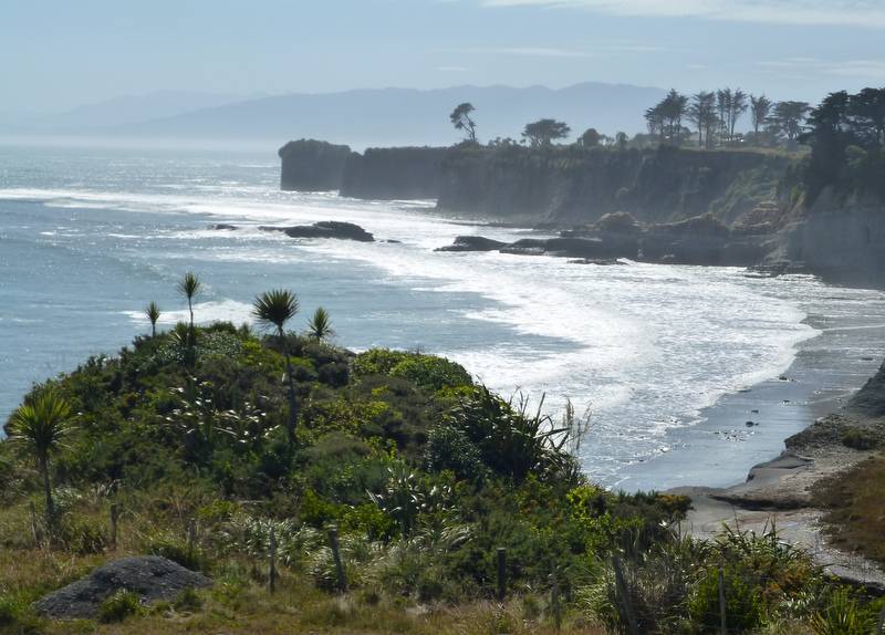
Foulwind Point Near Westport On The Tasman Sea
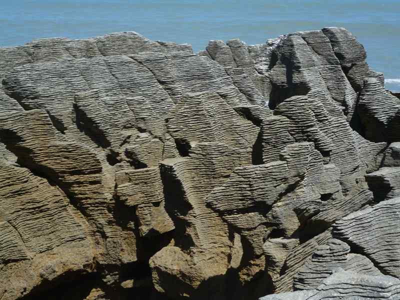
The coast road from Westport to Greymouth proved to be the best coastal scenery in New Zealand so far as I make my way south. Pancake rocks are particularly stunning. The surface of the rocks have worn with horizontal indentations that look like stacks of giant pancakes. Geologists dont know why the limestone has formed into this unusual shape and I like the idea that there are still a few unresolved mysteries in our planet.
Pancake Rocks Between Westport And Greymouth
I had chipped a filling in one tooth ages ago but as it didnt bother me I was happy to wait until an opportunity arose to get it fixed. Just before Christmas a back tooth started to give an occasional twinge so it was time to find a dentist. I was planning on spending a few days in Greymouth prior to riding the Lewis Pass to wait for the forecast rain to end so I found a dentist and booked an appointment for the following day. The dentist said that the back tooth causing a problem was a wisdom tooth and needed to come out. In addition to the chipped tooth there was another filling that was required. The dentist could repair the two teeth needing fillings and take out the wisdom tooth in one session. This sounded like a lot of work for him and pain for me but after perusing the estimate of $760 (£395) I gave the go-ahead and the dentist dived into my mouth with a syringe. The two fillings were completed without drama then it was time to part company with my wisdom tooth. While my mouth was overfull of fingers and implements there was what sounded like a very loud cracking noise from inside my head. I thought the tooth had snapped and that the dentist was going to have to go poking and fishing around the cavity to get the broken bits out. But no, a bit of bone, i.e. a lump of my skull which I had been very attached to had broken off with the tooth. The cavity wouldnt stop bleeding so a new array of implements had to be inserted into my mouth to sew up the wound. Then came the seriously painful bit, paying the bill!
The wound continued to bleed for the rest of the day and on into the following morning which literally had me spitting blood. Thinking that the day couldnt get any worse and while my mouth was still numb from the anaesthetic I opted to tackle my least favourite motorcycling job, cleaning and greasing the chain. I continued with other least favourite chores by doing my laundry. By the time the washing was optimistically hung out to dry on a cloudy overcast day which had produced occasional showers the anaesthetic had worn off so I decided to do the manly thing and lie on my bed and wallow in self-pity for the rest of the day. Needless to say, it started to rain again and my laundry didnt dry.
Lewis Pass
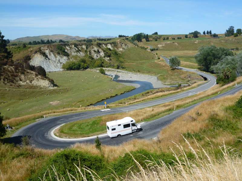
To help take my mind off the sore mouth and the soft, mushy, easy to chew diet I took to the first of the three mountain passes I intended to take in the south Island. Lewis Pass runs from Greymouth on the west coast through the old mining town of Reefton and on to Kaikoura on the west coast. Yet another good ride on quiet roads (apart from my noisy exhaust), no great altitude or serious changes to the weather to contend with as there was when tackling passes in the Andes just a pleasant day riding through the hills.
Hairpin Bends Of Lewis Pass
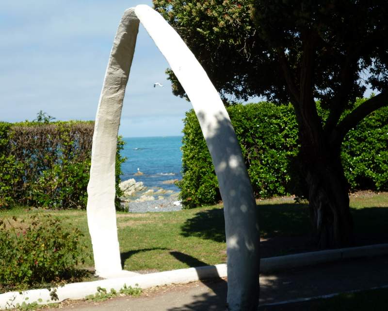
Kiakoura is the place to go for whale watching in New Zealand. I was tempted by a helicopter tour where you hover above the whales and can see the whole animal, the bits below the water as well as the bits above. The photos looked spectacular but it was way out of my budget. I settled for a stroll through the park that had a path curving its way through a series of whalebone arches. I did get to see dolphins swimming close to the beach. Kiakoura was founded on whaling which is how the bones where available. Instead of hunting the whales the town now makes its living catering to the whale watchers.
Kaikoura Whalebone Arch
I hadnt originally planned on visiting Christchurch following the earthquakes that devastated the city in 2010 and 2011 but I needed to travel through it to get to the start of the Arthurs Pass road and I wanted to visit nearby Lyttelton and the Banks Peninsular. Travelling anywhere around Christchurch; you soon notice the effects of the earthquakes. Lots of damaged roads, lots of roads closed with diversions in place while repairs are carried out, numerous closed buildings and, showing their battling spirit, businesses trading in modified shipping containers as the original buildings have been lost.
Christchurch Arts Centre, One Of The Hundreds Of Buildings Closed By The Earthquake
The city centre, now known as the Red Zone is completely fenced off with no admittance except for building workers. The damage is obvious and on a huge scale. They are still demolishing buildings and I didnt see any indication of starting to rebuild the city centre at all. As the damage is so extensive it has been decided to redevelop the whole city centre from scratch which seems like a good idea but the decision has delayed insurance settlements for some property owners. I spoke to one who said his building was severely damaged but repairable so the insurance company had offered the cost of the repair work. However the local government wont permit repairs as they want to demolish all the buildings in the block as part of the redevelopment. Up till now no one has agreed to pay for the difference between the repair costs and the cost of knocking the building down and rebuilding.
Christchurch Cathedral Behind The Red Zone Boundary Fence
I met a couple on Christmas day in Thames on the north island who had lived in Christchurch. Their home was severely damaged in one of the earthquakes with floors tilted over at extreme angles and obviously too dangerous to live in. They moved to Auckland the following day and dont intend to return.
Christchurch Red Zone Demolition Site
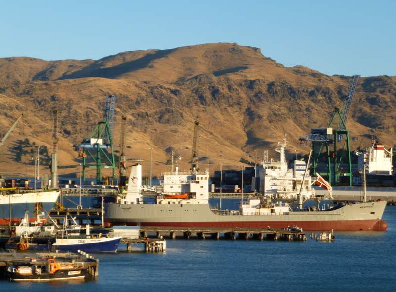
Lyttelton was a popular base for the Antarctic exploration expeditions of the early 1900s as a final port to stock up on last minute essential supplies, final checks and maintenance before heading out to the then unknown wilderness of the south. Scott, Shackleton and Australian, Douglas Mawson all chose Lyttelton as their final port before heading to Antarctica. A great uncle of mine accompanied Shackleton on one of his lesser known expeditions to Murmansk a few weeks before the end of World War One. Travelling may be a hereditary trait although in my great uncles case he was packing a rifle and bayonet. I came across the following quote on Shackletons northern Russia campaign at www.south-pole.com/p000098b.htm
The northern Russia campaign, said General Ironside, "was a side show of the Great War". Soldiers could hardly be spared from the front lines so troops were scraped from the bottom of the barrel to be sent to Russia.
Way to go Uncle Charlie!
Lyttelton Harbour Where Many Of The Antarctic Explorers Departed From On Their Expeditions South
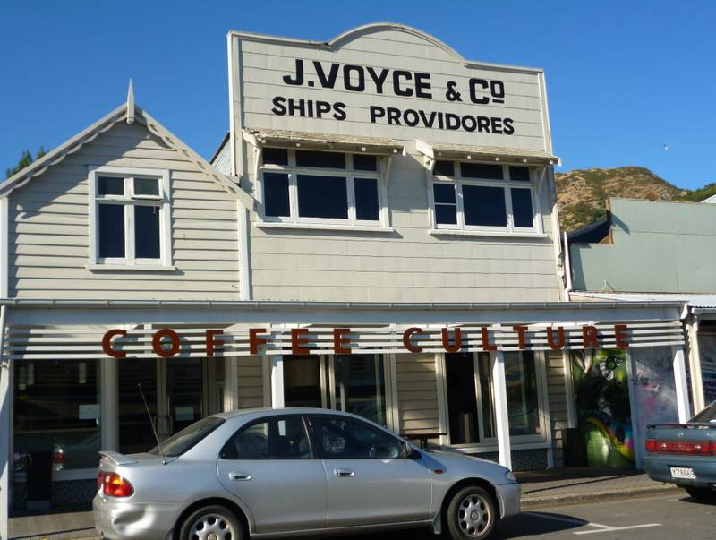
J Voyce and Co, Ships Providores of Lyttelton is now a café where I had a coffee. While there I was thinking and hoping that Shackleton, Scott and Mawson had all called in to buy those last minute nautical widgets before disappearing south for months or years at a stretch without any contact with the outside world.
My Coffee Break And Just Possibly, Suppliers To Antarctic Explorers!
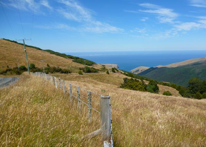
Banks Peninsular is the circular shaped bit of land sticking out into the Pacific Ocean to the south east of Christchurch. It has lots of narrow roads, mainly made of gravel running down to small inlets along the coast, an area I wanted to explore. I tried to take a scenic route on a road overlooking Christchurch on the way to the Banks Peninsular. I got to the top of the hills with the views looking down onto Christchurch under the clouds but had to return the way I came as the road was closed due to the earthquakes.
Looking Down On A Cloud Covered Christchurch
Banks Peninsular
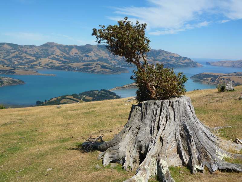
Banks Peninsular Tree Stump That Refuses To Die

