Honduras
Arriving at Copan Ruinas I went searching for a phone to call a couple of contacts for camping outside of town. The first, a friend of Lorenzo, the owner of Valhalla macadamia nut farm where I had stayed near Antigua, Guatemala was out and I needed to get my accommodation sorted out quickly. The second contact was a Finca (farm) that advertised various tourist activities including camping but when I found their agent in town they said they didnt offer camping after all. Fortunately I had passed a hostel during my searching for a phone so I stayed there as second best to camping.
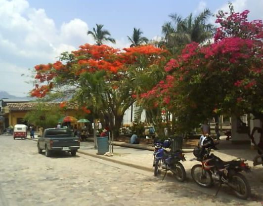
Copan Ruinas Town Park
The Copan Mayan archaeological site is a short walk from the town, I went early one morning before it got too hot. The entrance fee was a bit steep at ten pounds ($15US) particularly as Hondurans are admitted for 65 pence ($1US), however it was interesting to look around and marvel at the sophisticated lifestyle the pre Columbian Mayans had created for themselves. No one knows for sure why the Mayan civilisation collapsed although the most popular theory is that the cities become overpopulated, all the trees were felled for firewood and land clearance which resulted in soil erosion and poor harvests until the agricultural system could no longer support the population and they dispersed to new smaller, simpler villages.
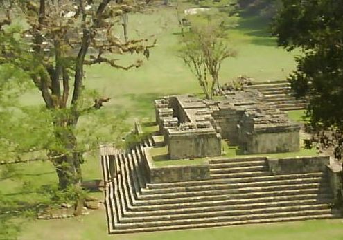
Copan Mayan Ruins
There was a nature walk through the trees on the archaeological site that lead to what is believed to be a practise Mayan ball court. The ball courts were used for a ball game although as some of the participants were sacrificed to the Mayan gods at the end of the match it was a serious game. The experts are still unsure whether it was the winners or the losers that were sacrificed. Was it an honour to win and be sacrificed where a better afterlife awaits or were the losers dragged kicking and screaming to the sacrificial altar? They must have been high pressure games either way. There were lots of colourful tropical birds and butterflies amongst the trees but none would stay still long enough to be photographed.
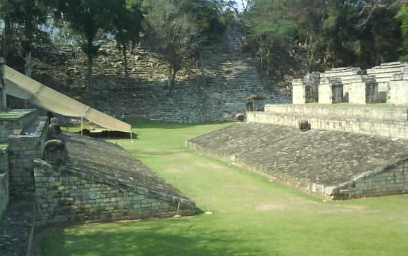
Copan Ruins Mayan Ballcourt. Players Were Sacrificed To The Gods After A Game
I had plotted my route from Copan Ruinas on secondary roads as I usually do. These secondary roads tend to be a mix of paved and dirt with little traffic. My map didnt distinguish between the paved and unpaved sections but I hadnt, so far encountered any secondary roads that were too rough for me or the bike. The day started out well with some good mountain scenery, riding on the expected mix of paved and unpaved roads to Corquin. Although it was only late morning I thought about stopping for the day as I had enjoyed the ride and didnt want to spoil the day by doing too much, particularly in the tropical heat of the afternoon. However it was an unpaved section of road leading out of Corquin which made me think I might be able to find somewhere to camp so I continued onwards.
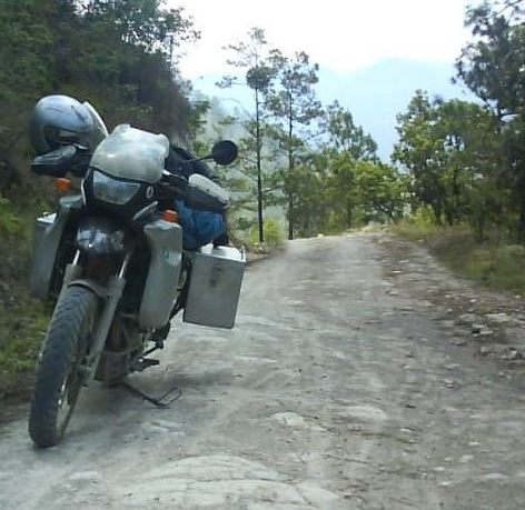
The Road From Corquin
You always think you will be able to turn round and head back if the road gets too bad but this time I ended up going down hill on a steep rocky track that was too narrow and slippery to turn around. When I eventually came to a place where I could turn around I knew I would have trouble retracing my steps back up the hill so kept going on into the unknown. The unknown turned out to be worse than the known but of course I didn't know that at the time. I dropped the bike eight times, all at slower than walking pace, mainly as I was trying to gently inch the bike down rough, rocky, steep descents. Theres something very sobering about being at the top of a steep incline and counting three spots where you are almost certain to come off but there is no alternative but to head down anyway. It reminded me of my Motorcycle Enduro days except that my bike was lighter and I was younger and fitter back then.
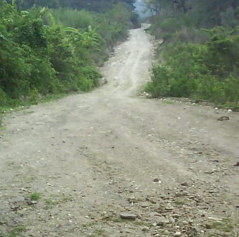
My Highway From Hell
Exhausted, battered and bruised I found a rare level spot beside a stream and asked a farmer if it would be ok to camp there. He said that it would be and I put the tent up looking forward to voluntarily being horizontal as opposed to falling into that position from the bike. A second farmer came along and pointed to a hole four feet from the tent and showed me some faint tracks coming from the hole that I hadnt noticed. He said (mainly through mime) that it was a snake as thick as an arm and that its jaw was big enough to bite across a thigh and that it could be attracted by the tent. And he was talking about his farmers muscular arm and thigh not my puny specimens. Flat areas for a tent were hard to find in these steep hills and I was far too tired to seriously think about moving. I asked, again mainly through mime if it was a good idea to block the hole up with rocks, he agreed and helped fill up the entrance then found me a stout stick to arm myself with. Thankfully I never got to see this monstrous serpent.
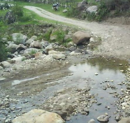
My Campsite Next To A Giant Serpent
The next day, feeling rested although a bit stiff and sore, I did a further couple of km on the rough track and managed to stay on the bike this time. I was still riding on dirt but the route was now thankfully a regular unpaved road. I was undecided about chancing doing more dirt roads or sticking to paved roads but the unpaved road continued to improved and I regained some confidence. My original route via La Esperanza would take me onto another eighty km or so section of unpaved road while the alternate paved route involved a big loop that added over 300 km to the journey. According to my map the paved road should have started again at San Manuel Colohete but although it was a reasonable dirt road it continued for a further 65 km to Gracias. As the map was wrong about the type of road on this section and having decided that paved roads were at least for now; the best invention man or god had ever made I took the longer paved loop. Both panniers were damaged by the repeated dropping of the bike and I was bruised and stiff. Initially I considered stopping at the first hostel or hotel I came to in order to lick my wounds but once I was on tarmac the riding was easy so I kept going until mid afternoon.
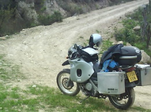
Damaged Panniers On The Highway From Hell
I stopped in Zambrano for a couple of days to get the panniers repaired. The mechanic did a reasonable job and only charged 9 pounds ($14US) although I havent tested them to see if they are still waterproof and suspect that they may not be. The Zambrano hotel I stayed in, the only one I could find, was on the main road (Pan Americana Highway) which was undergoing repairs and had a contra flow system in operation. The noise of trucks stopping with their engine brakes and pulling away again continued through the night and in the early hours the cockerels added to the racket with their pre dawn chorus.
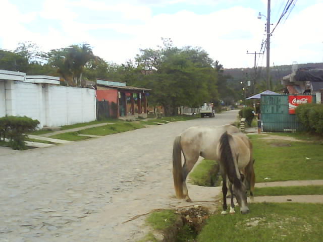
The Sleepy Town Of Zambrano Once Away From The Pan American Highway
The next stop was Santa Lucia in the Valle de Angeles a short distance from the capital city, Tegucigalpa. Santa Lucia is a picturesque hill town originally built in the colonial era to mine the silver ore deposits discovered in the mountains. With views down the valley to Tegucigalpa it has steep cobbled streets, a lakeside park and bougainvillea trees with flame red flowers in the parks and gardens.
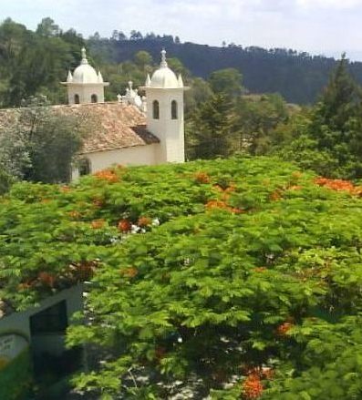
The Hill Town Of Santa Lucia
From Santa Lucia my route took me back to the Pan American highway and on to the Las Manos border crossing to Nicaragua. My first border crossing on a main road so I expected delays and chaos.
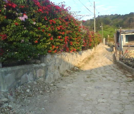
Colourful Hedge In Santa Lucia
