New Zealand North Island Part Two
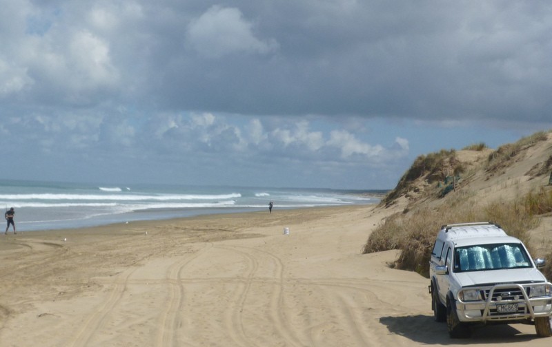
The inappropriately named Ninety Mile beach in Northlands near the northern tip of New Zealand is in fact ninety kilometres (fifty six miles) long. Vehicles are permitted and the sand is firm and smooth between the high and low tide lines although it was high tide when I was there; so I cant vouch for the firmness or smoothness of the beach personally. I wasnt particularly inclined to get my new (to me) motorbike covered in salt spray or risk an embarrassing off. The older I get the more and more I appreciate the qualities of paved roads! Signs say that hired vehicles are not allowed on the beach which should make it a motorhome (RV) free zone. Traffic is generally very light on New Zealands roads but a high proportion of the traffic outside of the cities is made up of hired camper vans known locally as white ants because they crawl out of the holiday parks and travel in single file convoys.
Ninety Mile Beach In The Far North Of New Zealand
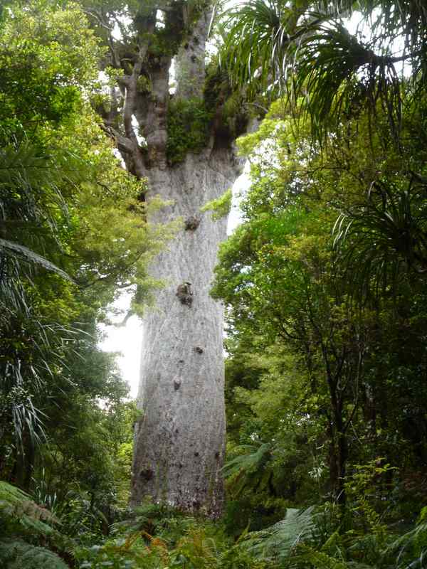
The largest kauri tree in the world stands a short distance from the road running through Waipoua Forest in Northland. The impressive tree with its five metre diameter trunk is known as Tāne Mahuta or Lord of the Forest; it stands forty five metre high and is at least 1200 years old and could possibly be up to 2500 years old. Vast areas of kauri forest were cleared by the early pioneers seeking timber for building which removed most of the older larger trees. The kauri gum or resin was also collected and used as early forms of firelighters and as chewing gum. Maoris also used the gum as a traditional pigment to make a dark colour for their tattoos.
The Massive Five Metre (16 Foot) Diameter Trunk Of Tane Mahuta The World's Largest Kauri Tree
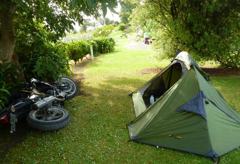
Camped at Matakohe near the kauri tree museum, the bike took its first tumble while parked next to the tent. The ground softened with rain through the night causing the side-stand to sink in. Fortunately I had followed my usual practise and parked with the bike leaning away from the tent otherwise it would have landed on me. I always inspect the ground and usually put a stone or bit of wood under the side-stand as a pad but the ground had been so hard when I first arrived that it had been difficult to get the tent pegs into it.
I Slept Through The Bike Falling Over Through The Night!
It was comforting and reassuring to learn that New Zealand contains no animals, reptiles or insects that can kill, injure or maim me. No bears, no poisonous snakes, just possibly; a few poisonous spiders that no one ever sees. It was therefore doubly disappointing to learn the inaccuracy of this information by being stung on the Adams apple by what I assume was a bee. I was riding the bike at around 80 kph (50 mph) when I saw a dark pea sized object sweep down from the sky then dart swiftly across and under my visor to cunningly locate the only area of naked flesh on display at the time. I didnt find the creature after being stung and stopping the bike but presume that if you are the size of a pea and are struck at 50 mph by an Adams apple you are unlikely to survive. An unpleasant experience for both of us. Through the night the sting swelled to resemble a bright red turkey wattle and restricted my breathing a little but I had survived another wildlife encounter. Whoever said there are no dangerous creatures in New Zealand hasnt been stung on the Adams apple while riding a motorbike.
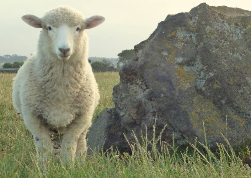
Returning to Auckland to complete a loop around the top half of the north island I camped at Ambury Regional Park on the shore of Manukau Harbour between the city and the airport. The Park contains a working farm which is open to the public and includes a variety of farm animals including of course, sheep. There are 4.45 million people and 31 million sheep in New Zealand. This ratio of seven sheep for each person has been reducing over the years as the occasional Kiwi (rugby mad person, not the fruit or the mythical bird) leaves sheep rearing in search of an ever broadening choice of alternative careers.
Ambury Regional Park And Camp Ground Near Auckland
Two days after initially sighting land Captain James Cook made his first New Zealand landing on the 8th October 1769 on the site where the town of Gisborne was later built. Dutch explorer, Abel Tasman was the first European to see New Zealand in 1642 but following a bloody battle from his ship with some Maori people he didnt land. Cook was the first European to circumnavigate the two islands and accurately map them although the Maori had arrived and settled from Polynesia hundreds of years earlier. The Maori were settling in New Zealand from 1280 and may have first arrived as early as 980.
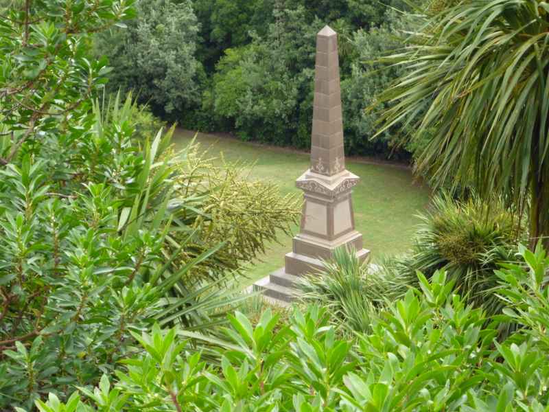
The Site Of Cook's First Landing On New Zealand
A few days before the end of the year I arrived in Gisborne to discover that it was full. This was a surprise considering how empty New Zealand had been up until this point of my journey. Gisborne is host to the Rhythm and Vines pop festival, the biggest New Years Eve party in New Zealand with 30,000 young music fans gathering for the three day festival. 30,000 people may not sound like a very large crowd if you are from a more densely populated part of the world but its a lot of Kiwis (rugby mad persons, not the fruit or mythical bird) to descend on one place. One out of every one hundred and fifty New Zealanders or 0.67% of the population were at the party. All these young party animals meant that the campsites were full and that I wouldnt have wanted to stay even if there had been room for me. I headed further up the coast to Tatapouri where I found a campsite with a quieter more sedate clientele more befitting one celebrating his sixty first new year!
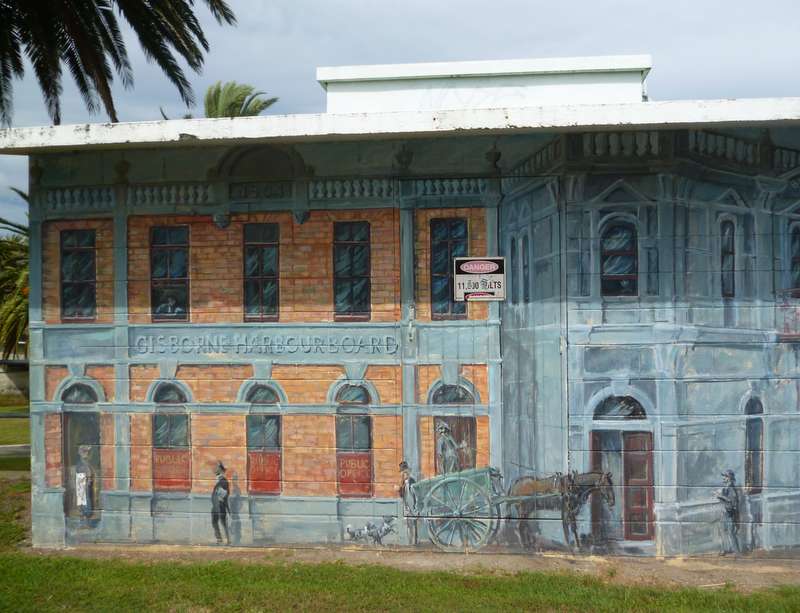
Painted Gisborne Sub Station
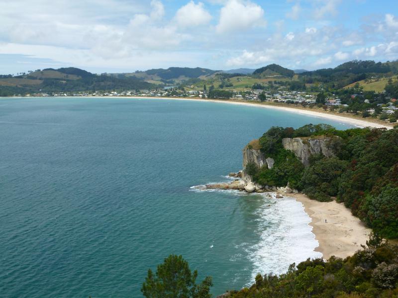
Cooks second landing in New Zealand was in Mercury Bay on the Coromandel peninsular on the 3rd November 1769. This was a few kilometres from the site of the first Maori landing. Kupe, a renowned Tahitian explorer landed in nearby Whitianga some 850 years earlier. The Polynesians had no written records and historians seem unsure of exactly when Kupe landed but some reports estimate that it was around the year 980 AD.
Cook's Beach, The Site Of His Second Landing On New Zealand
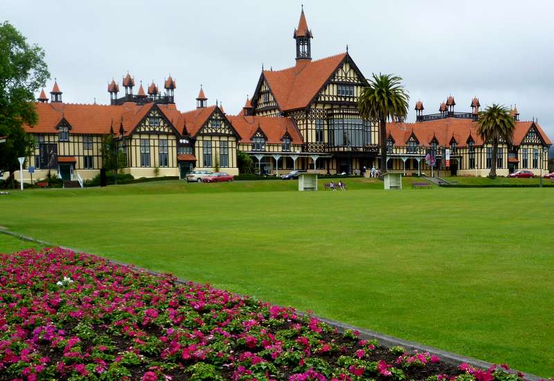
My first ride inland took me to Rotorua, a town with a background smell of sulphur that bubbles up through the lake and the hot mud pools. The lake, formed in a volcanic caldera has a number of hot springs as well as bubbling mud pools along its shore. The Rotorua museum housed in an impressive old building and the Blue Baths built to utilise the free hot water from the springs are set in perfectly manicured parkland which includes immaculate bowling greens.
Rotorua Museum
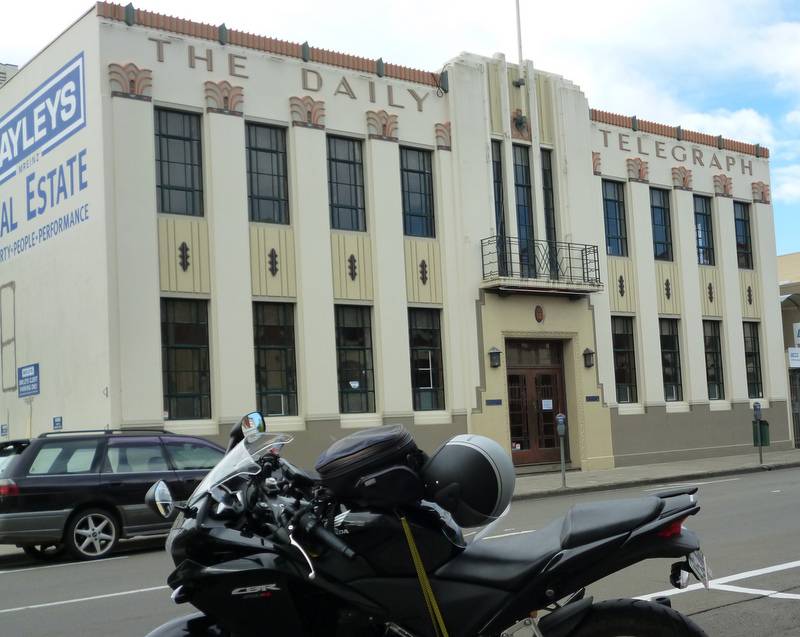
An earthquake on the 3rd February 1931 flattened most of Napier including the town centre. A phenomenal fifteen square miles (forty square kilometres) of land was permanently (or so we hope) lifted up out of the sea during the earthquake. The town was virtually rebuilt from scratch in the then popular and modern art deco style. The newly raised land was utilised and now forms part of todays Napier.
Napier Art Deco Building
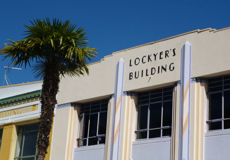
Napier is billed; alongside South Beach, Florida as joint art deco capital of the world, however the vast majority of the town centre art deco buildings have had unsympathetic modern shop fronts built. I imagine these modernising facelifts were carried out before Napier appreciated the architectural gem it had. At ground level it now looks like any other high street with large plate glass windows and doors and modern shop signs which sometimes obscure art deco features. You have to look above the canopy which provides shelter to the shoppers but obscures the view of what remains of the art deco architecture above ground level. It could have been stunning if the buildings had been left as originally built or renovated in the art deco style. Once away from the main shopping street there are a number of good art deco offices and homes but these are isolated buildings. It was well worth visiting, just not as spectacular as it could have been.
Napier's Art Deco Styling
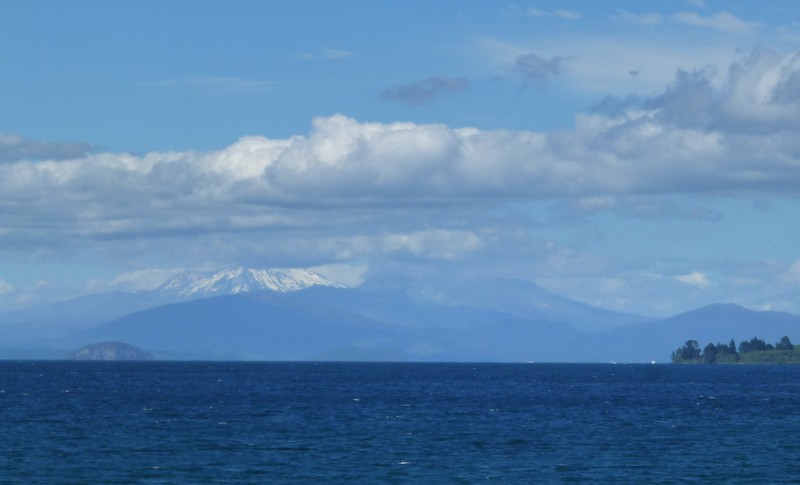
Lake Taupo, in the centre of the north island was formed by a huge volcanic eruption which ejected a colossal 1170 cubic kilometres of material and caused several hundred square kilometres of land to collapse. The caldera formed by the land collapse later filled with water to form the lake. Fortunately all this happened 26,500 years ago before any people arrived. Since then the volcano has erupted a further twenty seven times although the subsequent eruptions werent on the same epic scale as the first. The last eruption occurred around the year 200AD but the volcano is still classified as dormant rather than extinct.
Lake Taupo With My Next Destination, The Snowy Peak Of Ruapehu On The Horizon
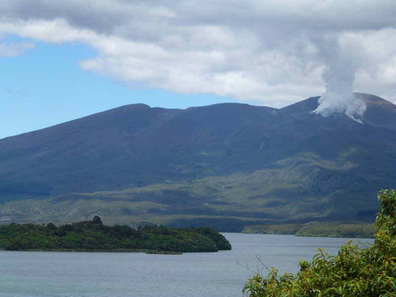
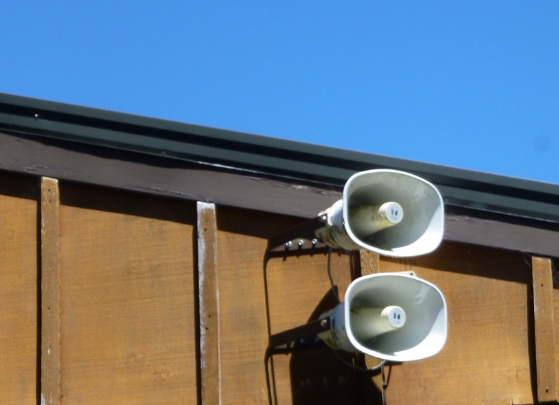
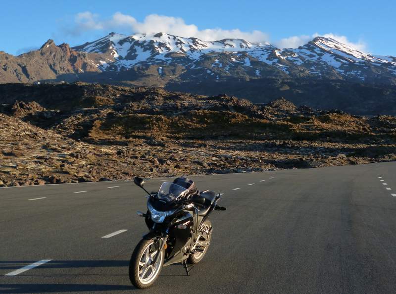
On my way to Tongariro National Park I unexpectedly passed an active volcano which was an additional bit of excitement to an already good day of riding the bike through New Zealands scenery. The activity was from one of a dozen or so cones that form the super volcano of Mount Tongariro. You get used to reading about volcanoes erupting thousands of years ago, hundreds of years ago or at the very least, several decades ago but another of Mount Tongariros cones, Ruapehu last erupted on the 21st November, 2012, six weeks prior to my visit. A column of ash was thrown four kilometres up into the sky. Footpaths near the summit where still closed as there was a possibility of imminent further eruptions. My campsite was equipped with sirens to warn of an eruption with evacuation procedures to nominated high ground away from any lava flows. It would appear that in New Zealand; it isnt the wildlife that is trying to kill you but the geology!
Smoking Tongariro Volcano
Campsite Volcano Eruption Siren
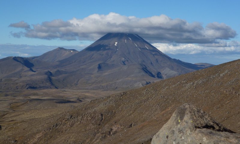
Tongariro NP was my first Hobbit / Lord Of The Rings film location. Although I havent seen the films and failed to finish reading the books when I attempted them years ago I have at least been to Mount Doom, Mordor, Emyn Muil, the Plains of Gorgoroth and later went on to the Dimholt Road. My favourite Hobbit fact is that $380,000 (£185,000) was spent on coffee by the film crew!
Mount Ngauruhoe (aka Mount Doom)
One shock and surprise in New Zealand that I havent fully recovered from yet is having to pay for wifi access. Throughout the Americas wifi had been readily available and free. Nicaragua and Bolivia, two of the poorest countries I have visited on this trip can provide free wifi but not New Zealand! Virtually all of the cheaper accommodation options, cafes and restaurants charge for accessing their wifi, usually around $4 per hour although cheaper deals are available for a full twenty-four hours. Instead of accessing the internet two or three times a day for short periods as I used to; I now have one mammoth session about once a week which makes it feel more like work than a pleasure. Whakapapa village in Tongariro NP had the most expensive wifi I have come across so far, an outrageous $8 (£4) per hour. The internet is used less in New Zealand than anywhere else I have been to on this trip. Paying for wifi reduces the time you spend on the internet which could be viewed as a good thing but I miss being able to research my trip, check the weather forecast etc. when I feel like it.
Mount Ruapehu Had Erupted Six Weeks Before My Visit
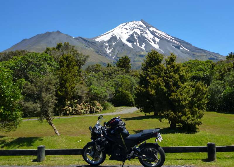
From Tongariro National Park I moved onto Stratford to explore another national park, Egmont which contains yet another volcano, Mount Taranaki. The route took me over the Forgotten World Highway, another great motorcycling road with good scenery and little traffic. Most of New Zealands roads are like that, even the main roads linking the major towns tend to be two lanes and almost free of traffic. I liked Stratford, there were walks through shady trees laid out along the river banks, a supermarket for groceries and, a rare treat for New Zealand, a café with free wifi all within walking distance of the campsite. Towering over the town and a short ride away was the snow capped peak of Mount Taranaki within Egmont National Park.
Mount Taranaki In Egmont National Park
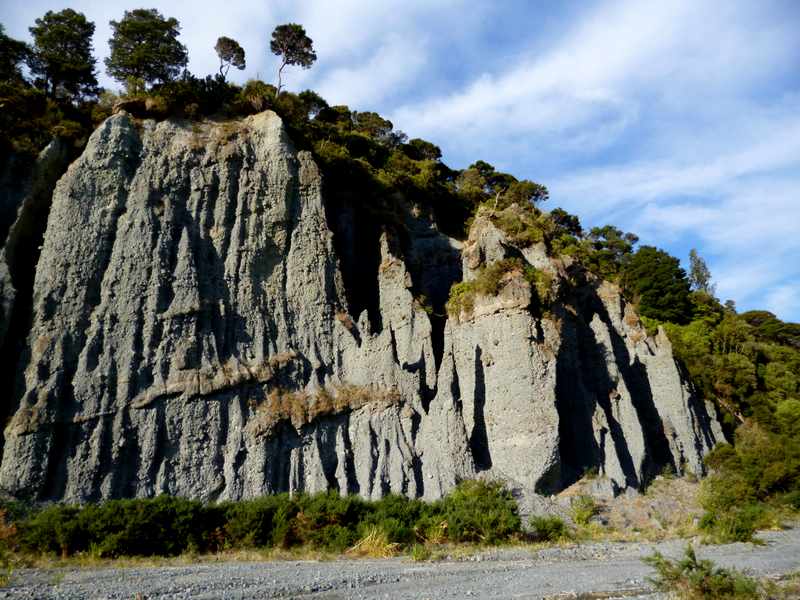
My final destination on the north island (apart from Wellington to catch the ferry to the south island) was the Putangirua Pinnacles on Palliser Bay or to give it its Hobbit name, Dimholt Road. As I was staying on a cheap and basic DOC (Department Of Conservation) campsite a reasonable distance from any shops I had to pick up groceries on the way which is a bit difficult with my restricted luggage capacity on the CBR. Once there I had to boil my drinking water again which reminded me of camping in Latin America. The campsite was relatively empty for the first night but it got crowded the following day which was the start of the weekend. I guess it is close enough to Wellington to attract Wellingtonians who want to escape the city. When I returned from a walk I found the motorbike blocked in between my tent and a campervan which had inched up right alongside the bike. On the opposite side of my camp a tent had been pitched with its guy ropes literally crossing mine. What ever happened to the peace and tranquillity of touring isolated, sparsely populated New Zealand? The answer would seem to be a combination of the long NZ school summer holidays and lots of foreign, predominantly German tourists.
Putangirua Pinnacles or Dimholt Road

