Mexico - Copper Canyon
My first day in Mexico turned out to be a comedy of errors. In all the best western films the Mexican bandits get drunk on tequila in the cantina, sleep late, drink some more tequila and its close to lunchtime before they are ready for any serious banditry. Therefore my cunning plan was to cross the border early and be well away from the troubled border area before any self respecting bandido was awake.
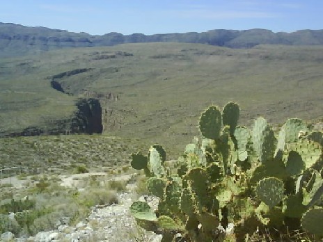
Canyon Along Hwy 16 Between The Border And Chihuahua City
The first thing to go wrong was when I removed the USA / Canada memory card from the GPS and installed the Mexican one. There was no map displaying and the initial reaction is to panic. How can I possibly navigate without a GPS? Its amazing how reliant you become on having a machine to tell you which way to go. Fortunately I was going to be following one road, Hwy 16 for a couple of hundred miles so the navigation shouldnt be too difficult.
I camped six miles from the border in Presidio, Texas and was up early enough to feed the mosquitoes. By 8am I was handing my B2 USA visa into The Department of Homeland Security at the border. Crossing the Rio Grande to the Mexican side I rode slowly past some officials trying to get their attention but they looked straight through me. I realised that they were customs and expected to reach immigration next but no, there I was in Mexico and more specifically Ojinaga High Street without my feet touching the ground. I remembered Grants advise on the HU website about getting insurance at the border and sure enough there were a couple of offices just beyond the border selling insurance. Picking one at random I got sixty days of cover for $70.
Feeling that something was wrong, I should have got an immigration stamp in my passport and possibly completed some paperwork to take the bike into Mexico but also feeling relieved that I was in Mexico and through the bureaucracy so quickly I headed towards Chihuahua remembering that there was another check point 20 miles or so from the border. I was soon beyond Ojinaga as Hwy 16 climbed into the mountains almost completely free of traffic and totally free of bandidos, killers and kidnappers, my early start had obviously caught them all napping.
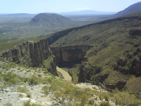
Canyon Along Hwy 16 Between The Border And Chihuahua City
After 25 miles I was beginning to think that there wasnt going to be a second check point but a mile or two later there it was. A friendly guy came over who could thankfully speak English and wanted to see some sort of vehicle permit. Obviously this was something I should have got at the border but I thought and hoped I could get it at this second checkpoint but alas, no I would have to return to the border at Ojinaga.
After trying to get away from the border area as quickly as possible I was now riding the first 27 miles three times! Once back in Ojinaga I got some Pesos from a cash point machine (ATM) and realised I hadnt a clue what a Peso was worth. I got the temporary vehicle import paperwork and an immigration stamp in my passport at the border. The system seems to be that you are supposed to know that you have to park and chase after the stamps and paperwork on your own volition. If you dont you will find out 27 miles later!
I now needed fuel to reach Chihuahua and was hungry so bought food and a drink for me and a drink for the bike. Having dealt with Immigration, Vehicle Imports, corner shop trader and fuel sellers (four at the pump and two in the office, I never discovered what they all do) and found them all helpful and friendly to someone whose only Spanish is No habla Espanol I forgot all about the bandidos, killers and kidnappers and headed down Hwy 16 once again. The man at the checkpoint wanting to see the vehicle import documentation was happy and 2.5 hours after my first visit I was finally leaving the checkpoint and heading for Chihuahua again. There was another military checkpoint further on manned by a group of army recruits with guns almost bigger than they were. Once again, taking my helmet off, grinning and saying No habla Espanol seemed to amuse them and we maintained a friendly banter while they searched my bags. Whatever they were looking for they didnt find and I was free to go.
My Spanish has now advanced from No habla Espanol which according to Google-Translate actually means Does not speak Spanish and may explain the amused expressions on the faces of the military to Soy no habla Espanol, I do not speak Spanish, I think the Mexican population at large quickly appreciates that I dont speak Spanish regardless of how or what I say!
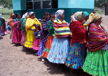
Tarahumara Women From The Chihuahua Region
Initially I thought I might make it to Creel beside Copper Canyon, my first real destination in Mexico but backtracking to Ojinaga ruled that out. I decided to get through Chihuahua then start looking for somewhere to stay on the western outskirts of the city. I navigated to Chihuahua without incident but getting out the other side wasnt as straight forward. I went through the town centre, melted whilst standing at all the red lights and ended up taking any main road that was heading south west (as indicated by the GPS) until I accidentally stumbled on the right one. Shortly afterwards I saw a motel and as I pulled up read a sign saying that rooms were 200 Pesos. I had no idea how much 200 Pesos was but decided to stop anyway as I hoped to sort out the GPS problem, wanted a shower and as I hadnt seen any campsites was probably going to have to stay in a motel anyway.
After showering I checked the exchange rate and my air conditioned room with shower and secure covered parking was $15, less than I had paid the previous night for a small patch of hard Texas ground to put my tent on and the privilege of feeding the mosquitoes in the morning. And there was more good news, searching my box of Garmin bits I found another unlabelled memory card. Once inserted Garmin could confidently navigate anywhere in Mexico but I have no idea where the memory card I had originally fitted came from.
![]()
Statue Of Christ On The Hilltop Overlooking Creel
The next day I headed for Creel which is a good base for exploring Copper Canyon. More good roads and scenery with little traffic although what traffic there was doesnt give you the amount of road space that you get in the USA, not a problem, it just requires a bit more attention. At 2238 metres (7242 feet) Creel has an almost perfect climate for me at this time of year, cool enough to avoid baking in helmet and bike suit, cool enough for walking but still shirtsleeves weather. The clouds do build up and there have been some late afternoon thunderstorms but you cant have everything.
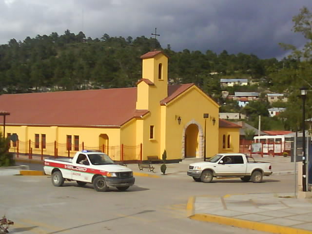
Creel, Chihuahua
I met someone at the Grand Canyon in Arizona who said that if I was going to Mexico I should visit Copper Canyon, it was bigger, deeper, wider and grander than the Grand Canyon without the commercialisation and the crowds. Its certainly very dramatic, wild and rugged country. In one respect it reminds me more of the maze of canyons in Canyonlands in Utah, Copper Canyon is one of eleven interlocking canyons, twisting in different directions in a confused tangle of gorges and whitewater. The whole area is covered in trees which tend to soften and blur the canyon sides which for me meant that the Grand Canyon has the bigger initial wow factor. That said, I spent two weeks exploring the Copper Canyon area, saw some amazing scenery and feel as though I have only scratched the surface of the place.
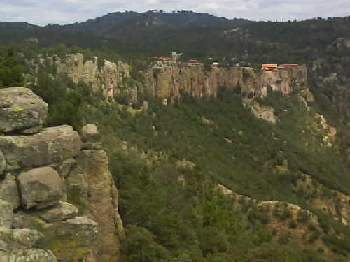
Copper Canyon
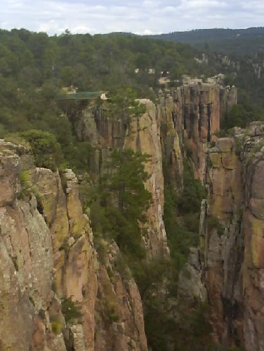
Copper Canyon
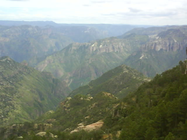
Copper Canyon
I was in Creel for Mexicos 200th Independence day. The town square or plaza was decorated and a stage built for live music for a party the evening before which ran on until the early hours. The following day there was going to be a parade but I didnt know what time it was and I missed it. By the time I went out the town centre was being reopened to traffic.
A postscript to my comedy of errors in entering Mexico. I read in a guide book that you had to take your tourist card issued at the border to a bank to have it stamped after paying a fee. I had borrowed the book from its author who was staying in the same hotel so making use of his expertise I checked with him which of the numerous official bit of paper issued at the border was the tourist card. The following day I waited in a queue at the bank for over two hours only to be sent to the manager by the confused bank teller. After ten minutes of trying to communicate with each other I finally understood when he said No Necesario. It turns out I had paid the fee at the border only instead of stamping the card they had stapled a receipt to it which I couldnt read.
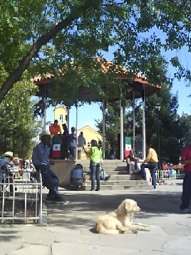
Creel Plaza
I decided to ride the short distance to Lake Arareko and walk around the lake taking a picnic lunch. Halfway round when I could see my bike across the lake there were some thunderclaps and I thought I was in for a soaking but the rain fortunately held off. I got back to the bike still dry but thirsty and hungry. After a quick shower I walked into town for a Mexican meal or a meal as they call it here. Im in the country that gave the world chocolate, sweet corn and Mexican food which has to be a good thing.
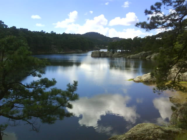
Lake Arareko
Another day I took a ride to Basaseachi Waterfall, a 173 mile roundtrip. It was warm so I left the motorbike suit behind and only carried lightweight hiking waterproofs. The road took me up over some mountains and it got cooler and cooler so that by the time I arrived at the small town beside the falls I was ready for a hot drink and some warm food. The road was mainly paved but there were short stretches of dirt and two of these were deeply rutted.
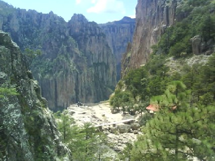
Basaseachi Waterfall From The Top
Basaseachi Falls are the 20th highest falls in the world and the third highest in the Americas. At 246 metres (807 feet) they are the biggest I have seen. Of course now I want get to the nineteen bigger falls wherever they are!
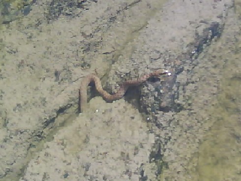
Snake In Pool At Basaseachi Falls
I was enjoying the view from the top, basking in the warmer afternoon weather and watched a small snake swimming in a pool wondering if there was a path down to the bottom of the falls. It was a mixed blessing when I found that there was. It was very rough and uneven as well as being steep enough to have to hang on to the vegetation or the cliff wall in places. However once it was discovered I had no choice but to venture down and then make the arduous ascent later,
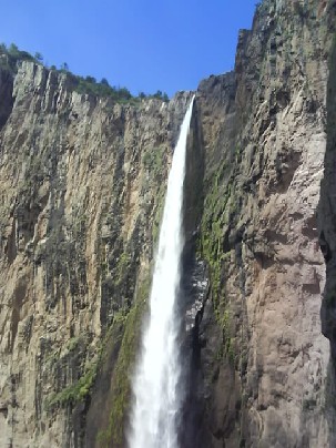
Basaseachi Waterfall From The Bottom
Shortly after setting off on the return journey as I started to climb back into the mountains there were the obvious signs of rain ahead. I was putting on the lightweight waterproofs as the first heavy drops began to fall. Soon it was raining heavily with water running down the road, the drainage unable to cope and the thunder clashed loudly overhead. I got colder and wetter and had trouble seeing through the visor which is overdue being replaced. The two soft rutted sections were fun with water and mud splattering up my legs. Once I reached the summit and started to descend the rain eased considerably and stopped altogether for periods although it was raining steadily for the last fifteen miles as I shivered, stuck behind an old pickup truck crawling along. I will carry proper waterproofs with me on any longer trips in future.
The following morning I realised a drawback of travelling light and not thinking about what I had been wearing. I often wear my lightweight shorts under my trousers so that I can swap from bike trousers to lightweight trousers or remove either to just wear the shorts whilst maintaining what little dignity I have left. Both the shorts and trousers were still wet so that I had nothing to wear other than the bike trousers until the shorts dried.
I was premature in stating that Garmin could now navigate throughout Mexico. The map and database are nowhere near as detailed as the European or USA ones. Roads that have clearly existed for a while and appear on maps arent in the Garmin Map. Seeking alternative navigational aids I thought I had discovered a new way of plotting routes but suspect I have just caught up with everybody else. Using Google Earth I started locating destinations and waypoints then transferring the grid references into the GPS. This has worked so far apart from Garmin refusing to plot a route because there are no roads nearby when we are actually riding on the missing well established tarmac road!
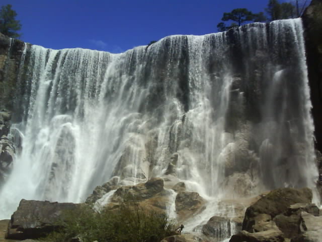
Cusarare Waterfall Near Creel
I have spoken to a number of travellers who visit Mexico regularly. From what they say and from my own positive experience I think the Mexican border problem isnt as bad as it used to be. Everyone I have met has been helpful and friendly. Certainly the vast majority of visitors experience no problems. I guess the situation will have to be stable and safe for several years before tourists get the confidence to start coming back in their previous numbers. It seems a shame, walking around Creel with all its empty restaurants wondering which one to give my custom to.
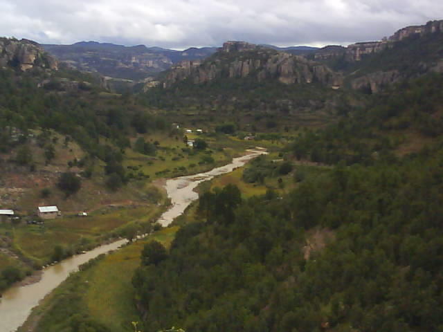
Copper Canyon, South Of Creel
The road from Creel running south east towards Parral is one not to be missed, particularly the first section that runs through the Copper Canyon area. The mountainous road snakes through and over the canyons with stunning scenery but being Mexico you have to look out for horses, cattle, donkeys, goats, small boy goat herders, chickens, rocks and patches of mud. I saw all of these lurking around different bends! Dogs were unusually absent though.
