Ecuador (North)
Santa graciously granted my Christmas wish for the end of the wet season, at least for a while. I crossed the border from Colombia to Ecuador on the first dry day I had seen in weeks and saw virtually no rain over the Christmas and New Year period. I have ridden on dry dirt roads and walked on dry, mud free footpaths and trails, I had almost forgotten what a mud free existence was like. The occasional rain shower would fall once I reached Quito but at least the ground has time to dry out between the showers.
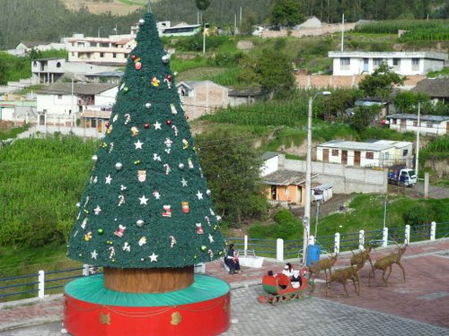
Christmas In Ecuador
I had been told that the Colombia - Ecuador border crossing at Ipiales was one of the quickest and easiest borders in Latin America. Unfortunately for me, just before Christmas the border is swamped with Colombians and Ecuadorians returning home for Christmas. It took me six hours to get across, most of that time standing in queues. The most frustrating wait was to clear the bike out of Colombia. I know two people that had left their bikes in Colombia until their bike import document expired and just rode passed Aduana (customs) without any problem. I was tempted to do the same because of the queue, however I joined the end of the line having checked with an official and showed him my paperwork to make sure it was the line to process exiting Colombia. Everyone in front of me was entering Colombia so I checked again with a policeman to confirm I was in the right line. Whilst waiting I counted six brand new unregistered cars being driven into Colombia without stopping to process any customs paperwork which didnt seem right. Eventually it was my turn to be processed. The official that had seen my paperwork when I first arrived simply took it from me and said I could go. I suppose I should have been grateful that he didnt want to check the VIN number which is the usual procedure but I just thought, why couldnt he have taken the paperwork from me when he first saw it an hour and quarter earlier.
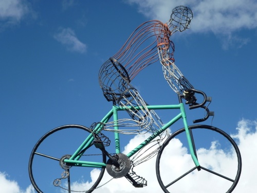
Pan Americana Highway Cycling Monument
Im still benefiting from the motorcyclists that I have met and have run on ahead of me acting as my scouts sending back reports on places to go, places to avoid, good roads, bad roads. Sandra and Jordan from Canada send regular reports and Im glad to say have frightened me off the road I had intended to take into Peru. Younger and fitter riders have dropped their bikes on the road south from Vilcabamba; crossing the border at Zumba so I will happily find an alternative. The other options are via Macarà or the most popular, the coast road at Huaquillas.
The first stop in Ecuador was in San Gabriel not far from the border. At just over 9000 feet (2800 metres) it was cold enough for three blankets at night but fine during the day. Surrounded by mountains with peaks normally concealed in the cloud. One day the sky was clearer and from the mirador (viewpoint) above the town I saw my first snow covered Andean mountain peak, just a few days too late to make it a white Christmas. If a snow covered mountain on the horizon counts as a white Christmas, it was close enough for me.
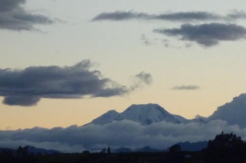
The Nearest I Got To A White Christmas
Ecuador, or at least San Gabriel was refreshingly cheap, fuel was 2$ per US gallon (34 pence a litre), my private room with ensuite bathroom complete with lukewarm water and WiFi was $5 (£3.30) per night and a huge breakfast (desayuno completo) of rice, potato, salad, roast chicken or beef, a fruit smoothie, coffee and a cheese sandwich followed by two soft boiled eggs right at the end of the meal was $2.50 (£1.65). The cheese sandwich is served with the coffee and I saved mine for later on in the day. Breakfast topped up by some cheap fruit kept me going for the rest of the day. My main gripe with Ecuadorian cuisine having ridden from Colombia and all the good coffee is that instant coffee is served almost universally.
Otavalo is renowned for its arts and crafts market, particularly the Saturday market which spills out from the market place onto the surrounding streets. In my travels south through Latin America the indigenous Indians have been a noticeable minority, sometimes rarely seen and when they are present in the towns they are usually selling arts and crafts on the street. In Otavalo they were very much the majority and doing all the jobs normally done by the Latinos which was nice to see. The Saturday animal market had people leading pigs and cows past the hostel from 5am onwards. Having woken me up I decided to locate the market at a more reasonable hour of the day to see what was going on. It was a very colourful affair with most people dressed in their local costumes.

Otavalo Animal Market
My hostel in Otavalo had a large garage where I could wash and check the bike over. It had developed a problem of being reluctant to start in the mornings but was fine after that. The engine would start, run for a second then stop as if the ignition had been turned off. It would take up to twenty attempts before the engine would run by which time I started to worry about draining the battery. As the garage was warm and dry I eliminated the problem being related to the damp or cold (it sometimes felt cold at night but was never cold enough to effect engine starting) although altitude was a possibility. I decided the problem was related to the computer controlled engine management system shutting the engine down shortly after it started. I disconnected and reconnected the battery in an attempt to reconfigure the computer without success so decided to take the bike into the next BMW dealership which was in Quito.
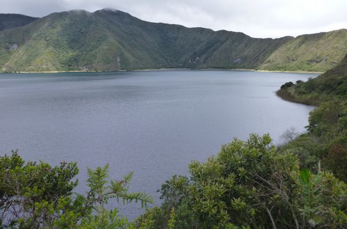
Cuicocha Lake Near Otavalo
On the way south on the Pan Americana Highway to the equator and Quito I saw my second huge snow covered mountain towering over the road. Normally there is too much cloud to see the mountain tops. This stretch of the Pan Americana Highway was free from the lines of slow moving trucks and I was able to enjoy the scenery and the sweeping bends.
The equator was a significant landmark on my journey so I crossed it twice. Once on the Pan Americana Highway on the way to Quito and again a few days later when I went to see the Middle Of The World Monument (Mitad del Mundo) at San Antonio. The Mitad del Mundo centrepiece is a 30 metre high tower erected in 1979 with a yellow line running along the ground then up and over the centre of the tower denoting the equator. Unfortunately due partially to more accurate GPS measuring devices being available now and partially to the people that do the calculations choosing a different mapping datum the tower is 240 metres (780 feet) south of the equator. The true equator is unmarked and runs outside the whole Mitad del Mundo tourist village of museums, shops and restaurants although a steady stream of tourists still await their turn to get their photograph taken straddling the equator.
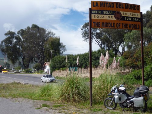
Equator - Pan America Highway
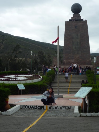
Equator - San Antonio
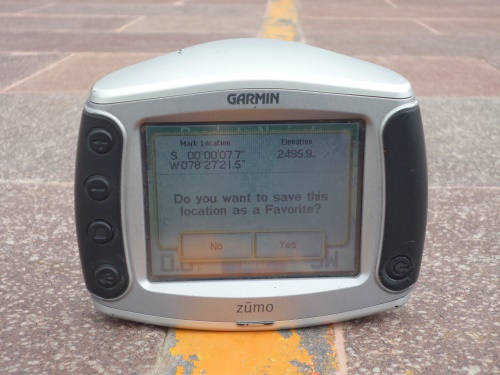
If They Had Had GPS in 1979 The Yellow Equator Line Would Have Been In The Right Place
While playing with my GPS I discovered that the equator is half way (as near as makes no difference) between the best place in the United States, Big Timber, Montana and Patagonia. Big Timber being 3720 miles (5951 km) to the north west and Patagonia slightly closer at 3672 miles (5875 km) to the south.
I arrived in Quito, dropped off my bag and headed straight to the BMW dealer to try and get the cold starting problem sorted out. I had heard a few tales about the dealership taking a long time with repairs but I got an email 24 hours after dropping the bike off to say it was ready and the bill was $29 (£20). They suggested that I pick the bike up the following day so that I could see it being started for the first time that day and sure enough it started immediately. I rode off delighted to have the problem resolved so quickly and cheaply. Alas; anything that seems too good to be true usually is. The following day and each day since; the first time I start the bike takes a lot of cranking. I suspect the mechanic had started the bike before I arrived and the $29 no longer seems such a bargain.
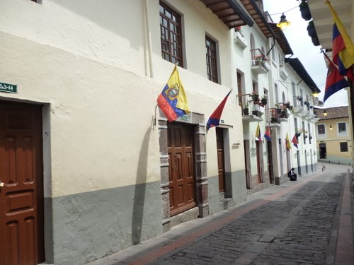
Calle de la Ronda, Quito Old Town
The only reason I went to Quito was to try and get the bike sorted out as I normally avoid the bigger cities but the old colonial area of Quito was well worth seeing. Quito was declared the 2011 American Capital of Culture and the plazas and parks all had displays of public art that were worth seeing.

Quito - 2011 American Capital Of Culture
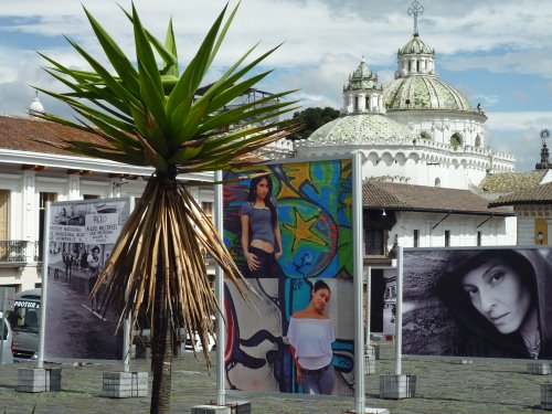
Public Art In San Francisco Plaza
One afternoon I was walking through the main Independence Plaza and saw a crowd, TV cameras and a large police and military presence at the Government Palace. As I went to investigate a large fleet of Iranian diplomatic cars drove away. Mahmoud Ahmadinejad, the Iranian president had just arrived from Cuba on a tour to win support for his nuclear development program. On this trip I have now been outside buildings containing the Presidents of the USA (a hotel in San Francisco) and Iran, two leaders who are not on the friendliest of terms at the moment.
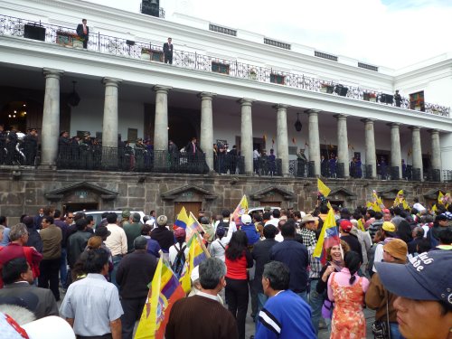
Government Palace With The Presidents Of Ecuador And Iran Inside
There is a hill with a large aluminium statue of El Panecillo Virgin towering over the old colonial town of Quito which seemed an obvious place to walk for views of the city and the surrounding countryside although the day I went was very hazy. On the way back down I noticed a sign painted on a wall in English warning that this was a Robbery Zone and advising that tourists should not walk on this street. Further down I stopped to talk to a tourist policeman whos role I have now ascertained is to aid and assist tourists rather than to make sure we behave ourselves. He said all tourists should take a taxi up and down the hill and that there were a lot of robberies during the day as well as at night. He was standing near the bottom of the steps to turn back tourists on their way up. Fortunately for me he wasnt there when I started my ascent and nobody deemed me worthy of robbing. The dangers of climbing the hill were common knowledge to everyone in Quito except me and anyone I spoke to thought I had been lucky to escape the bad guys attention.
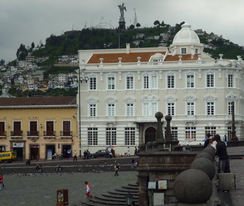
Panecillo Hill, Quito
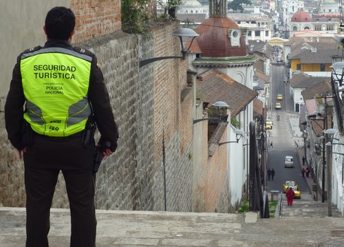
Armed Tourist Police - I'm Glad They Are On My Side
I had a cold night near Cotapaxi National Park where I hoped to see Cotopaxi, the highest active volcano in the world at 19,348 ft (5897 metres) but for the twenty-four hours I was there the sky was gray with mist and drizzling rain which reduced visibility to a couple of fields full of the hostel owners cattle. There is no guarantee with mountain weather, sometimes your lucky and sometimes your not and today wasnt my day.

Cotapaxi Hostel
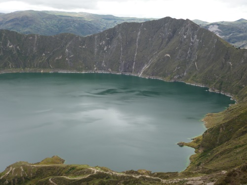
Quilotoa Crater Lake Near Latacunga
Baños turned out to be a very touristy town full of young Chilean and Argentinean tourists attracted by the cheap prices and the large choice of adventure sports (or exciting, exotic ways to kill yourself as I think of them). I was sitting in a roomful of boisterous, conscript age Argentineans checking the news and read that my Prime Minister, David Cameron was accusing the Argentines of colonial aspirations over the Falkland Islands, or the Malvinas as Im trying to get into the habit of thinking of them. I wish he would think before making such silly statements. With our history, the British have no right to accuse anyone of having Colonial Aspirations.
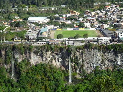
Baños Waterfalls
The town of Baños nestles beneath the very active Tungurahua volcano. There was a large eruption from Tungurahua in 1999 and there have been five more since then, the latest in April 2011. The volcano supplies abundant hot water which Baños (Spanish for bathrooms!) has used to create a spa town. As usual my quest was to try and see and photograph the volcano. The best I managed was a partial glimpse of the snow covered summit through swirling cloud.
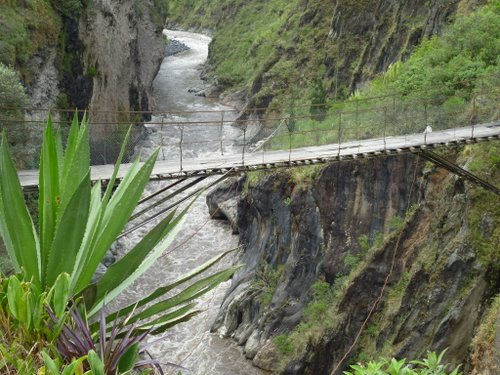
Rickety San Francisco Footbridge, Baños
My paper and GPS map showed a direct road between Baños and Riobamba but a number of old blogs dated between 2003 and 2007 said the road was closed as a section had been buried under ash and rock when Tungurahua erupted. It wasnt far so I decided to ride out and establish whether it was still closed. The road was open and paved apart from the section where a new dirt road had been carved through the deep volcanic debris. The dirt road was very dusty as it made its way through the lunar landscape of volcanic boulders and ash. A road sign; which if I interpreted correctly said Do Not Continue If Lava Is Flowing sounded like seriously good advice!
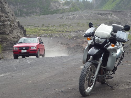
Road Carved Through The Luna Landscape Of Volcanic Ash And Boulders
